
Craig Allen (center) a USGS Research Ecologist discusses fire effects of Las Conchas fire with a group of regional fire ecologists and fire managers during a field trip sponsored by the Joint Fire Science Program.
Images
Here, you'll find images related to research going on at the Fort Collins Science Center. Our team of scientists are working on multiple areas of environmental interest, ranging from land conservation effectiveness to invasive reptiles.
Filter Total Items: 225

A USGS scientist leads field trip
Craig Allen (center) a USGS Research Ecologist discusses fire effects of Las Conchas fire with a group of regional fire ecologists and fire managers during a field trip sponsored by the Joint Fire Science Program.

Gallatin National Forest
Looking south over Yellowstone from Gallatin National Forest
Looking south over Yellowstone from Gallatin National Forest

Flames consume woody fuels in a managed wildfire, New Mexico
Flames consume woody fuels in a managed wildfire, New Mexico
Flames consume woody fuels in a managed wildfire, New Mexico

Hikers negotiate a mountainside near Fulford, CO.
Three hikers negotiate a mountainside full of wildflowers near Fulford, Colorado in the summer of 2014.
Three hikers negotiate a mountainside full of wildflowers near Fulford, Colorado in the summer of 2014.

Wind turbines in Wyoming.
Wind turbines working in Wyoming.

Cheatgrass on a frosty morning
Cheatgrass on a frosty morning at the SageSTEP project Five Creeks study site north of Steens Mountain in southeast Oregon.
Cheatgrass on a frosty morning at the SageSTEP project Five Creeks study site north of Steens Mountain in southeast Oregon.

Erin Muths holds up an ARMI sign at the top of Mt Edna
Erin Muths holds up an ARMI sign at the top of Mt Edna, Rocky Mountain National Park (2014)
Erin Muths holds up an ARMI sign at the top of Mt Edna, Rocky Mountain National Park (2014)

A storm on the horizon of a grassy meadow.
A storm on the horizon of a grassy meadow in western Nebraska.
A storm on the horizon of a grassy meadow in western Nebraska.

Jemez Mountains with aspen trees, NM.
Jemez Mountains with aspen trees, NM.
Jemez Mountains with aspen trees, NM.

A managed fire burning in the Gila Wilderness, New Mexico.
A managed fire burning in the Gila Wilderness, New Mexico.
A managed fire burning in the Gila Wilderness, New Mexico.

A hiker on the Lower White River Wilderness trail
A hiker on the Lower White River Wilderness trail. BLM photo.
A hiker on the Lower White River Wilderness trail. BLM photo.

Elk on a feedground in Wyoming.
Elk on a feedground in Wyoming.
Elk on a feedground in Wyoming.

Invasive tamarisk on the Colorado River.
This image is of invasive tamarisk (salt cedar) growing on the banks of the Colorado River.
This image is of invasive tamarisk (salt cedar) growing on the banks of the Colorado River.

VisWall in the RAM room
The VisWall in the RAM room at the Fort Collins Science Center. Photo by Tracy Holcombe, USGS, in Jan 2012.
The VisWall in the RAM room at the Fort Collins Science Center. Photo by Tracy Holcombe, USGS, in Jan 2012.

Agriculture and grazing
Agriculture and grazing

The Little Missouri River, flood plain
The Little Missouri River, flood plain and surrounding badlands in the North Unit of Theodore Roosevelt National Park. Leafless gray trees on the flood plain are mostly cottonwood, and dark green trees are rocky mountain juniper. Cottonwood stands occur in arc-shaped bands increasing in age with distance from the channel.
The Little Missouri River, flood plain and surrounding badlands in the North Unit of Theodore Roosevelt National Park. Leafless gray trees on the flood plain are mostly cottonwood, and dark green trees are rocky mountain juniper. Cottonwood stands occur in arc-shaped bands increasing in age with distance from the channel.

Wind turbines around a farm house
Wind turbines around a farm house
Wind turbines around a farm house

Male greater sage-grouse silhouette with clouds
Male greater sage-grouse silhouette with clouds. Photo by Tatiana Gettleman (USGS).
Male greater sage-grouse silhouette with clouds. Photo by Tatiana Gettleman (USGS).

Turbid Coastal Plume of the Elwha River, Washington
The turbid waters of the Elwha River and the coastal waters of the Strait of Juan de Fuca mix directly offshore of the river mouth, forming a large coastal plume. This plume is easily identified by the cloudiness of the water (or "turbidity") resulting from sediment discharged by the river. Two large dams on the Elwha River were incrementally r
The turbid waters of the Elwha River and the coastal waters of the Strait of Juan de Fuca mix directly offshore of the river mouth, forming a large coastal plume. This plume is easily identified by the cloudiness of the water (or "turbidity") resulting from sediment discharged by the river. Two large dams on the Elwha River were incrementally r

Turbid Coastal Plume of the Elwha River, Washington
The turbid waters of the Elwha River and the coastal waters of the Strait of Juan de Fuca mix directly offshore of the river mouth, forming a large coastal plume. This plume is easily identified by the cloudiness of the water (or "turbidity") resulting from sediment discharged by the river. Two large dams on the Elwha River are being incrementally r
The turbid waters of the Elwha River and the coastal waters of the Strait of Juan de Fuca mix directly offshore of the river mouth, forming a large coastal plume. This plume is easily identified by the cloudiness of the water (or "turbidity") resulting from sediment discharged by the river. Two large dams on the Elwha River are being incrementally r
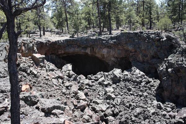
Lava tube opening/possible bat roost with pine forest above.
Opening of a large lava tube at El Malpais National Monument in western New Mexico and likely roost for bats, 2011.
Opening of a large lava tube at El Malpais National Monument in western New Mexico and likely roost for bats, 2011.