


Hydrologist, Hank Johnson, measures water temperature and specific conductance from a well near Opal Springs Oregon.
How can I find the depth to the water table in a specific location?
The depth to the water table can change (rise or fall) depending on the time of year. During the late winter and spring when accumulated snow starts to melt and spring rainfall is plentiful, water on the surface infiltrates into the ground and the water table rises. When water-loving plants start to grow again in the spring and precipitation gives way to hot, dry summers, the water table falls because of evapotranspiration.
The most reliable method of obtaining the depth to the water table at any given time is to measure the water level in a shallow well with a tape. If no wells are available, surface geophysical methods can sometimes be used, depending on surface accessibility for placing electric or acoustic probes.
Databases containing depth-to-water measurements can also be helpful, though they don't always have current data:
- The USGS National Water Dashboard has depth-to-water measurements made in the present and the past. Use the panel on the right to toggle OFF the default Streamflow data and toggle ON Groundwater Levels. Hover over or click on any triangle for more information.
- The National Groundwater Monitoring Network is a compilation of groundwater monitoring wells from federal, state, and local groundwater networks across the nation. Use their Data Portal to zoom in to your area of interest and click on any site.
- Your state government probably maintains a database of drillers' logs that have water levels recorded when a well was drilled, and hydrologic consultants often have reports that contain water level data from shallow boreholes.
Consulting any or all of these sources is a good first step in finding out the depth to the water table.
Learn more:
- How do I find the best place to drill for water on my property?
- Aquifers and Groundwater
- Ground Water and the Rural Homeowner
Related
Where can I find detailed sampling methods for surface water and groundwater?
The National Field Manual for the Collection of Water-Quality Data (National Field Manual) provides guidelines and standard procedures for USGS personnel who collect data used to assess the quality of the Nation’s surface water and groundwater resources. The manual is published as separate chapters. Learn more: Techniques of Water-Resources Investigations Reports
How important is groundwater?
Groundwater, which is in aquifers below the surface of the Earth, is one of the Nation's most important natural resources. Groundwater is the source of about 37 percent of the water that county and city water departments supply to households and businesses (public supply). It provides drinking water for more than 90 percent of the rural population who do not get their water delivered to them from...
Where can I get my well water tested?
Some counties offer free well water testing, so check with your county first. If they don't, use this EPA website to find a list of state-certified laboratories in your area that do water testing, or contact your county or state health department or your State Certification Officer for assistance. Prices will vary depending on the laboratory and the test(s), but most people consider the cost to be...
What is the difference between a confined and an unconfined (water table) aquifer?
A confined aquifer is an aquifer below the land surface that is saturated with water. Layers of impermeable material are both above and below the aquifer, causing it to be under pressure so that when the aquifer is penetrated by a well, the water will rise above the top of the aquifer. A water table--or unconfined--aquifer is an aquifer whose upper water surface (water table) is at atmospheric...
What is the Ground Water Atlas of the United States?
This Ground Water Atlas of the United States is a series of USGS publications that describe the location, the extent, and the geologic and hydrologic characteristics of the important aquifers of the Nation. The series consists of 13 chapters that describe the regional groundwater resources that collectively cover 50 States, Puerto Rico, and the U.S. Virgin Islands. Learn more: Principal Aquifers...
If the ground filters water, is groundwater always clean?
Water drawn from a well was once precipitation that fell onto Earth's surface. It seeped into the ground and, over time, occupied the porous space in some subsurface material. Big particles that are in surface streams, such as leaf chunks, will not be seen in groundwater. So, yes, big particles are filtered out by the ground, along with some minerals and chemicals that are too small to see. But...
How do I find the best place to drill for water on my property?
Many factors must be considered before deciding where to drill a water well. The most important is to decide how the well will be used. If the well is for drinking water, then local geology, hydrology, and state regulations are important to know. Contact the department in your state government that regulates and tracks water and natural resources. They should have information on licensed drillers...

Well water measurement near Opal Springs, Oregon
Hydrologist, Hank Johnson, measures water temperature and specific conductance from a well near Opal Springs Oregon.

Physical Scientist Shannon Fisher taking a water level measurement with a calibrated electric tape at the monthly discrete groundwater observation well located in Foster, Rhode Island
linkPhysical Scientist Shannon Fisher taking a water level measurement with a calibrated electric tape at the monthly discrete groundwater observation well located in Foster, Rhode Island. (Station ID#: 414420071422301 RI-FOW 40)
Winter 2024 Photo Contest: Sam Banas, Honorable Mention category

Measuring the groundwater level in a well near Lame Deer, Montana
Measuring the groundwater level in a well near Lame Deer, Montana
Measuring the groundwater level in a well near Lame Deer, Montana

Measuring Total Well Depth Using a Steel Tape - YouTube
This video demonstrates how to measure total well depth below land surface using a weighted, graduated steel tape.
This video demonstrates how to measure total well depth below land surface using a weighted, graduated steel tape.

Measuring Water Levels in a Flowing Well
This video demonstrates how to measure low pressure hydraulic head in a flowing well.
This video demonstrates how to measure low pressure hydraulic head in a flowing well.

Measuring Groundwater with Steel Tape
This video demonstrates how to measure water levels in wells using a graduated steel tape.
This video demonstrates how to measure water levels in wells using a graduated steel tape.

Measuring Groundwater with Electric Tape
This video demonstrates how to measure water levels in wells using an electric tape.
This video demonstrates how to measure water levels in wells using an electric tape.
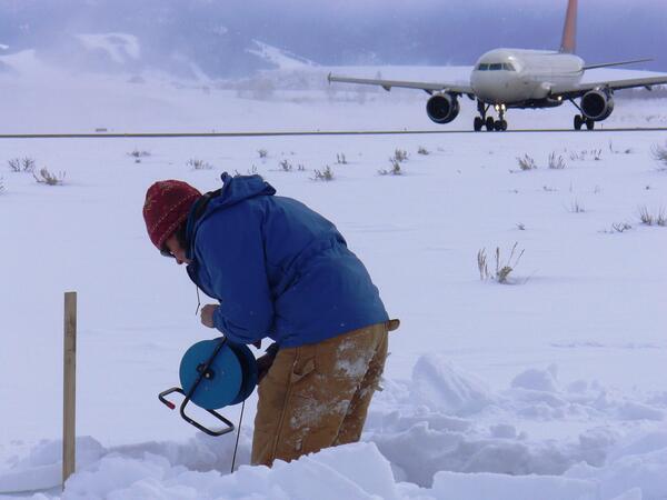
Taking a water-level measurement in a monitoring well at Jackson Hole
Taking a water-level measurement in a monitoring well at Jackson Hole Airport.
Taking a water-level measurement in a monitoring well at Jackson Hole Airport.

Well, Well, Well! How Deep is the Water Table?
This month we highlight a new interactive map that allows users to determine the depth to groundwater at any location in the Portland Metropolitan Area, Oregon. This month's episode features an interview with the groundwater project's lead author, USGS hydrologist Daniel Snyder.
This month we highlight a new interactive map that allows users to determine the depth to groundwater at any location in the Portland Metropolitan Area, Oregon. This month's episode features an interview with the groundwater project's lead author, USGS hydrologist Daniel Snyder.

Groundwater well overflowing
Groundwater well overflowing
Related
Where can I find detailed sampling methods for surface water and groundwater?
The National Field Manual for the Collection of Water-Quality Data (National Field Manual) provides guidelines and standard procedures for USGS personnel who collect data used to assess the quality of the Nation’s surface water and groundwater resources. The manual is published as separate chapters. Learn more: Techniques of Water-Resources Investigations Reports
How important is groundwater?
Groundwater, which is in aquifers below the surface of the Earth, is one of the Nation's most important natural resources. Groundwater is the source of about 37 percent of the water that county and city water departments supply to households and businesses (public supply). It provides drinking water for more than 90 percent of the rural population who do not get their water delivered to them from...
Where can I get my well water tested?
Some counties offer free well water testing, so check with your county first. If they don't, use this EPA website to find a list of state-certified laboratories in your area that do water testing, or contact your county or state health department or your State Certification Officer for assistance. Prices will vary depending on the laboratory and the test(s), but most people consider the cost to be...
What is the difference between a confined and an unconfined (water table) aquifer?
A confined aquifer is an aquifer below the land surface that is saturated with water. Layers of impermeable material are both above and below the aquifer, causing it to be under pressure so that when the aquifer is penetrated by a well, the water will rise above the top of the aquifer. A water table--or unconfined--aquifer is an aquifer whose upper water surface (water table) is at atmospheric...
What is the Ground Water Atlas of the United States?
This Ground Water Atlas of the United States is a series of USGS publications that describe the location, the extent, and the geologic and hydrologic characteristics of the important aquifers of the Nation. The series consists of 13 chapters that describe the regional groundwater resources that collectively cover 50 States, Puerto Rico, and the U.S. Virgin Islands. Learn more: Principal Aquifers...
If the ground filters water, is groundwater always clean?
Water drawn from a well was once precipitation that fell onto Earth's surface. It seeped into the ground and, over time, occupied the porous space in some subsurface material. Big particles that are in surface streams, such as leaf chunks, will not be seen in groundwater. So, yes, big particles are filtered out by the ground, along with some minerals and chemicals that are too small to see. But...
How do I find the best place to drill for water on my property?
Many factors must be considered before deciding where to drill a water well. The most important is to decide how the well will be used. If the well is for drinking water, then local geology, hydrology, and state regulations are important to know. Contact the department in your state government that regulates and tracks water and natural resources. They should have information on licensed drillers...
Well water measurement near Opal Springs, Oregon
Hydrologist, Hank Johnson, measures water temperature and specific conductance from a well near Opal Springs Oregon.
Hydrologist, Hank Johnson, measures water temperature and specific conductance from a well near Opal Springs Oregon.
Physical Scientist Shannon Fisher taking a water level measurement with a calibrated electric tape at the monthly discrete groundwater observation well located in Foster, Rhode Island
linkPhysical Scientist Shannon Fisher taking a water level measurement with a calibrated electric tape at the monthly discrete groundwater observation well located in Foster, Rhode Island. (Station ID#: 414420071422301 RI-FOW 40)
Winter 2024 Photo Contest: Sam Banas, Honorable Mention category
Measuring the groundwater level in a well near Lame Deer, Montana
Measuring the groundwater level in a well near Lame Deer, Montana
Measuring the groundwater level in a well near Lame Deer, Montana
Measuring Total Well Depth Using a Steel Tape - YouTube
This video demonstrates how to measure total well depth below land surface using a weighted, graduated steel tape.
This video demonstrates how to measure total well depth below land surface using a weighted, graduated steel tape.
Measuring Water Levels in a Flowing Well
This video demonstrates how to measure low pressure hydraulic head in a flowing well.
This video demonstrates how to measure low pressure hydraulic head in a flowing well.
Measuring Groundwater with Steel Tape
This video demonstrates how to measure water levels in wells using a graduated steel tape.
This video demonstrates how to measure water levels in wells using a graduated steel tape.
Measuring Groundwater with Electric Tape
This video demonstrates how to measure water levels in wells using an electric tape.
This video demonstrates how to measure water levels in wells using an electric tape.
Taking a water-level measurement in a monitoring well at Jackson Hole
Taking a water-level measurement in a monitoring well at Jackson Hole Airport.
Taking a water-level measurement in a monitoring well at Jackson Hole Airport.
Well, Well, Well! How Deep is the Water Table?
This month we highlight a new interactive map that allows users to determine the depth to groundwater at any location in the Portland Metropolitan Area, Oregon. This month's episode features an interview with the groundwater project's lead author, USGS hydrologist Daniel Snyder.
This month we highlight a new interactive map that allows users to determine the depth to groundwater at any location in the Portland Metropolitan Area, Oregon. This month's episode features an interview with the groundwater project's lead author, USGS hydrologist Daniel Snyder.
Groundwater well overflowing
Groundwater well overflowing
Updated Date: April 9, 2025