
USGS Water and Fire Technicians team members, Jorge Gonzalez and Efren Alvarado, made repairs to the Buck Mountain precipitation gage during the Blue 2 Fire near Alto, New Mexico on June 7, 2024. This station, along with similar gages, provides critical real-time rainfall data to the National Weather Service and local emergency managers.
Multimedia
To See More USGS Images
To Watch More USGS Videos
To Listen to More USGS Audio Files
To See More USGS Webcams
Photos, videos, audio files, and webcam photos described and linked on this webpage come from a wide variety of USGS science activities and presentations done by USGS Science Center staff members in the Region 7: Upper Colorado Basin. The "View All" link buttons at the bottom of the sections on this page lead to webpages containing links to additional multimedia files.
Images

USGS Scientists Deploy to New Mexico Fire to Enhance Water Monitoring
USGS Water and Fire Technicians team members, Jorge Gonzalez and Efren Alvarado, made repairs to the Buck Mountain precipitation gage during the Blue 2 Fire near Alto, New Mexico on June 7, 2024. This station, along with similar gages, provides critical real-time rainfall data to the National Weather Service and local emergency managers.
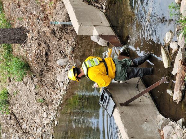
Repairing a streamgage during the Blue 2 Fire near Alto, New Mexico
A member of the USGS Water and Fire Technicians Team repairs a streamgage during the Blue 2 Fire near Alto, New Mexico.
A member of the USGS Water and Fire Technicians Team repairs a streamgage during the Blue 2 Fire near Alto, New Mexico.

The USGS Water and Fire Technicians Team prepares to evaluate precipitation and streamflow gauges during the Blue 2 Fire near Alto, New Mexico.
linkThe USGS Water and Fire Technicians Team prepares to evaluate precipitation and streamflow gauges during the Blue 2 Fire near Alto, New Mexico.
The USGS Water and Fire Technicians Team prepares to evaluate precipitation and streamflow gauges during the Blue 2 Fire near Alto, New Mexico.
linkThe USGS Water and Fire Technicians Team prepares to evaluate precipitation and streamflow gauges during the Blue 2 Fire near Alto, New Mexico.

USGS scientist retrieves water quality sensor on the Rio Grande in Albuquerque, New Mexico
USGS scientist Kimberly Beisner retrieves a water quality sensor on the Rio Grande for a PFAS study in Albuquerque, New Mexico.
USGS scientist Kimberly Beisner retrieves a water quality sensor on the Rio Grande for a PFAS study in Albuquerque, New Mexico.

USGS scientists walk into the Rio Grande to collect water samples for a PFAS study near Valle de Oro, New Mexico.
linkUSGS scientists Kimberly Beisner and Keely Miltenberger walk into the Rio Grande to collect water samples for a PFAS study near Valle de Oro, New Mexico.
USGS scientists walk into the Rio Grande to collect water samples for a PFAS study near Valle de Oro, New Mexico.
linkUSGS scientists Kimberly Beisner and Keely Miltenberger walk into the Rio Grande to collect water samples for a PFAS study near Valle de Oro, New Mexico.

Water quality sampler deployed on the Rio Grande in Alameda, New Mexico.
Water quality sampler deployed on the Rio Grande to collect an integrated sample of PFAS in the water in Alameda, New Mexico.
Water quality sampler deployed on the Rio Grande to collect an integrated sample of PFAS in the water in Alameda, New Mexico.
Videos

The Evolution of UAS Platforms at USGS
The Department of the Interior (DOI) and U.S. Geological Survey (USGS) took an interest in uncrewed aircraft system (UAS) technologies in the early 2000s, when UAS were predominantly being used for military applications.
The Department of the Interior (DOI) and U.S. Geological Survey (USGS) took an interest in uncrewed aircraft system (UAS) technologies in the early 2000s, when UAS were predominantly being used for military applications.

UAS Operations for Carbon Sequestration Research on Public Lands near Moab, Utah in May 2023
In support of U.S. Geological Survey (USGS) Southwest Biological Science Center research, the USGS National Uncrewed Systems Office (NUSO) conducted uncrewed aircraft systems (UAS) remote sensing flights near Moab, Utah in May 2023 for multi-scale carbon sequestration research on public lands.
In support of U.S. Geological Survey (USGS) Southwest Biological Science Center research, the USGS National Uncrewed Systems Office (NUSO) conducted uncrewed aircraft systems (UAS) remote sensing flights near Moab, Utah in May 2023 for multi-scale carbon sequestration research on public lands.

Getting started with nabatr: package download & a new way to login
The North American Bat Monitoring Program: R Data Connection Package can be used to extract and summarize data from NABat projects and data requests. This video tutorial provides a brief overview of how to get started with the NABat R package, including how to download the package as well as how to log in using partner portal credentials.
The North American Bat Monitoring Program: R Data Connection Package can be used to extract and summarize data from NABat projects and data requests. This video tutorial provides a brief overview of how to get started with the NABat R package, including how to download the package as well as how to log in using partner portal credentials.

Introduction to NABat
Introduction to the North American Bat Monitoring Program, including a short history of the program, a review of key program components, and highlights of program outcomes and products.
Introduction to the North American Bat Monitoring Program, including a short history of the program, a review of key program components, and highlights of program outcomes and products.

Planning, Partner Portal Prep, & Protocols for Mobile Acoustic Surveys
Training webinar for Mobile Acoustic Surveying hosted by Sarah Gaulke (USGS). The webinar details preparing for and implementing Mobile Acoustic Surveys for bat monitoring, including how to use the NABat Partner Portal to plan a survey route
Training webinar for Mobile Acoustic Surveying hosted by Sarah Gaulke (USGS). The webinar details preparing for and implementing Mobile Acoustic Surveys for bat monitoring, including how to use the NABat Partner Portal to plan a survey route

Uploading Stationary/Mobile Acoustic Surveys to the NABat Partner Portal
NABat Training Webinar on how to upload acoustic survey data to the NABat Partner Portal. Hosted by Dane Smith (USGS).
NABat Training Webinar on how to upload acoustic survey data to the NABat Partner Portal. Hosted by Dane Smith (USGS).
Audio

Outstanding in the Field (Ep 5): Fish in the Grand Canyon
The USGS Ecosystems Mission Area brings you Outstanding in the Field, a series of stories about our science, our adventures, and our efforts to better understand our fish and wildlife and the ecosystems that support them. In this episode we describe some of the one-of-a-kind native fish species that call the Grand Canyon segment of the Colorado River home.
The USGS Ecosystems Mission Area brings you Outstanding in the Field, a series of stories about our science, our adventures, and our efforts to better understand our fish and wildlife and the ecosystems that support them. In this episode we describe some of the one-of-a-kind native fish species that call the Grand Canyon segment of the Colorado River home.
Webcams

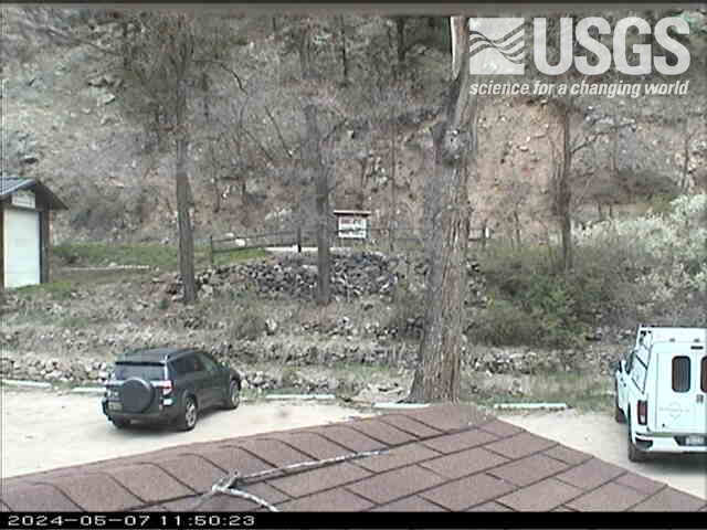
Streamgage 09071750 Colorado River above Glenwood Springs, CO
Webcam at USGS Streamgage 09071750 Colorado River above Glenwood Springs, CO.
Visit Water Data For the Nation to get current data for this site.
Webcam at USGS Streamgage 09071750 Colorado River above Glenwood Springs, CO.
Visit Water Data For the Nation to get current data for this site.
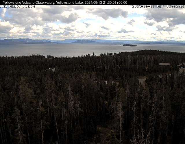
Webcam at Yellowstone Lake
The camera view is south-southeast over Yellowstone Lake from the cell phone tower near Fishing Bridge. Stevenson Island is visible within the lake on the right. The view extends down the Southeast Arm between the Promontory (low ridge rising from the lake) and the eastern shore.
The camera view is south-southeast over Yellowstone Lake from the cell phone tower near Fishing Bridge. Stevenson Island is visible within the lake on the right. The view extends down the Southeast Arm between the Promontory (low ridge rising from the lake) and the eastern shore.
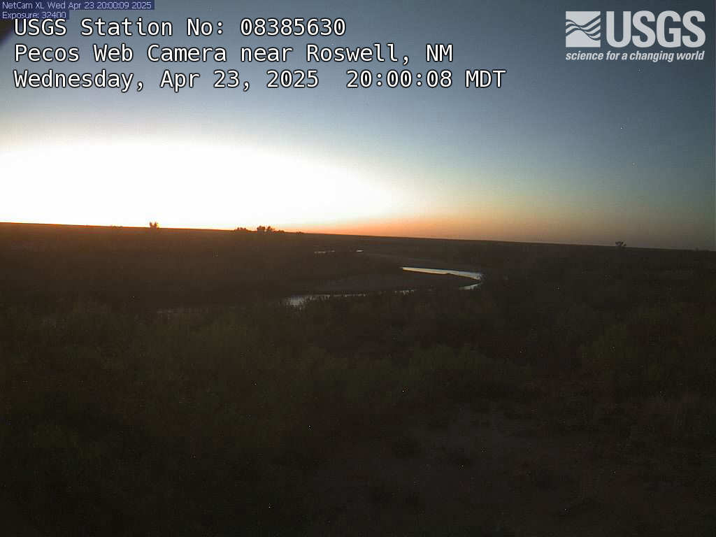
Pecos River Near Roswell, NM
This is a webcam image of the Pecos River near Roswell, New Mexico - Site #334716104175400
This is a webcam image of the Pecos River near Roswell, New Mexico - Site #334716104175400
Pecos River Near Acme, NM
This is a webcam image of the Pecos River near Acme, New Mexico - Site #08386000
This is a webcam image of the Pecos River near Acme, New Mexico - Site #08386000
Four Mile Creek AT Orodell, CO (06727500)
View from a USGS webcam of Fourmile Creek at Orodell, CO, USGS site number 06727500
View from a USGS webcam of Fourmile Creek at Orodell, CO, USGS site number 06727500