
Landslides near the 2017 Thomas fire burn area that initiated during a series of atmospheric river events in December 2022 and January 2023.
Images
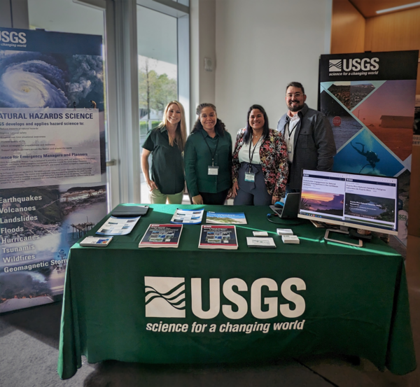
Images intro.
Filter Total Items: 7145

Landslides near the 2017 Thomas fire burn area
Landslides near the 2017 Thomas fire burn area that initiated during a series of atmospheric river events in December 2022 and January 2023.

San Lorenzo, Puerto Rico Landslide Monitoring Site
San Lorenzo, Puerto Rico landslide lonitoring site. The San Lorenzo monitoring station is located in a moderately vegetated area underlain by Cretaceous volcaniclastic rock.
San Lorenzo, Puerto Rico landslide lonitoring site. The San Lorenzo monitoring station is located in a moderately vegetated area underlain by Cretaceous volcaniclastic rock.

Donya-Frank Gilchrist facilitates session on "Approaches to Resilience from the International Caribbean" at the SCDRP Annual Meeting
linkDr. Donya-Frank Gilchrist of the USGS St. Petersburg Coastal and Marine Science Center facilitated a session on "Approaches to Resilience from the International Caribbean" at the 2023 Southeast and Caribbean Disaster Resilience Partnership (SCDRP) Annual Meeting in Miami, Florida.

Donya-Frank Gilchrist presents on USGS Natural Hazards Science at the SCDRP Annual Meeting
Dr. Donya-Frank Gilchrist of the USGS St. Petersburg Coastal and Marine Science Center facilitated a session on "Approaches to Resilience from the International Caribbean" at the 2023 Southeast and Caribbean Disaster Resilience Partnership (SCDRP) Annual Meeting in Miami, Florida.
Dr. Donya-Frank Gilchrist of the USGS St. Petersburg Coastal and Marine Science Center facilitated a session on "Approaches to Resilience from the International Caribbean" at the 2023 Southeast and Caribbean Disaster Resilience Partnership (SCDRP) Annual Meeting in Miami, Florida.
Engaging with Stakeholders on Caribbean Natural Hazards
From left to right: Meaghan Emory, Dr. Donya Frank-Gilchrist, Dr.
From left to right: Meaghan Emory, Dr. Donya Frank-Gilchrist, Dr.

HVO scientist views new eruption in Halema‘uma‘u crater
A USGS Hawaiian Volcano Observatory geologist documents the new eruption within Halema‘uma‘u crater, at Kīlauea summit within Hawai‘i Volcanoes National Park. The eruption began just after 4:30 p.m. on January 5, 2023, and remains confined to Halema‘uma‘u crater. USGS image by D. Downs.
A USGS Hawaiian Volcano Observatory geologist documents the new eruption within Halema‘uma‘u crater, at Kīlauea summit within Hawai‘i Volcanoes National Park. The eruption began just after 4:30 p.m. on January 5, 2023, and remains confined to Halema‘uma‘u crater. USGS image by D. Downs.

Upgrade to Kīlauea summit webcam
The KWcam webcam, on the west rim of Kīlauea caldera, was upgraded on January 4, 2023, to a more advanced model, which provides a slightly wider view and higher image quality. This should provide an improved view of any future activity in Halema‘uma‘u. In this photo, an HVO scientist begins the process of the webcam swap. USGS photo by M. Patrick.
The KWcam webcam, on the west rim of Kīlauea caldera, was upgraded on January 4, 2023, to a more advanced model, which provides a slightly wider view and higher image quality. This should provide an improved view of any future activity in Halema‘uma‘u. In this photo, an HVO scientist begins the process of the webcam swap. USGS photo by M. Patrick.

Hunga Tonga 2.JPG
The large HTHH volcanic explosion created fast low-frequency pressure waves that penetrated about 3.1 miles/5 kilometers into the shallow crust (shown in yellow). Wind and small explosions (shown in blue) create shorter pressure waves that only penetrate down about 328 feet/100 meters.
The large HTHH volcanic explosion created fast low-frequency pressure waves that penetrated about 3.1 miles/5 kilometers into the shallow crust (shown in yellow). Wind and small explosions (shown in blue) create shorter pressure waves that only penetrate down about 328 feet/100 meters.

Hunga Tonga 3.JPG
The waveforms of the ground motion recording and the pressure sensor recording from a station with both types of instruments (see second image above) match up, indicating that the pressure waves are causing the ground (crust) to deflect.
The waveforms of the ground motion recording and the pressure sensor recording from a station with both types of instruments (see second image above) match up, indicating that the pressure waves are causing the ground (crust) to deflect.

Coring in the Marsh
USGS scientists collect core samples from marsh to explore the drives of wetland accretion in the face of rising seas and human impacts impact the evolution on salt marshes.
USGS scientists collect core samples from marsh to explore the drives of wetland accretion in the face of rising seas and human impacts impact the evolution on salt marshes.

Marsh in Wellfleet, MA
USGS scientists collect core samples from marsh to explore the drives of wetland accretion in the face of rising seas and human impacts impact the evolution on salt marshes.
USGS scientists collect core samples from marsh to explore the drives of wetland accretion in the face of rising seas and human impacts impact the evolution on salt marshes.

2022 Coring
As sea levels rise, salt water extends further up tidal rivers. As sea-level rise accelerates, vegetation transitions are increasingly observed and USGS scientists are busy assessing those changes. USGS scientists take soil cores in the marsh.
As sea levels rise, salt water extends further up tidal rivers. As sea-level rise accelerates, vegetation transitions are increasingly observed and USGS scientists are busy assessing those changes. USGS scientists take soil cores in the marsh.

Drone at Sunset
A UAS flies a photogrammetry mission over recently burned landscapes in Tahoe National Forest.
A UAS flies a photogrammetry mission over recently burned landscapes in Tahoe National Forest.

Preflight Checks at Mosquito
Isaac Anderson (National Innovation Center) preforms a pre-flight check of a UAS before a photogrammetry mission in post-fire, landslide-prone terrain in Tahoe National Forest.
Isaac Anderson (National Innovation Center) preforms a pre-flight check of a UAS before a photogrammetry mission in post-fire, landslide-prone terrain in Tahoe National Forest.

Landing at Mosquito
Isaac Anderson and Liz Hyde (National Innovation Center) bring in a drone for a landing, after flying a photogrammetry mission over landslide-prone terrain recently burned in the Mosquito fire (2022).
Isaac Anderson and Liz Hyde (National Innovation Center) bring in a drone for a landing, after flying a photogrammetry mission over landslide-prone terrain recently burned in the Mosquito fire (2022).

Mosquito Ridge at Sunset
USGS researches and remote pilots coordinate their operations during a break in the action during a photogrammetry flight campaign in post-fire terrain in Tahoe National Forest.
USGS researches and remote pilots coordinate their operations during a break in the action during a photogrammetry flight campaign in post-fire terrain in Tahoe National Forest.

A collage of images depicts shoreline habitat and wildlife that use the Salton Sea area
A collage of images depicts shoreline habitat and wildlife that use the Salton Sea area in southern California.
A collage of images depicts shoreline habitat and wildlife that use the Salton Sea area in southern California.

Video footage of USGS Research Geologist Patrick Barnard in the field
Video footage of USGS Research Geologist Patrick Barnard in the field, from the short film "Our Beautiful Planet - Saving Our Shores"
Video footage of USGS Research Geologist Patrick Barnard in the field, from the short film "Our Beautiful Planet - Saving Our Shores"

Polar bear walking along Beaufort Sea coast
A polar bear walking along the Beaufort Sea coast with storm waves breaking behind it, filmed during fieldwork at Barter Island, Alaska.
A polar bear walking along the Beaufort Sea coast with storm waves breaking behind it, filmed during fieldwork at Barter Island, Alaska.

Fissure 3 Mauna Loa - November 30, 2022
This image, taken during an early morning overflight on 30 November 2022, shows Fissure 3, the dominant source of activity. As of 7 a.m. HST, the lava fountains are 20-25 meters in height (65-82 feet) and feed a lava flow moving to the northeast at ~130 meters per hour (0.08 miles per hour).
This image, taken during an early morning overflight on 30 November 2022, shows Fissure 3, the dominant source of activity. As of 7 a.m. HST, the lava fountains are 20-25 meters in height (65-82 feet) and feed a lava flow moving to the northeast at ~130 meters per hour (0.08 miles per hour).

Mauna Loa eruption from the Northeast Rift Zone sends lava flows to the north downslope toward Saddle Road. As of 6am local time, flows were 6 miles from Saddle Road.
linkPhotograph taken from Saddle Road at 6AM Hawaii time on November 29, 2022 shows lava flows moving northeast downslope of Mauna Loa volcano from the Northeast Rift Zone eruption.