
Hawaiian Volcano Observatory scientists prepare an Unoccupied Aircraft Systems (UAS) unit for launch at Kīlauea summit on January 14, 2022. Imagery collected by the UAS will be used to generate a 3-dimensional model that will be used to evaluate the eruption within Halema‘uma‘u for changes.
Images
Hawaiian Volcano Observatory images of eruptive activity, field work, and more.
Filter Total Items: 2879

UAS mission at Kīlauea summit — January 14, 2022
Hawaiian Volcano Observatory scientists prepare an Unoccupied Aircraft Systems (UAS) unit for launch at Kīlauea summit on January 14, 2022. Imagery collected by the UAS will be used to generate a 3-dimensional model that will be used to evaluate the eruption within Halema‘uma‘u for changes.

UAS mission at Kīlauea summit — January 14, 2022
An Unoccupied Aircraft System (UAS) unit surveys the eruption site at the summit of Kīlauea on January 14, 2022. UAS photos, data, and samples help scientists to understand ongoing volcanic processes and their associated hazards, and to detect changes that might indicate shifts in the character of activity.
An Unoccupied Aircraft System (UAS) unit surveys the eruption site at the summit of Kīlauea on January 14, 2022. UAS photos, data, and samples help scientists to understand ongoing volcanic processes and their associated hazards, and to detect changes that might indicate shifts in the character of activity.

January 13, 2022 — Kīlauea summit down-dropped block
Active lava in Halema‘uma‘u is visible in this image, with rubble from Kīlauea's 2018 collapse events prominent in the foreground. The background of the photo is framed by the fault scarps that formed within the caldera during the 2018 summit collapse events at Kīlauea. USGS image by M. Warren.
Active lava in Halema‘uma‘u is visible in this image, with rubble from Kīlauea's 2018 collapse events prominent in the foreground. The background of the photo is framed by the fault scarps that formed within the caldera during the 2018 summit collapse events at Kīlauea. USGS image by M. Warren.

January 13, 2022 — Kīlauea summit down-dropped block
Eruptions within Halema‘uma‘u crater over the past year have filled in the deepest part of Kīlauea caldera that collapsed during 2018. This image shows the young lava lake surface bounded by fault scarps that formed within the caldera during 2018.
Eruptions within Halema‘uma‘u crater over the past year have filled in the deepest part of Kīlauea caldera that collapsed during 2018. This image shows the young lava lake surface bounded by fault scarps that formed within the caldera during 2018.

January 13, 2022 — Kīlauea summit down-dropped block
Close-up view of the margin of overflows from the active lava lake within Halema‘uma‘u crater at the summit of Kīlauea. These overflows are encroaching northwards onto the lowest of the down-dropped blocks that formed during Kīlauea's 2018 summit collapse events. USGS image by K. Kamibayashi.
Close-up view of the margin of overflows from the active lava lake within Halema‘uma‘u crater at the summit of Kīlauea. These overflows are encroaching northwards onto the lowest of the down-dropped blocks that formed during Kīlauea's 2018 summit collapse events. USGS image by K. Kamibayashi.

January 13, 2022 — Kīlauea summit down-dropped block
This monitoring station partially survived the 2018 collapse events at the summit of Kīlauea. Located on one of the blocks that “down-dropped” during those events, the station was lowered in elevation by over 150 m (almost 500 ft) in 2018.
This monitoring station partially survived the 2018 collapse events at the summit of Kīlauea. Located on one of the blocks that “down-dropped” during those events, the station was lowered in elevation by over 150 m (almost 500 ft) in 2018.

January 13, 2022 — Kīlauea summit down-dropped block
On January 13, 2022, Hawaiian Volcano Observatory (HVO) staff conducted a mission to rescue monitoring equipment that was being threatened by overflows from the active lava lake within Halema‘uma‘u at the summit of Kīlauea.
On January 13, 2022, Hawaiian Volcano Observatory (HVO) staff conducted a mission to rescue monitoring equipment that was being threatened by overflows from the active lava lake within Halema‘uma‘u at the summit of Kīlauea.

January 10, 2022 — Continued lava lake activity in Halema‘uma‘u
Despite several brief pauses over the past month, lava lake activity continues in Halema‘uma‘u crater, at the summit of Kīlauea. Lava is erupting from the west vent, which has built a steep spatter cone. The active lake is perched slightly above the surrounding solidified lava. USGS photo by M. Patrick.
Despite several brief pauses over the past month, lava lake activity continues in Halema‘uma‘u crater, at the summit of Kīlauea. Lava is erupting from the west vent, which has built a steep spatter cone. The active lake is perched slightly above the surrounding solidified lava. USGS photo by M. Patrick.

January 10, 2022 — Kīlauea
A close up of the perched levee impounding the active lava lake in Halema‘uma‘u crater, at the summit of Kīlauea. Photo taken on January 10, 2022, from the south rim of Kīlauea caldera. USGS photo by M. Patrick.
A close up of the perched levee impounding the active lava lake in Halema‘uma‘u crater, at the summit of Kīlauea. Photo taken on January 10, 2022, from the south rim of Kīlauea caldera. USGS photo by M. Patrick.

January 10, 2022 — Kīlauea
A close up of the surface texture on the active lava lake in Halema‘uma‘u crater, at the summit of Kīlauea. The classic zig-zag pattern in apparent in the incandescent spreading zones between crustal plates that form on the surface of the lava lake. USGS photo by M. Patrick.
A close up of the surface texture on the active lava lake in Halema‘uma‘u crater, at the summit of Kīlauea. The classic zig-zag pattern in apparent in the incandescent spreading zones between crustal plates that form on the surface of the lava lake. USGS photo by M. Patrick.

January 7, 2022—Kīlauea summit eruption reference map
This reference map depicts the ongoing Kīlauea summit eruption on January 7, 2022. One eruptive vent is intermittently active within Halemaʻumaʻu, along the western edge of the lava lake. When this vent is effusing lava, it pours into the active portion of the lake, colored red on this map.
This reference map depicts the ongoing Kīlauea summit eruption on January 7, 2022. One eruptive vent is intermittently active within Halemaʻumaʻu, along the western edge of the lava lake. When this vent is effusing lava, it pours into the active portion of the lake, colored red on this map.

Kīlauea summit monitoring data November 1, 2021, to January 22, 2022
Plots showing the correlation between Kīlauea summit sulfur dioxide emissions (SO2) in tonnes per day (top panel), ground tilt in microradians (middle panel), and seismic tremor (RSAM) (lower panel) for the period of November 1, 2021, to January 22, 2022. Eruptive pauses and highly diminished activity are highlighted in blue. USGS plots.
Plots showing the correlation between Kīlauea summit sulfur dioxide emissions (SO2) in tonnes per day (top panel), ground tilt in microradians (middle panel), and seismic tremor (RSAM) (lower panel) for the period of November 1, 2021, to January 22, 2022. Eruptive pauses and highly diminished activity are highlighted in blue. USGS plots.

Types of explosive clasts found at the summit of Mauna Loa
Types of explosive clasts found in the debris fan deposits at the summit of Mauna Loa: (A) unaltered ponded lava flow, (B) unaltered pāhoehoe, (C) altered ponded lava flow, often has a red to pink hue, (D) thermally altered pāhoehoe, often has a red-to-pink hue, (E) gabbroic xenolith, the most crystalline rocks we found, (F) bread-crust outer surfaces and vesicular
Types of explosive clasts found in the debris fan deposits at the summit of Mauna Loa: (A) unaltered ponded lava flow, (B) unaltered pāhoehoe, (C) altered ponded lava flow, often has a red to pink hue, (D) thermally altered pāhoehoe, often has a red-to-pink hue, (E) gabbroic xenolith, the most crystalline rocks we found, (F) bread-crust outer surfaces and vesicular

Map of explosive deposits at the edge of Moku‘āweoweo, the summit caldera of Mauna Loa.
Map of explosive deposits at the edge of Moku‘āweoweo, the summit caldera of Mauna Loa. Map showing the size distribution of ejecta, sorted by maximum length in centimeters (one inch is about 2.5 cm). The colors indicate the different size fractions in centimeters. The largest blocks were found closest to the rim.
Map of explosive deposits at the edge of Moku‘āweoweo, the summit caldera of Mauna Loa. Map showing the size distribution of ejecta, sorted by maximum length in centimeters (one inch is about 2.5 cm). The colors indicate the different size fractions in centimeters. The largest blocks were found closest to the rim.
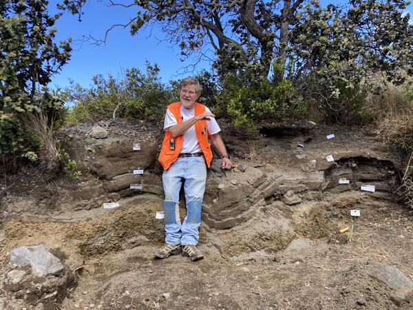
Don Swanson describing Keanakāko‘i Tephra deposits
Don Swanson describes the stratigraphy of Keanakāko‘i deposits near Uēkahuna Bluff at Kīlauea summit within Hawai‘i Volcanoes National Park.
Don Swanson describes the stratigraphy of Keanakāko‘i deposits near Uēkahuna Bluff at Kīlauea summit within Hawai‘i Volcanoes National Park.

Olivine in Hawaiian basalt
(L) Green olivine crystals in lava from Mauna Loa’s 1868 eruption. (R) Microscope image of a single olivine crystal extracted from tephra at Kīlauea. This crystal is about 1 mm (less than 1/16 of an inch) tall.
(L) Green olivine crystals in lava from Mauna Loa’s 1868 eruption. (R) Microscope image of a single olivine crystal extracted from tephra at Kīlauea. This crystal is about 1 mm (less than 1/16 of an inch) tall.

NOAA Ocean Exploration’s remotely operated vehicle Deep Discoverer
NOAA Ocean Exploration’s remotely operated vehicle Deep Discoverer will be used during Voyage to the Ridge 2022 to acquire high-definition visual data and collect limited samples in poorly explored areas along the Charlie-Gibbs Fracture Zone, Mid-Atlantic Ridge, and Azores Plateau.
NOAA Ocean Exploration’s remotely operated vehicle Deep Discoverer will be used during Voyage to the Ridge 2022 to acquire high-definition visual data and collect limited samples in poorly explored areas along the Charlie-Gibbs Fracture Zone, Mid-Atlantic Ridge, and Azores Plateau.

Eruptive activity resumes at west vent in Halema‘uma‘u
Eruptive activity resumed today in Halema‘uma‘u crater, at the summit of Kīlauea volcano, after a brief pause of several days. This photograph shows spattering and lava effusion from the west vent, which has built a steep spatter cone. USGS image by M. Patrick.
Eruptive activity resumed today in Halema‘uma‘u crater, at the summit of Kīlauea volcano, after a brief pause of several days. This photograph shows spattering and lava effusion from the west vent, which has built a steep spatter cone. USGS image by M. Patrick.

Halemaʻumaʻu lava pond on December 30, 2021
During recent multi-day pauses in the ongoing Kīlauea summit eruption, a small portion of the Halemaʻumaʻu lava lake has consistently remained active: a small, ovular lava pond just north of the briefly dormant western fissure.
During recent multi-day pauses in the ongoing Kīlauea summit eruption, a small portion of the Halemaʻumaʻu lava lake has consistently remained active: a small, ovular lava pond just north of the briefly dormant western fissure.

Island of Hawai‘i seismicity
Two weeks of earthquake activity preceding the September 29, 2021, eruption at Kīlauea summit. The regions of interest indicated on the map include: KS (Kīlauea summit); ML (Mauna Loa summit); P (Pāhala).
Two weeks of earthquake activity preceding the September 29, 2021, eruption at Kīlauea summit. The regions of interest indicated on the map include: KS (Kīlauea summit); ML (Mauna Loa summit); P (Pāhala).

2022 Volcano Awareness Month program calendar
Island of Hawai‘i Volcano Awareness Month 2022 calendar of programs, with descriptions.
Island of Hawai‘i Volcano Awareness Month 2022 calendar of programs, with descriptions.