
NW CASC’s USGS Director Nicole DeCrappeo on a recent rafting trip through the Grand Canyon on the Colorado River. She brought along a paper John Wesley Powell, an explorer and the 2nd director of the USGS, to commemorate the 150th anniversary of his historic trip down the Colorado River.
Images
Explore photos, graphics, and illustrations related to projects from across the CASC Network. And be sure to check out our Climate Illustrations page, featuring free-to-download illustrations that help describe tricky climate concepts and explain how climate change affects the world around us.
Filter Total Items: 280

Nicole DeCrappeo Colorado River
NW CASC’s USGS Director Nicole DeCrappeo on a recent rafting trip through the Grand Canyon on the Colorado River. She brought along a paper John Wesley Powell, an explorer and the 2nd director of the USGS, to commemorate the 150th anniversary of his historic trip down the Colorado River.

Partners discuss seasonal drought experiments.
Partners discuss seasonal drought experiments.
Partners discuss seasonal drought experiments.

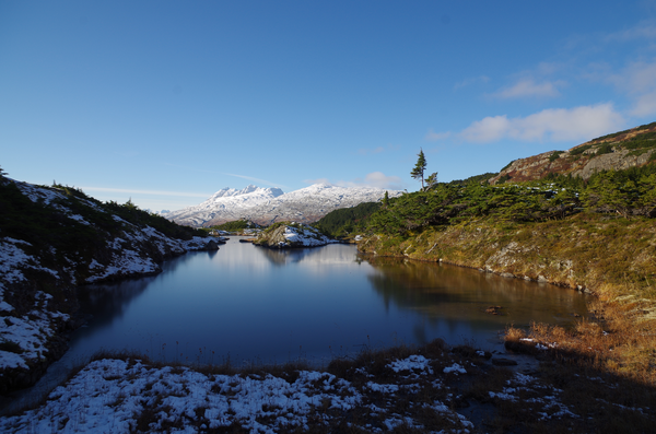
Unuk River in Winter
Unuk River sampling site.
Unuk River sampling site.

Florida Bay at Sunset, 2018
After a long day collecting cores, the team of scientists watch the sun set over the Florida Bay.
After a long day collecting cores, the team of scientists watch the sun set over the Florida Bay.
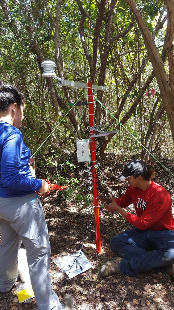
Scientists Monitoring Moisture in a Puerto Rican Forest
Deploying environmental monitoring equipment in a mesic (between wet and dry) forest in western Puerto Rico. Characterizing fine-scale moisture gradients between dry and wet forests is critical to understand which habitats are likely to remain suitable for vulnerable amphibian species as the climate changes.
Deploying environmental monitoring equipment in a mesic (between wet and dry) forest in western Puerto Rico. Characterizing fine-scale moisture gradients between dry and wet forests is critical to understand which habitats are likely to remain suitable for vulnerable amphibian species as the climate changes.

View of Nellie Juan Glacier from Wolverine Glacier
View of Nellie Juan Glacier from Wolverine Glacier
View of Nellie Juan Glacier from Wolverine Glacier

View from Wolverine Glacier from Helicopter
View from Wolverine Glacier from Helicopter
View from Wolverine Glacier from Helicopter

A windblown stand of hemlock trees at the Wolverine Glacier field site
A windblown stand of hemlock trees at the Wolverine Glacier field site
A windblown stand of hemlock trees at the Wolverine Glacier field site
View West from Wolverine Glacier
View West from Wolverine Glacier
View West from Wolverine Glacier

Mountain Hemlock in Alaska
Mountain Hemlock in Alaska
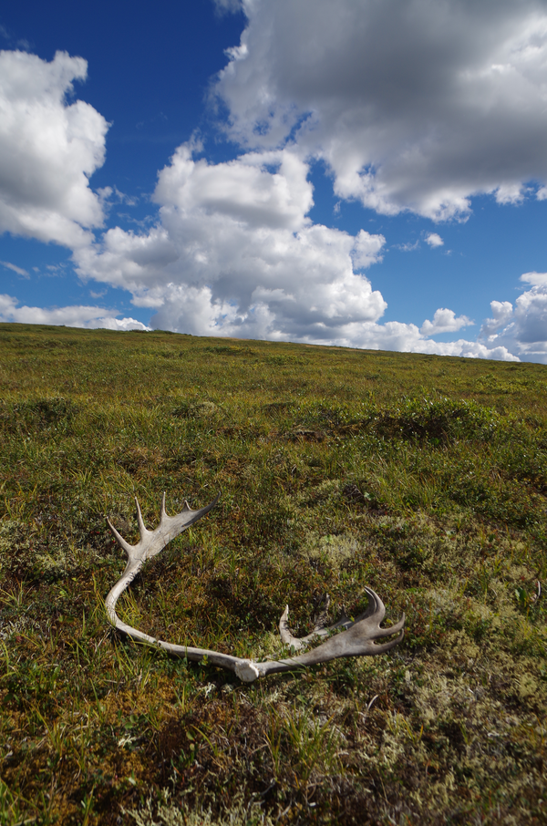
Antlers, White Mountains, Alaska
Antlers, White Mountains, Alaska
Antlers, White Mountains, Alaska
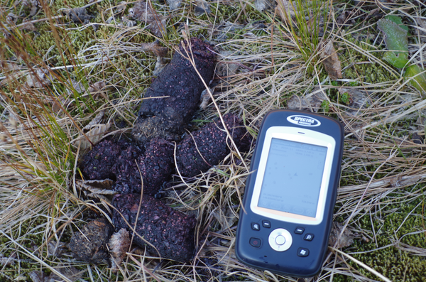
Big bear scat found while in the field
Big bear scat found while in the field
Big bear scat found while in the field
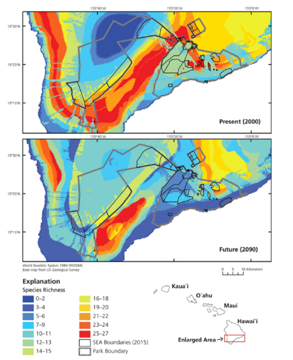
Species richness heat map
Native species richness (of the 29 species) using cool to warm colors to represent overlapping distributions of few to many species, respectively. The top panel shows that the present (year 2000) distribution of hotspots in the national park aligns well with the distribution of SEAs.
Native species richness (of the 29 species) using cool to warm colors to represent overlapping distributions of few to many species, respectively. The top panel shows that the present (year 2000) distribution of hotspots in the national park aligns well with the distribution of SEAs.

Michelle Staudinger dissecting a dolphinfish
Staudinger dissecting a dolphinfish at the Annual Ducks Fishing tournament in Morehead City, North Carolina. Credit: Joshua Snyder
Staudinger dissecting a dolphinfish at the Annual Ducks Fishing tournament in Morehead City, North Carolina. Credit: Joshua Snyder

Fieldwork in Tanzania
Brian Miller, research ecologist for the NC CASC, on the road while doing fieldwork in Tanzania.
Brian Miller, research ecologist for the NC CASC, on the road while doing fieldwork in Tanzania.
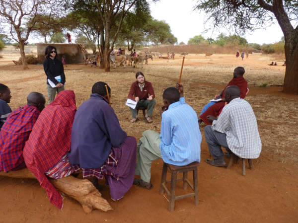
Miller interviewing Maasai pastoralists about drought adaptation
Miller interviewing Maasai pastoralists about how they have coped with drought amidst conservation and land use changes.
Miller interviewing Maasai pastoralists about how they have coped with drought amidst conservation and land use changes.

Miller collecting geospatial data in East Africa
Miller collecting geospatial data as part of his dissertation research on drought resources in East Africa.
Miller collecting geospatial data as part of his dissertation research on drought resources in East Africa.
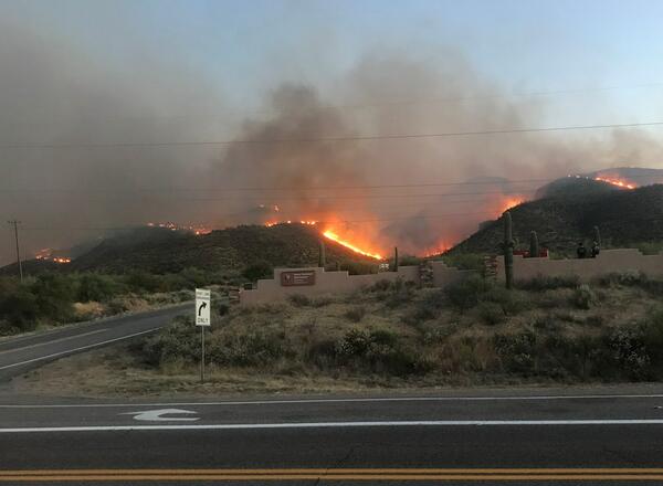
Flames from the Woodbury Fire rise above Tonto National Monument
Flames from the Woodbury Fire rise above Tonto National Monument.
Flames from the Woodbury Fire rise above Tonto National Monument.

Dauphin Island, Alabama
A view of a vegetated inland coastline overlooking the water on Dauphin Island, Alabama. The island protects mainland Alabama’s coastal communities and resources from storms, while also providing recreational opportunities (fishing, beach tourism, etc.) and other economic benefits to the local community and state.
A view of a vegetated inland coastline overlooking the water on Dauphin Island, Alabama. The island protects mainland Alabama’s coastal communities and resources from storms, while also providing recreational opportunities (fishing, beach tourism, etc.) and other economic benefits to the local community and state.
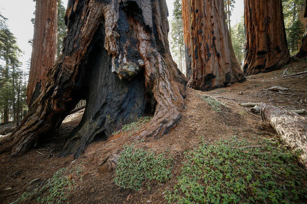
Burned, hollowed out base of a sequoia tree in Sequoia National Park
Burned, hollowed out base of a sequoia tree in Sequoia National Park
Burned, hollowed out base of a sequoia tree in Sequoia National Park
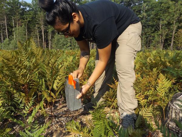
Mari Rodriguez
Mari Rodriguez checks a trap for mice at a field site in Michigan for research.
Mari Rodriguez checks a trap for mice at a field site in Michigan for research.