USGS Research Hydrologist Glenn Hodgkins presents his work on extreme low streamflows in North and South America, Europe and Australia and the climatic factors that drive them at AGU24 in Washington D.C.
Multimedia
Multimedia
Images

USGS Research Hydrologist Glenn Hodgkins presents his work on extreme low streamflows in North and South America, Europe and Australia and the climatic factors that drive them at AGU24 in Washington D.C.

USGS New England Water Science Center Hydrologist Janet Barclay presents her research at AGU24. She calculated the amount of groundwater-transported nitrogen entering Long Island Sound from Connecticut.
USGS New England Water Science Center Hydrologist Janet Barclay presents her research at AGU24. She calculated the amount of groundwater-transported nitrogen entering Long Island Sound from Connecticut.

A screen capture of an interactive web application that displays Nitrogen Loading from Selected Long Island Sound Tributaries from 1995 to 2021.
A screen capture of an interactive web application that displays Nitrogen Loading from Selected Long Island Sound Tributaries from 1995 to 2021.
The USGS New England Water Science Center co-located their Connecticut office to the campus of Goodwin University in 2023. The university hosted an official ribbon cutting of the new facility in October 2024 with federal, state, and local politicians attending and sharing their well wishes.
The USGS New England Water Science Center co-located their Connecticut office to the campus of Goodwin University in 2023. The university hosted an official ribbon cutting of the new facility in October 2024 with federal, state, and local politicians attending and sharing their well wishes.

USGS New England Water Science Center Deputy Director holds a certificate from the General Assembly of the State of Connecticut.
USGS New England Water Science Center Deputy Director holds a certificate from the General Assembly of the State of Connecticut.

Pie Chart Showing Relative Amounts of Copper Produced in Leading Copper Producing States in 2019
linkPie chart showing relative amounts of copper produced by leading copper producing states in the U.S. in 2019 (derived from data in Flanagan, D.M., 2019, Copper, in Metals and minerals: U.S. Geological Survey Minerals Yearbook 2019, v. 1, p. 20.1-20.30.
Videos
 Susquehanna River Story — What does the science say about water quality?
Narrated presentation that provides a unique synthesis of the story of nutrient water quality in the Susquehanna watershed.
Narrated presentation that provides a unique synthesis of the story of nutrient water quality in the Susquehanna watershed.
Rangeland managers need information on the current vegetation condition and how the landscape has changed through time.
Rangeland managers need information on the current vegetation condition and how the landscape has changed through time.
This video is an introduction of the USGS Northeast Region's science efforts to support society's evolving needs through its engaged and diverse workforce.
This video is an introduction of the USGS Northeast Region's science efforts to support society's evolving needs through its engaged and diverse workforce.
 The USGS Northeast Region: Delivering Science for Better Decisions
This video is an introduction of the USGS Northeast Region's science efforts to support society's evolving needs through its engaged and diverse workforce.
This video is an introduction of the USGS Northeast Region's science efforts to support society's evolving needs through its engaged and diverse workforce.
 The USGS Northeast Region: Delivering Science for Better Decisions (AD)
This video is an introduction of the USGS Northeast Region's science efforts to support society's evolving needs through its engaged and diverse workforce.
This video is an introduction of the USGS Northeast Region's science efforts to support society's evolving needs through its engaged and diverse workforce.
This video shows users how to utilize the StreamStats Batch Processor for processing multiple points in StreamStats for delineation and streamflow estimates. It explains how to submit new batches, check the status of previously submitted batches, and download results.
This video shows users how to utilize the StreamStats Batch Processor for processing multiple points in StreamStats for delineation and streamflow estimates. It explains how to submit new batches, check the status of previously submitted batches, and download results.
Webcams
MA-HWY-I95S-OGFC-STATION 00568 Needham, MA. The highway monitoring station 421652071120601 is located along Interstate 95 in Norfolk County, Massachusetts.
MA-HWY-I95S-OGFC-STATION 00568 Needham, MA. The highway monitoring station 421652071120601 is located along Interstate 95 in Norfolk County, Massachusetts.
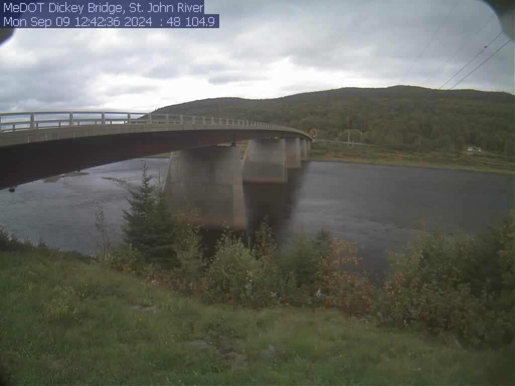
View of the St. John River from the webcam located at St. John River at Dickey, Maine (01037050)
View of the St. John River from the webcam located at St. John River at Dickey, Maine (01037050)
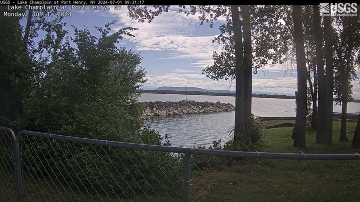
PLEASE NOTE: During winter months, ice and snow can affect the picture quality. The camera is cleaned as often as it is safe to do so.
Lake Champlain at Port Henry, NY (04294413)
PLEASE NOTE: During winter months, ice and snow can affect the picture quality. The camera is cleaned as often as it is safe to do so.
Lake Champlain at Port Henry, NY (04294413)
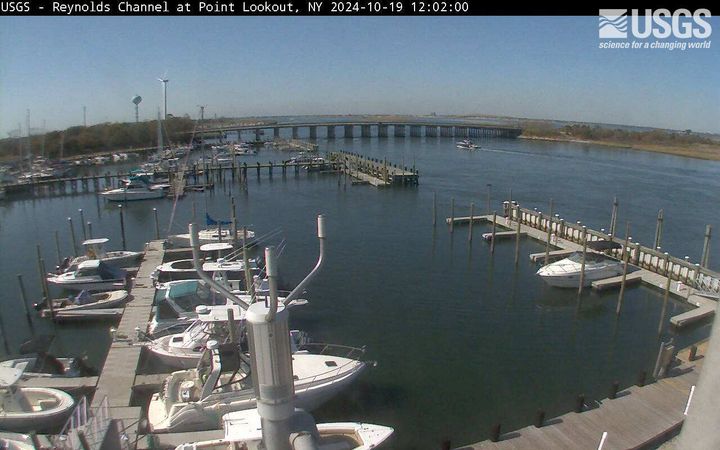
Latest webcam image of Reynolds Channel (01310740).
Image timestamp is in Eastern Standard Time.
Webcam is located on tower at USGS gaging station, looking west-northwest toward Loop Parkway Bridge.
Latest webcam image of Reynolds Channel (01310740).
Image timestamp is in Eastern Standard Time.
Webcam is located on tower at USGS gaging station, looking west-northwest toward Loop Parkway Bridge.
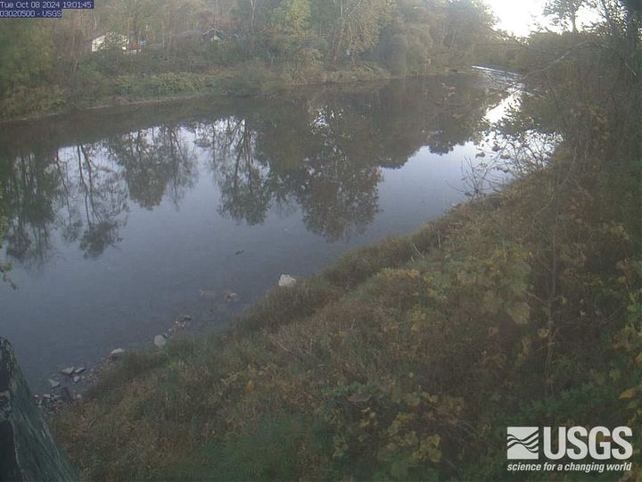
The latest view from Oil Creek at Rouseville, PA (03020500). View the webcam for more details.
The latest view from Oil Creek at Rouseville, PA (03020500). View the webcam for more details.
The latest view from the camera at Allegheny River at Franklin, PA (03025500). Visit webcam for more details.
The latest view from the camera at Allegheny River at Franklin, PA (03025500). Visit webcam for more details.


