
Mohawk River Ice Jam at Lock 8 in Schenectady, NY near USGS gaging station 01354330
Images
Images
Filter Total Items: 1911

Mohawk River Ice Jam at Lock 8 in Schenectady, NY
Mohawk River Ice Jam at Lock 8 in Schenectady, NY near USGS gaging station 01354330

Walls and carts of cores
Core racks filled with split cores in D-tubes in the K.O. Emery Geotechnical Wing walk-in refrigerator
Core racks filled with split cores in D-tubes in the K.O. Emery Geotechnical Wing walk-in refrigerator

Erika Lentz is interviewed by WBZ Boston for a sea-level rise segment
Erika Lentz, Woods Hole Coastal and Marine Science Center Research Geologist interviewed by WBZ Boston Meterologist, Danielle Niles fora segment on sea-level rise
Erika Lentz, Woods Hole Coastal and Marine Science Center Research Geologist interviewed by WBZ Boston Meterologist, Danielle Niles fora segment on sea-level rise

Erika Lentz interview by WBZ Meteorologist, Danielle Niles
Research geologist, Erika Lentz, interviewed on Trunk River Beach, Falmouth, MA, by WBZ meterologist, Danielle Niles, about the future impacts of sea-level rise
Research geologist, Erika Lentz, interviewed on Trunk River Beach, Falmouth, MA, by WBZ meterologist, Danielle Niles, about the future impacts of sea-level rise

Licking River at Highway 536 near Alexandria, Kentucky
Licking River at Highway 536 near Alexandria, Kentucky gage, looking downstream from the gage location.
Licking River at Highway 536 near Alexandria, Kentucky gage, looking downstream from the gage location.
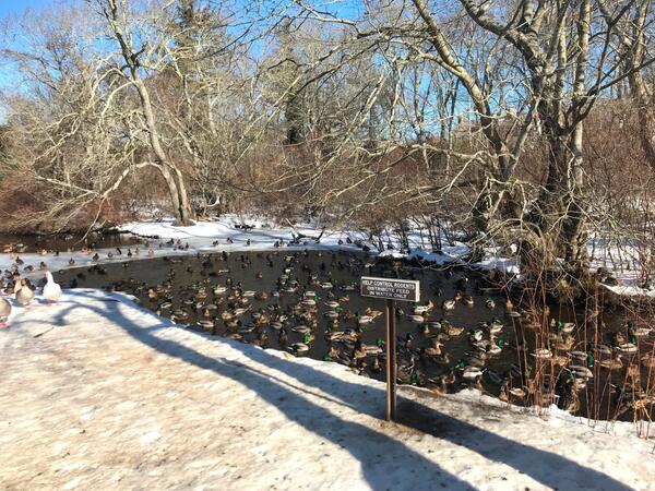
Hook Pond Dreen at Davids Lane, East Hampton, New York
Ducks in Hook Pond Dreen at Davids Lane, East Hampton, New York
Ducks in Hook Pond Dreen at Davids Lane, East Hampton, New York

Scouting out high water marks after blizzard
New England WSC Physical Scientist Andy Massey scouting out high water marks associated with the blizzard of January 2018. Houghs Neck Maritime Center, Quincy, MA.
New England WSC Physical Scientist Andy Massey scouting out high water marks associated with the blizzard of January 2018. Houghs Neck Maritime Center, Quincy, MA.

Jonathan Cohl holding a piece of ice at Delaware River
Northeast Region Photo Contest Winner | March 2019 | People
Jonathan Cohl holding a piece of ice from Delaware River at Frenchtown, NJ
Northeast Region Photo Contest Winner | March 2019 | People
Jonathan Cohl holding a piece of ice from Delaware River at Frenchtown, NJ

Field Photo Friday Winner for April 2018
Transporting equipment used for maintenance of groundwater well CT2498 in Perrysburg, New York
Transporting equipment used for maintenance of groundwater well CT2498 in Perrysburg, New York

Berm at Jim Foot Key, Florida (2018)
In Photo: The red circle indicates the same position as shown in the April 2014 photo. The mangroves have lost all their leaves and the berm is significantly thinner following the storm.
In Photo: The red circle indicates the same position as shown in the April 2014 photo. The mangroves have lost all their leaves and the berm is significantly thinner following the storm.

Assembly of chains, shackles, and links
Sediment transport team members assemble chain, shackles and pear links that are are attached to the anchor and floats as part of deploying a mooring.
Sediment transport team members assemble chain, shackles and pear links that are are attached to the anchor and floats as part of deploying a mooring.

Meteorological equipment deployment
Sediment transport team members prepare to deploy a buoy instrumented with Meteorological sensors
Sediment transport team members prepare to deploy a buoy instrumented with Meteorological sensors

Oceanographic Equipment Deployment
An instrumented bottom lander platform is lowered off the stern of the R/V Savannah during deploment
An instrumented bottom lander platform is lowered off the stern of the R/V Savannah during deploment

Oceanographic equipment deployment at sunrise
Dawn breaks behind one of the bottom landers on deployment day.
Dawn breaks behind one of the bottom landers on deployment day.

Buoy, Buoy
The buoy that measures meteorological conditions at the site after deployment.
The buoy that measures meteorological conditions at the site after deployment.

USGS Team Work!
Sediment transport team members attach a quick-release to the top of a bottom lander prior to deployment
Sediment transport team members attach a quick-release to the top of a bottom lander prior to deployment

Woods Hole Coastal and Marine Science Center Sediment Transport Team
Sediment transport team members manage tag lines to control the motion of the bottom lander as it is deployed.
Sediment transport team members manage tag lines to control the motion of the bottom lander as it is deployed.

Elizabeth Pendleton describes USGS work to map the Mass. seafloor
Elizabeth Pendleton describes USGS work to map the Massachusetts seafloor to State Senator Viriato “Vinny” deMacedo.
Elizabeth Pendleton describes USGS work to map the Massachusetts seafloor to State Senator Viriato “Vinny” deMacedo.

Eroding permafrost on Alaska’s Arctic Coast
Eroding permafrost on Alaska’s Arctic Coast. Inundation of permafrost like this produced subsea permafrost
Eroding permafrost on Alaska’s Arctic Coast. Inundation of permafrost like this produced subsea permafrost

Perspective views of multibeam bathymetry data acquired by the USGS
Perspective views of multibeam bathymetry data acquired by the USGS aboard the R/V Medeia. Shallower depths in red. Arrows point to the distinct line in the seafloor associated with the Queen Charlotte-Fairweather fault.
Perspective views of multibeam bathymetry data acquired by the USGS aboard the R/V Medeia. Shallower depths in red. Arrows point to the distinct line in the seafloor associated with the Queen Charlotte-Fairweather fault.

Lesser Scaup
A male lesser scaup at the USGS Eastern Ecological Science Center in Maryland. This bird was not part of this new research. Photograph taken in 2017. Credit: Jeffrey Sullivan, USGS.
A male lesser scaup at the USGS Eastern Ecological Science Center in Maryland. This bird was not part of this new research. Photograph taken in 2017. Credit: Jeffrey Sullivan, USGS.