
Figure 3. Appearance of descaling site exposed to fast green FCF dye 96 hours after intentional descaling injury, showing lack of scales, presence of fast green staining in areas of epidermal disruption and absence of staining in areas where migrating epidermal cells have closed the wound.
Images
Explore images.
Filter Total Items: 701

Figure 3. Appearance of Descaling Site Exposed to Fast Green FCF Dye
Figure 3. Appearance of descaling site exposed to fast green FCF dye 96 hours after intentional descaling injury, showing lack of scales, presence of fast green staining in areas of epidermal disruption and absence of staining in areas where migrating epidermal cells have closed the wound.

Figure 4. Scanning Electron Micrograph of Descaling Area
Figure 4. Scanning electron micrograph of descaling area delimited by box in Figure 3 showing epidermal disruption (arrows), empty scale pockets and restoration of epidermal integrity (asterisk). An exposed scale with visible concentric ridges is visible at the lower center. Scale bar = 500 µm.
Figure 4. Scanning electron micrograph of descaling area delimited by box in Figure 3 showing epidermal disruption (arrows), empty scale pockets and restoration of epidermal integrity (asterisk). An exposed scale with visible concentric ridges is visible at the lower center. Scale bar = 500 µm.

Crooked River at Smith Rocks
Crooked River of the Deschutes River Basin, Oregon, flows through Smith Rocks
Crooked River of the Deschutes River Basin, Oregon, flows through Smith Rocks
Controlled burn at Hart Mountain National Wildlife Refuge.
Wildfire is one of the largest sources of re-released mercury to the atmosphere and a component to the widespread movement of inorganic mercury to aquatic sediments.
Wildfire is one of the largest sources of re-released mercury to the atmosphere and a component to the widespread movement of inorganic mercury to aquatic sediments.

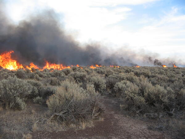
Sagebrush on fire in a controlled burn
Controlled burn at Hart Mountain National Wildlife Refuge, Oregon.
Controlled burn at Hart Mountain National Wildlife Refuge, Oregon.

Seismic station at Yellow Rock (YEL) with the toe of the west arm o...
Seismic station at Yellow Rock (YEL) with the toe of the west arm of Crater Glacier in the background. This station site was eventually covered by the glacier.
Seismic station at Yellow Rock (YEL) with the toe of the west arm of Crater Glacier in the background. This station site was eventually covered by the glacier.

Researcher weighing a sturgeon
Researcher weighing sturgeon. Columbia River, bottom trawl for young-of-year (YOY) indexing.
Researcher weighing sturgeon. Columbia River, bottom trawl for young-of-year (YOY) indexing.

Researcher measuring sturgeon length
Researcher measuring sturgeon length. Bottom trawl for young-of-year (YOY) indexing. Columbia River.
Researcher measuring sturgeon length. Bottom trawl for young-of-year (YOY) indexing. Columbia River.

Investigation and disease prevention of Spring Viremia of Carp Virus
Typical clinical signs of disease, pop eye, dermal hemorrhages, abdominal distension, and hemorrhages at the base of fins, displayed in koi infected with spring viremia of carp virus (SVCV).
Typical clinical signs of disease, pop eye, dermal hemorrhages, abdominal distension, and hemorrhages at the base of fins, displayed in koi infected with spring viremia of carp virus (SVCV).

Panoramic photograph from the southern rim of Mount St. Helens' cra...
Panoramic photograph from the southern rim of Mount St. Helens' crater rim looking north with accompanying annotation.
Panoramic photograph from the southern rim of Mount St. Helens' crater rim looking north with accompanying annotation.

Panoramic photograph from Mount St. Helens' crater rim looking nort...
View the annotated version of this photograph.
View the annotated version of this photograph.

Mount St. Helens crater July 26, 2006, nearly vertical view from SW.
View the annotated image.

Mount St. Helens Panorama
View northward from Mount St. Helens' crater rim, July 2006.
View northward from Mount St. Helens' crater rim, July 2006.

Fish biologist with Shortnose sucker
Fish biologist with Shortnose sucker
Fish biologist with Shortnose sucker

Helicopter flying toward lava spine at Mount St. Helens to collect ...
Helicopter flying toward lava spine at Mount St. Helens to collect rocks—note the "Jaws" collector hanging underneath. April 28, 2007
Helicopter flying toward lava spine at Mount St. Helens to collect rocks—note the "Jaws" collector hanging underneath. April 28, 2007

Topographic map, Mount St. Helens, C.E. 1919 annotated with locatio...
Due to the cataclysmic eruption of May 18, 1980, many of the locations annotated on this map are now either covered or no longer visible.
Due to the cataclysmic eruption of May 18, 1980, many of the locations annotated on this map are now either covered or no longer visible.

Mount Adams, WA as seen from Mount St. Helens (west). Trees are co...
Mount Adams, Washington as seen from Mount St. Helens (west). Trees are covered in frost in the foreground.
Mount Adams, Washington as seen from Mount St. Helens (west). Trees are covered in frost in the foreground.

Mount Jefferson (pointed peak in middle) and Three Sisters (to righ...
Mount Jefferson (pointed peak in middle) and Three Sisters (to the right) in Oregon, south-facing aerial view as seen from Mount St. Helens.
Mount Jefferson (pointed peak in middle) and Three Sisters (to the right) in Oregon, south-facing aerial view as seen from Mount St. Helens.

Global Positioning System receiver (dome on pole) and seismometer
Global Positioning System receiver (dome on pole) and seismometer (box on ground in distance) at a volcano monitoring station for Three Sisters in Central Oregon. Solar panel mounted to pole.
Global Positioning System receiver (dome on pole) and seismometer (box on ground in distance) at a volcano monitoring station for Three Sisters in Central Oregon. Solar panel mounted to pole.

Loowit Falls flows north out of Mount St. Helens crater. White buil...
Loowit Falls flows north out of Mount St. Helens crater. White building in upper right corner is the Loowit gage house, which contains an Acoustic Flow Monitor.
Loowit Falls flows north out of Mount St. Helens crater. White building in upper right corner is the Loowit gage house, which contains an Acoustic Flow Monitor.

South-facing Mount St. Helens with Mount Hood and Mount Jefferson o...
South-facing aerial view of Mount St. Helens with Mount Hood (left) and Mount Jefferson (right) on the horizon. June 8, 2005.
South-facing aerial view of Mount St. Helens with Mount Hood (left) and Mount Jefferson (right) on the horizon. June 8, 2005.