U.S. flag

An official website of the United States government

Washington Water Science Center

The USGS Washington Water Science Center provides water resource information. You’ll find information about Washington’s rivers and streams, as well as groundwater, water quality, and cutting-edge water research. We welcome you to explore our data and scientific research.

News

U.S. Geological Survey scientists measure what often remains invisible – groundwater in the southeast Puget Sound region

U.S. Geological Survey scientists measure what often remains invisible – groundwater in the southeast Puget Sound region

USGS Firelight: PHIRE Edition - Vol. 2 | Issue 2

Uncrewed Aviation Systems (UAS) Training Interest Survey

Uncrewed Aviation Systems (UAS) Training Interest Survey

Publications

Quantifying fine sediment infiltration in spawning gravel used by Chinook salmon (Oncorhynchus tshawytscha) in the Sauk River Basin, Washington, 2018–21

Fine sediment can infiltrate into river substrate that salmonid fish species (Oncorhynchus spp.) use to spawn. High levels of sediment infiltration can increase egg-to-fry mortality, which corresponds to the period when salmonids are still residing in the subsurface gravels. This study quantifies fine sediment infiltration of Chinook salmon (Oncorhynchus tshawytscha) spawning habitat during the eg
Authors
Kristin L. Jaeger, Scott W. Anderson, Anya C. Leach, Scott T. Morris

Groundwater and surface-water interactions in the Lower Duwamish Waterway, Seattle, Washington

The U.S. Geological Survey (USGS), in cooperation with the Washington State Department of Ecology (Ecology), conducted a study to describe the current understanding of the regional groundwater system of the lower Duwamish River valley and groundwater and surface-water interactions in the lower Duwamish Waterway. The lower Duwamish Waterway is the final 5-mile (mi) reach of the Duwamish River befor
Authors
Jackson N. Mitchell, Kathleen E. Conn

Numerical model of the groundwater-flow system near the southeastern part of Puget Sound, Washington

Groundwater flow in the active model area (AMA) was simulated using a groundwater-flow model. A steady-state model version of the model simulates equilibrium conditions, and a transient model version simulates monthly variability. The model corresponds to the physical and temporal dimensions of the conceptual model and groundwater budget. The steady-state model version represents average condition
Authors
Andrew J. Long, Elise E. Wright, Leland T. Fuhrig, Valerie A.L. Bright

Science

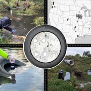
Preliminary Research Sheds Light on Proper Analysis and Sample Handling for the Tire-Derived Contaminants 6PPD and 6PPD-quinone

Tire and road wear particles have been shown to cause acute effects to sensitive aquatic animals and degrade their habitats. U.S. Geological Survey (USGS) scientists developed methods to accurately identify aquatic compounds, such as 6PPD and 6PPD-quinone, that can cause acute mortality events in coho salmon (Oncorhynchus kisutch).
link

Preliminary Research Sheds Light on Proper Analysis and Sample Handling for the Tire-Derived Contaminants 6PPD and 6PPD-quinone

Tire and road wear particles have been shown to cause acute effects to sensitive aquatic animals and degrade their habitats. U.S. Geological Survey (USGS) scientists developed methods to accurately identify aquatic compounds, such as 6PPD and 6PPD-quinone, that can cause acute mortality events in coho salmon (Oncorhynchus kisutch).
Learn More

Water temperature modeling in Mount Rainier National Park

The Issue: Changes in the water temperature and flow regimes of rivers throughout the western United States have contributed to shifts in the ranges of aquatic species that they support. Cold-water species such as fish are sensitive to changes in water temperature, which regulates their physiological functions and behavior. How USGS will help: A spatial stream network (SSN) model was developed...
link

Water temperature modeling in Mount Rainier National Park

The Issue: Changes in the water temperature and flow regimes of rivers throughout the western United States have contributed to shifts in the ranges of aquatic species that they support. Cold-water species such as fish are sensitive to changes in water temperature, which regulates their physiological functions and behavior. How USGS will help: A spatial stream network (SSN) model was developed...
Learn More

Green-Duwamish Watershed 6PPD-q small stream monitoring

Pacific salmon and trout, especially coho, are threatened by a toxic contaminant resulting from tire additives that end up in untreated road runoff. This contaminant, 6PPD-q, has been associated with high rates of coho pre-spawn mortality in streams, including in the Green-Duwamish watershed. Many coho spawning streams in the watershed are predicted to be at high risk for “urban runoff mortality...
link

Green-Duwamish Watershed 6PPD-q small stream monitoring

Pacific salmon and trout, especially coho, are threatened by a toxic contaminant resulting from tire additives that end up in untreated road runoff. This contaminant, 6PPD-q, has been associated with high rates of coho pre-spawn mortality in streams, including in the Green-Duwamish watershed. Many coho spawning streams in the watershed are predicted to be at high risk for “urban runoff mortality...
Learn More
Was this page helpful?