
Looking downstream along the cowpasture river.
Images
Explore water-related photography, imagery, and illustrations.
Filter Total Items: 2410

Cowpasture river looking downstream.
Looking downstream along the cowpasture river.

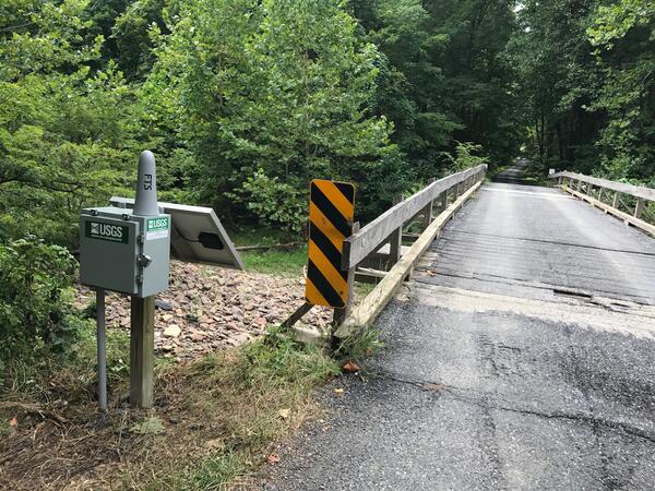
Cowpasture river monitoring at Route 627 near Williamsville, VA
Cowpasture river monitoring at Route 627 near Williamsville, VA
Cowpasture river monitoring at Route 627 near Williamsville, VA

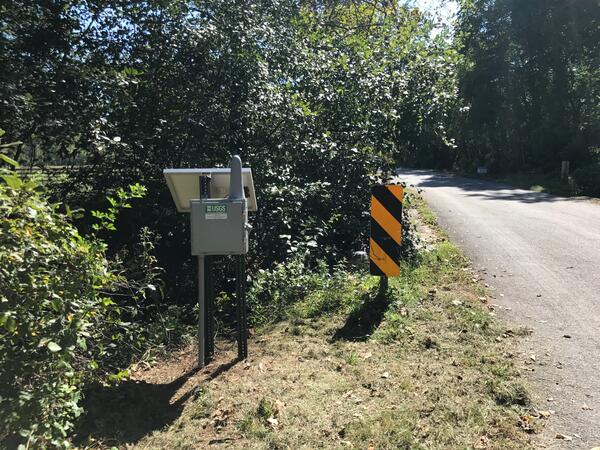
Monitoring at Little Stony Creek above Archer Trail near Pembroke, VA
Water monitoring at Little Stony Creek above Archer Trail near Pembroke, VA
Water monitoring at Little Stony Creek above Archer Trail near Pembroke, VA
Monitoring Ramseys Draft at Route 716 near West Augusta
Monitoring Ramseys Draft at Route 716 near West Augusta
Monitoring Ramseys Draft at Route 716 near West Augusta

Monitoring Roanoke River along Route 626 at Lafayette, VA
Monitoring Roanoke River along Route 626 at Lafayette, VA
Monitoring Roanoke River along Route 626 at Lafayette, VA
Monitoring Spruce Creek at Route 627 near Nellysford, VA
Monitoring Spruce Creek at Route 627 near Nellysford, VA
Monitoring Spruce Creek at Route 627 near Nellysford, VA


USGS StreamStats: Hydrologic and Geospatial Data
USGS StreamStats: Hydrologic and Geospatial Data Integrated to Support Water Science and Management
USGS StreamStats: Hydrologic and Geospatial Data Integrated to Support Water Science and Management

Groundwater Sampling at Mt. Hope Cemetery, Michigan
Is this cemetery haunted? Probably not, but there could be tiny things moving beyond the grave. The USGS sampled groundwater downhill of Mt. Hope Cemetery in Lansing, Michigan, to find out if materials associated with decomposition and burial processes could affect groundwater quality near a cemetery.
Is this cemetery haunted? Probably not, but there could be tiny things moving beyond the grave. The USGS sampled groundwater downhill of Mt. Hope Cemetery in Lansing, Michigan, to find out if materials associated with decomposition and burial processes could affect groundwater quality near a cemetery.
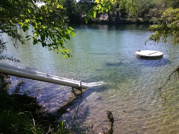
Monitoring equipment at Frio River at Concan, Tex.
Monitoring equipment at Frio River at Concan, Tex.
Monitoring equipment at Frio River at Concan, Tex.

Pump hoist truck at Shavano Park at Fawn Drive
Back cover photo from

Groundwater sampling equipment at AY-68-27-610 (Parkwood Park).
Back cover photo from

Comal 1 spring run
Back cover photo from
Back cover photo from

Nitrate sensor at the Frio River at Concan, Tex.
Back cover photo from

Comal spring run
Cover background photo from
Cover background photo from

Frio Stilling well
Photo from pages 8 and 9 of
Photo from pages 8 and 9 of

Dry Frio below Concan
Photograph from page 19 of
Photograph from page 19 of

Helotes flood
Page 67 photo from
Page 67 photo from

USGS Groundwater Well
USGS groundwater site 414831072173002 in Tolland County, Connecticut, near the Hydrogeophysics Branch office.
USGS groundwater site 414831072173002 in Tolland County, Connecticut, near the Hydrogeophysics Branch office.