
Small Unmanned Aerial System (UAS) collecting digital photos to create digital elevation models. UAS are an increasingly important tool for monitoring, assessing, and conducting targeted scientific research for the nation.
Images
Explore water-related photography, imagery, and illustrations.
Filter Total Items: 2402

Unmanned Aerial System in Flight
Small Unmanned Aerial System (UAS) collecting digital photos to create digital elevation models. UAS are an increasingly important tool for monitoring, assessing, and conducting targeted scientific research for the nation.

Dry wash in San Rafael Desert with white surface salts
Dry wash in San Rafael Desert with white surface salts. White efflorescent salts form on the soil surface as water evaporates from the soil leaving the salt at the surface.
Dry wash in San Rafael Desert with white surface salts. White efflorescent salts form on the soil surface as water evaporates from the soil leaving the salt at the surface.

Salt Wash in the San Rafael Swell with white surface salts
Muddy Creek in the San Rafael Swell with white surface salts.
Muddy Creek in the San Rafael Swell with white surface salts.

Field work at Vermejo River in New Mexico
Hydrologic Technician Jacob Wikle snapped this photo of the Vermejo River while he was out searching for groundwater wells near the ghost town of Dawson, New Mexico, as part of the statewide groundwater monitoring network.
Hydrologic Technician Jacob Wikle snapped this photo of the Vermejo River while he was out searching for groundwater wells near the ghost town of Dawson, New Mexico, as part of the statewide groundwater monitoring network.

Image of a new monitoring benchmark
Occupying a surveying benchmark.
Occupying a surveying benchmark.

Hampton Roads Benchmark Monitoring: Occupying Benchmark 2
Occupying a surveying benchmark.

Hampton Roads Benchmark Monitoring: Occupying a Benchmark
Hampton Roads Benchmark Monitoring: Occupying a Benchmark
Hampton Roads Benchmark Monitoring: Occupying a Benchmark

Measuring streamflow in the Sisquoc River near Garey, California.
USGS technician measuring streamflow in the Sisquoc River near Garey, California, upstream of the Santa Maria Mesa Road Bridge.
USGS technician measuring streamflow in the Sisquoc River near Garey, California, upstream of the Santa Maria Mesa Road Bridge.

USGS Streamgaging on the Pit River operates year round.
USGS Streamgaging equipment and cableway on the Pit River near Canby, California operates year round.
USGS Streamgaging equipment and cableway on the Pit River near Canby, California operates year round.

Lowering an acoustic Doppler current profiler from a cable way.
USGS technicians preparing for a streamflow measurement by lowering an acoustic Doppler current profiler from a cable way on the American River near Fair Oaks, California.
USGS technicians preparing for a streamflow measurement by lowering an acoustic Doppler current profiler from a cable way on the American River near Fair Oaks, California.

Technicians prepare to board a boat to measure water flow.
USGS technicians prepare to board a boat to go out to the center of the channel in the San Joaquin River below Friant Dam to get an accurate measurement of water flow during releases from the Dam for flood control.
USGS technicians prepare to board a boat to go out to the center of the channel in the San Joaquin River below Friant Dam to get an accurate measurement of water flow during releases from the Dam for flood control.

Measuring streamflow in fast moving floodwater.
USGS hydrographer measuring streamflow using a handheld Acoustic Doppler Velocimeter in fast moving floodwater Cajon Creek near Keenbrook, California.
USGS hydrographer measuring streamflow using a handheld Acoustic Doppler Velocimeter in fast moving floodwater Cajon Creek near Keenbrook, California.

USGS Streamgaging Station in northern Nevada.
USGS Streamgaging Station in northern Nevada.
USGS Streamgaging Station in northern Nevada.

Measuring streamflow in northern Nevada.
USGS technician measuring streamflow in northern Nevada.
USGS technician measuring streamflow in northern Nevada.

Roanoke River Valley
A photo of the Roanoke River Valley at Sunset.
A photo of the Roanoke River Valley at Sunset.

Cowpasture river looking downstream.
Looking downstream along the cowpasture river.
Looking downstream along the cowpasture river.

Cowpasture river monitoring at Route 627 near Williamsville, VA
Cowpasture river monitoring at Route 627 near Williamsville, VA
Cowpasture river monitoring at Route 627 near Williamsville, VA

Monitoring at Little Stony Creek above Archer Trail near Pembroke, VA
Water monitoring at Little Stony Creek above Archer Trail near Pembroke, VA
Water monitoring at Little Stony Creek above Archer Trail near Pembroke, VA
Monitoring Ramseys Draft at Route 716 near West Augusta
Monitoring Ramseys Draft at Route 716 near West Augusta
Monitoring Ramseys Draft at Route 716 near West Augusta

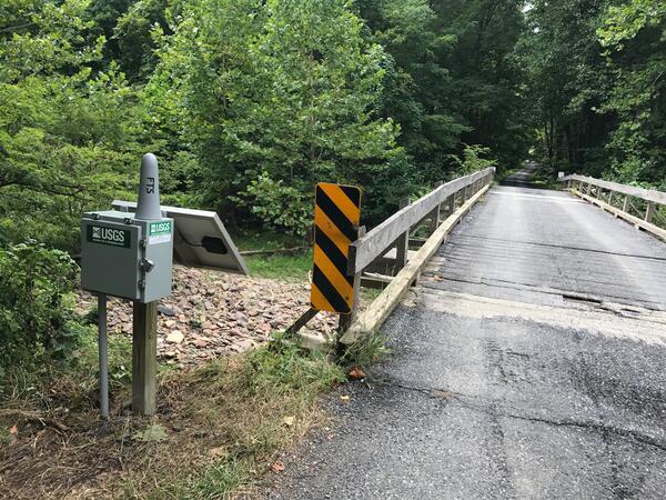
Monitoring Roanoke River along Route 626 at Lafayette, VA
Monitoring Roanoke River along Route 626 at Lafayette, VA
Monitoring Roanoke River along Route 626 at Lafayette, VA
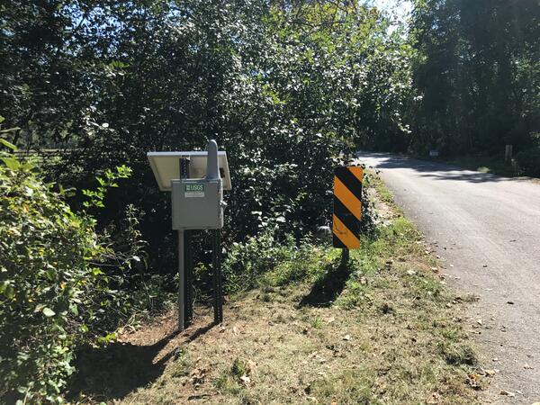
Monitoring Spruce Creek at Route 627 near Nellysford, VA
Monitoring Spruce Creek at Route 627 near Nellysford, VA
Monitoring Spruce Creek at Route 627 near Nellysford, VA