We have installed a webcam at Pocotaligo River at I-95, above Manning to allow you to view (in real time) the current river-stage conditions.
During periods of flooding, the South Atlantic Water Science Center will take control of the camera.

Official websites use .gov
A .gov website belongs to an official government organization in the United States.
Secure .gov websites use HTTPS
A lock () or https:// means you’ve safely connected to the .gov website. Share sensitive information only on official, secure websites.
Access all multimedia to include images, video, audio, webcams, before-after imagery, and more. Filter and explore with filtering options to refine search.
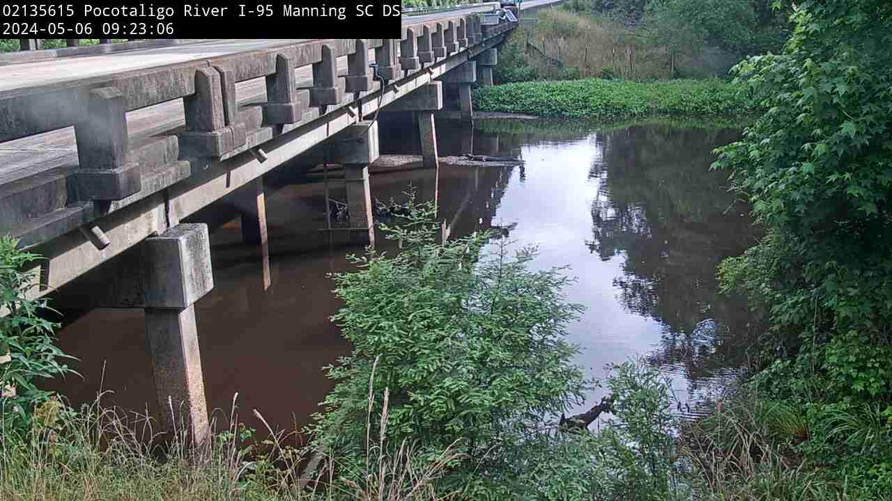
We have installed a webcam at Pocotaligo River at I-95, above Manning to allow you to view (in real time) the current river-stage conditions.
During periods of flooding, the South Atlantic Water Science Center will take control of the camera.
We have installed a webcam at Pocotaligo River at I-95, above Manning to allow you to view (in real time) the current river-stage conditions.
During periods of flooding, the South Atlantic Water Science Center will take control of the camera.

In the winter of 2015, the public noticed thousands of dead seabirds washing ashore across the western coast of the United States and Canada. The USGS linked this massive seabird die-off to the North Pacific Marine Heatwave. A marine heatwave occurs when sea surface temperatures are above normal for an extended period of time.
In the winter of 2015, the public noticed thousands of dead seabirds washing ashore across the western coast of the United States and Canada. The USGS linked this massive seabird die-off to the North Pacific Marine Heatwave. A marine heatwave occurs when sea surface temperatures are above normal for an extended period of time.
The rangelands of the western United States are changing more quickly than many other parts of the lower 48. Miles upon miles of the area or semi-arid landscapes in states like Idaho, Montana and Nevada are now carpeted by fire fueling invasive grasses. Cheatgrass is the most prevalent, which is troublesome for several reasons.
The rangelands of the western United States are changing more quickly than many other parts of the lower 48. Miles upon miles of the area or semi-arid landscapes in states like Idaho, Montana and Nevada are now carpeted by fire fueling invasive grasses. Cheatgrass is the most prevalent, which is troublesome for several reasons.

2021 was an interesting year for deformation at both Kīlauea and Mauna Loa volcanoes. At Kīlauea, 2021 provided a glimpse of what the future might hold as the system recovers from the large collapses that accompanied the 2018 lower East Rift Zone eruption.
2021 was an interesting year for deformation at both Kīlauea and Mauna Loa volcanoes. At Kīlauea, 2021 provided a glimpse of what the future might hold as the system recovers from the large collapses that accompanied the 2018 lower East Rift Zone eruption.

Mauna Loa is an active volcano, though it has been quiet for almost 30 years. An eruption is not imminent, but patterns of ground deformation on Mauna Loa over the past year may indicate that new, previously unobserved processes may have occurred. Mauna Loa lava flows have the capacity to disrupt lives and commerce throughout the Island of Hawai‘i.
Mauna Loa is an active volcano, though it has been quiet for almost 30 years. An eruption is not imminent, but patterns of ground deformation on Mauna Loa over the past year may indicate that new, previously unobserved processes may have occurred. Mauna Loa lava flows have the capacity to disrupt lives and commerce throughout the Island of Hawai‘i.

It seems the effects of climate change were all too clear in 2021. Yet, we know more change is expected. When trying to adapt to a changing climate, with all the inherent uncertainties about how the future may play out, resource managers often turn to scenario planning as a tool.
It seems the effects of climate change were all too clear in 2021. Yet, we know more change is expected. When trying to adapt to a changing climate, with all the inherent uncertainties about how the future may play out, resource managers often turn to scenario planning as a tool.

The tallest volcano on the Galapagos Islands began erupting on January 6. The eruption sent lava flows down the mountainside and ash skyward. Like the Hawaiian Islands, the Galapagos are volcanic islands formed over an active hotspot. Wolf Volcano last erupted in May and June of 2015.
The tallest volcano on the Galapagos Islands began erupting on January 6. The eruption sent lava flows down the mountainside and ash skyward. Like the Hawaiian Islands, the Galapagos are volcanic islands formed over an active hotspot. Wolf Volcano last erupted in May and June of 2015.

Communities on the Island of Hawai‘i continue to recover from Kīlauea’s 2018 lower East Rift Zone eruption and summit collapse as does the USGS Hawaiian Volcano Observatory (HVO). During the events of 2018, HVO instruments were lost, monitoring infrastructure was impacted, and HVO staff had to evacuate the observatory, which was damaged beyond repair.
Communities on the Island of Hawai‘i continue to recover from Kīlauea’s 2018 lower East Rift Zone eruption and summit collapse as does the USGS Hawaiian Volcano Observatory (HVO). During the events of 2018, HVO instruments were lost, monitoring infrastructure was impacted, and HVO staff had to evacuate the observatory, which was damaged beyond repair.

Incredibly high sulfur dioxide (SO2) emission rates were measured during the lower East Rift Zone of Kīlauea in 2018—nearly 200,000 tonnes per day. Emissions dropped to only about 30 tonnes per day during Kīlauea’s non-eruptive quiet period from 2018–2020.
Incredibly high sulfur dioxide (SO2) emission rates were measured during the lower East Rift Zone of Kīlauea in 2018—nearly 200,000 tonnes per day. Emissions dropped to only about 30 tonnes per day during Kīlauea’s non-eruptive quiet period from 2018–2020.
Satellites like Landsat are valuable for mapping fire perimeters and for monitoring trends in burn severity or in post-fire recovery. Satellites can cover wide areas with a single pass, whereas helicopter, drone, or airplane fire line mapping can take hours.
Satellites like Landsat are valuable for mapping fire perimeters and for monitoring trends in burn severity or in post-fire recovery. Satellites can cover wide areas with a single pass, whereas helicopter, drone, or airplane fire line mapping can take hours.

This video highlights the Geomorphology team at the MD-DE-DC Water Science Center, and features interviews with several USGS scientists.
They discuss what skills they possess, what technologies they use, and how their research helps advance the mission of the USGS.
This video highlights the Geomorphology team at the MD-DE-DC Water Science Center, and features interviews with several USGS scientists.
They discuss what skills they possess, what technologies they use, and how their research helps advance the mission of the USGS.

Recent activity has altered the landscape in northwestern China. Alluvial Fan, from the second Earth As Art collection, was acquired in 2002 by the ASTER sensor on NASA’s Terra satellite. It’s truly a fan favorite, often named one of the top images of the entire collection.
Recent activity has altered the landscape in northwestern China. Alluvial Fan, from the second Earth As Art collection, was acquired in 2002 by the ASTER sensor on NASA’s Terra satellite. It’s truly a fan favorite, often named one of the top images of the entire collection.

This is an animation showing the changing conditions of USGS streamgages from October 1, 2021 to December 31, 2021. The river conditions shown range from the driest condition seen at a gage (red open circles) to the wettest (blue closed circles). A purple outer ring around a gage indicates it is flooding.
This is an animation showing the changing conditions of USGS streamgages from October 1, 2021 to December 31, 2021. The river conditions shown range from the driest condition seen at a gage (red open circles) to the wettest (blue closed circles). A purple outer ring around a gage indicates it is flooding.

This is an animation showing the changing conditions of USGS streamgages from October 1, 2020 to September 30, 2021. The river conditions shown range from the driest condition seen at a gage (red open circles) to the wettest (blue closed circles). A purple outer ring around a gage indicates it is flooding.
This is an animation showing the changing conditions of USGS streamgages from October 1, 2020 to September 30, 2021. The river conditions shown range from the driest condition seen at a gage (red open circles) to the wettest (blue closed circles). A purple outer ring around a gage indicates it is flooding.

Before we get into what happened during the month of December 2021, let’s review what happened at Yellowstone over the past year.
Before we get into what happened during the month of December 2021, let’s review what happened at Yellowstone over the past year.

The marshes of Plum Island Estuary are among those predicted by scientists to submerge during the next century under conservative projections of sea-level rise.
The marshes of Plum Island Estuary are among those predicted by scientists to submerge during the next century under conservative projections of sea-level rise.

Eruptive activity resumed today in Halema‘uma‘u crater, at the summit of Kīlauea volcano, after a brief pause of several days. This video shows spattering and lava effusion from the west vent, which has built a steep spatter cone.
Eruptive activity resumed today in Halema‘uma‘u crater, at the summit of Kīlauea volcano, after a brief pause of several days. This video shows spattering and lava effusion from the west vent, which has built a steep spatter cone.

Following the lower East Rift Zone eruption and summit collapse of Kīlauea in 2018, the volcano remained quiet for more than two years. Lava returned to Kīlauea in December 2020, boiling off the water lake that had been present at the base of Halema‘uma‘u crater, and starting a five-month long eruption in Hawai‘i Volcanoes National Park.
Following the lower East Rift Zone eruption and summit collapse of Kīlauea in 2018, the volcano remained quiet for more than two years. Lava returned to Kīlauea in December 2020, boiling off the water lake that had been present at the base of Halema‘uma‘u crater, and starting a five-month long eruption in Hawai‘i Volcanoes National Park.

The last year has been a busy one for seismologists at the USGS Hawaiian Volcano Observatory. Earthquake activity at Kīlauea summit has varied over the past year, with upticks in a variety of seismic signals providing clues to the start of the December 2020 and September 2021 Kīlauea summit eruptions.
The last year has been a busy one for seismologists at the USGS Hawaiian Volcano Observatory. Earthquake activity at Kīlauea summit has varied over the past year, with upticks in a variety of seismic signals providing clues to the start of the December 2020 and September 2021 Kīlauea summit eruptions.

Geophysical equipment loop for electromagnetic survey on ground prior to liftoff by helicopter. In January 2021 a helicopter carried an airborne electromagnetic induction sensor over parts of northeastern Wisconsin as part of a USGS study to map the aquifers in the region.
Geophysical equipment loop for electromagnetic survey on ground prior to liftoff by helicopter. In January 2021 a helicopter carried an airborne electromagnetic induction sensor over parts of northeastern Wisconsin as part of a USGS study to map the aquifers in the region.

Structure-from-motion techniques use photographs taken from different angles to reconstruct the three-dimensional shape of an object. At Kīlauea, this technique has been used to rapidly generate maps of eruption activity from aerial imagery, allowing scientists to quantify changes over time such as the volume of lava erupted and surface area covered by lava.
Structure-from-motion techniques use photographs taken from different angles to reconstruct the three-dimensional shape of an object. At Kīlauea, this technique has been used to rapidly generate maps of eruption activity from aerial imagery, allowing scientists to quantify changes over time such as the volume of lava erupted and surface area covered by lava.

