
This map shows recent unrest at Kīlauea's summit and Southwest Rift Zone. Yellow circles denote earthquake locations from October 4–November 5, 2023, as recorded by HVO seismometers.
Images
Hawaiian Volcano Observatory images of eruptive activity, field work, and more.
Filter Total Items: 2879

November 5, 2023—Summary map of intrusive activity at Kīlauea Volcano
This map shows recent unrest at Kīlauea's summit and Southwest Rift Zone. Yellow circles denote earthquake locations from October 4–November 5, 2023, as recorded by HVO seismometers.

Continuous GPS monitoring station and data on the Island of Hawai'i
Left: Annotated photo showing a continuous GPS monitoring station installed by HVO on the Island of Hawai'i. USGS photo by A.P. Ellis. Right: Example graph of processed daily GPS data positions in the east-west (top panel), north-south (middle panel), and vertical (bottom panel) axes for a GPS monitoring station at the summit of Kīlauea over the past two years.
Left: Annotated photo showing a continuous GPS monitoring station installed by HVO on the Island of Hawai'i. USGS photo by A.P. Ellis. Right: Example graph of processed daily GPS data positions in the east-west (top panel), north-south (middle panel), and vertical (bottom panel) axes for a GPS monitoring station at the summit of Kīlauea over the past two years.
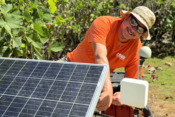
USGS Hawaiian Volcano Observatory chief field engineer
USGS Hawaiian Volcano Observatory chief field engineer Kevan Kamibayashi conducts maintenance on a volcano-monitoring station located in American Samoa. USGS photo by J. Chang.
USGS Hawaiian Volcano Observatory chief field engineer Kevan Kamibayashi conducts maintenance on a volcano-monitoring station located in American Samoa. USGS photo by J. Chang.

Mauna Loa 2022 eruption anniversary video
Thumbnail image for Mauna Loa 2022 eruption anniversary video. Mauna Loa is Earth's largest active volcano and covers just over half of the Island of Hawaiʻi. It erupted most recently in November-December 2022, and it will erupt again.
Thumbnail image for Mauna Loa 2022 eruption anniversary video. Mauna Loa is Earth's largest active volcano and covers just over half of the Island of Hawaiʻi. It erupted most recently in November-December 2022, and it will erupt again.

The National University of Equatorial Guinea (UNGE) volcano monitoring team and collaborators
The UNGE team with a newly installed seismic station. Also pictured is Dr. Christine Sealing (Fulbright Specialist), top row second from left, and Aaron Rinehart (USAID-USGS VDAP) bottom row second from right.
The UNGE team with a newly installed seismic station. Also pictured is Dr. Christine Sealing (Fulbright Specialist), top row second from left, and Aaron Rinehart (USAID-USGS VDAP) bottom row second from right.

Pico Basile volcano
Pico Basile volcano, located on Bioko Island in Equatorial Guinea (western Africa).
Pico Basile volcano, located on Bioko Island in Equatorial Guinea (western Africa).

USGS field engineering technician installs a borehole
USGS field engineering technician Seth Swaney works on installing the borehole and upgrading seismic station AHUD, located south of Kaluapele and the summit of Kīlauea. USGS photo by M. Warren.
USGS field engineering technician Seth Swaney works on installing the borehole and upgrading seismic station AHUD, located south of Kaluapele and the summit of Kīlauea. USGS photo by M. Warren.

October 25, 2023 — Kīlauea GPS campaign wraps up
In this photo, taken on October 3, 2023, near Kīlauea's coastline in Hawai‘i Volcanoes National Park, a GPS antenna is mounted on a fixed rod. A GPS receiver, housed in the yellow box, records the positions that can be compared with those from previous years to discern subtle patterns of ground deformation associated with volcanic activity.
In this photo, taken on October 3, 2023, near Kīlauea's coastline in Hawai‘i Volcanoes National Park, a GPS antenna is mounted on a fixed rod. A GPS receiver, housed in the yellow box, records the positions that can be compared with those from previous years to discern subtle patterns of ground deformation associated with volcanic activity.

October 25, 2023 — Kīlauea GPS campaign wraps up
During the annual Kīlauea GPS campaign, scientists temporarily deploy a number of GPS instruments at established benchmarks; their recorded positions can be compared with those from previous years to discern subtle patterns of ground deformation associated with volcanic activity.
During the annual Kīlauea GPS campaign, scientists temporarily deploy a number of GPS instruments at established benchmarks; their recorded positions can be compared with those from previous years to discern subtle patterns of ground deformation associated with volcanic activity.

October 25, 2023 — Kīlauea GPS campaign wraps up
Hawaiian Volcano Observatory geophysicists completed the annual GPS survey of Kīlauea. Most Kīlauea and Mauna Loa GPS campaign survey sites have been occupied every year since the early 1990s, whereas the less active volcanoes Hualālai and Haleakalā are surveyed every 3–5 years. USGS photo by A. Ellis.
Hawaiian Volcano Observatory geophysicists completed the annual GPS survey of Kīlauea. Most Kīlauea and Mauna Loa GPS campaign survey sites have been occupied every year since the early 1990s, whereas the less active volcanoes Hualālai and Haleakalā are surveyed every 3–5 years. USGS photo by A. Ellis.

October 25, 2023 — Kīlauea GPS campaign wraps up
Hawaiian Volcano Observatory geophysicists recently completed the annual GPS survey of Kīlauea.
Hawaiian Volcano Observatory geophysicists recently completed the annual GPS survey of Kīlauea.

October 24, 2023 — Reference map of September 2023 Kīlauea summit eruption
This reference map depicts the Kīlauea summit region following the most recent eruption in September 2023. The provided statistics for the eruption were measured and calculated from detailed aerial mapping that was completed after activity had ceased; a much weaker gas plume allowed for more accurate modeling of the post-eruption lava surface.
This reference map depicts the Kīlauea summit region following the most recent eruption in September 2023. The provided statistics for the eruption were measured and calculated from detailed aerial mapping that was completed after activity had ceased; a much weaker gas plume allowed for more accurate modeling of the post-eruption lava surface.

October 24, 2023—Summary map of intrusive activity at Kīlauea Volcano
This map shows recent unrest at Kīlauea summit. Yellow circles denote earthquake locations from October 4–24, 2023, as recorded by HVO seismometers. Nearly 2,000 earthquakes were detected during this time period. Colored fringes denote areas of ground deformation from September 24–October 10 as measured by satellite radar.
This map shows recent unrest at Kīlauea summit. Yellow circles denote earthquake locations from October 4–24, 2023, as recorded by HVO seismometers. Nearly 2,000 earthquakes were detected during this time period. Colored fringes denote areas of ground deformation from September 24–October 10 as measured by satellite radar.

Dr. Jim Kauahikaua in the field
Dr. Jim Kauahikaua using an instrument that detects very low frequencies on Pu‘u‘ō‘ō lava flows. The instrument allows for the continuous monitoring of the cross-sectional area of molten lava in the lava tube. USGS photo.
Dr. Jim Kauahikaua using an instrument that detects very low frequencies on Pu‘u‘ō‘ō lava flows. The instrument allows for the continuous monitoring of the cross-sectional area of molten lava in the lava tube. USGS photo.

October 12, 2023—Summary map of intrusive activity at Kīlauea Volcano―October 4–12, 2023
This map shows recent unrest in Kīlauea’s summit region. Colored fringes denote areas of ground deformation and yellow circles denote earthquake locations.
This map shows recent unrest in Kīlauea’s summit region. Colored fringes denote areas of ground deformation and yellow circles denote earthquake locations.

October 6, 2023 — Kīlauea GPS campaign wraps up
A GPS site is occupied on the south flank of Kīlauea, inside Hawai‘i Volcanoes National Park, as part of the 2023 annual campaign survey. The survey data will supplement continuous data collected at permanent GPS sites on Kīlauea volcano. The Pacific Ocean is visible in the background. USGS photo by A. Ellis.
A GPS site is occupied on the south flank of Kīlauea, inside Hawai‘i Volcanoes National Park, as part of the 2023 annual campaign survey. The survey data will supplement continuous data collected at permanent GPS sites on Kīlauea volcano. The Pacific Ocean is visible in the background. USGS photo by A. Ellis.

October 3, 2023 — Kīlauea GPS campaign
A GPS survey benchmark is being occupied on the Southwest Rift Zone of Kīlauea. The metal disk on the ground beneath the tripod is the benchmark, which is cemented to the lava flow surface. Each year during the Kīlauea GPS campaign survey, a high-precision GPS unit is centered over the benchmark to collect data.
A GPS survey benchmark is being occupied on the Southwest Rift Zone of Kīlauea. The metal disk on the ground beneath the tripod is the benchmark, which is cemented to the lava flow surface. Each year during the Kīlauea GPS campaign survey, a high-precision GPS unit is centered over the benchmark to collect data.

October 3, 2023 — Kīlauea GPS campaign continues
Hawaiian Volcano Observatory geophysicists continue performing the annual GPS survey of Kīlauea. Most Kīlauea and Mauna Loa GPS campaign survey sites have been occupied every year since the early 1990s, whereas the less active volcanoes Hualālai and Haleakalā are surveyed every 3–5 years.
Hawaiian Volcano Observatory geophysicists continue performing the annual GPS survey of Kīlauea. Most Kīlauea and Mauna Loa GPS campaign survey sites have been occupied every year since the early 1990s, whereas the less active volcanoes Hualālai and Haleakalā are surveyed every 3–5 years.

Views of the September 2023 Kīlauea summit eruption
This is a cover photo for a video compilation Kīlauea volcano's summit eruption in September 2023. The video shows clips of the eruptive vents and lava fountains as the eruption progressed from September 10-16, 2023. USGS image.
This is a cover photo for a video compilation Kīlauea volcano's summit eruption in September 2023. The video shows clips of the eruptive vents and lava fountains as the eruption progressed from September 10-16, 2023. USGS image.

September 18, 2023 — Overview of recent Halema‘uma‘u eruption site
This overview of the recent eruption site within caldera at the summit of Kīlauea was captured during a Hawaiian Volcano Observatory helicopter overflight on Monday, September 18, 2023.
This overview of the recent eruption site within caldera at the summit of Kīlauea was captured during a Hawaiian Volcano Observatory helicopter overflight on Monday, September 18, 2023.

September 17, 2023 — Kīlauea summit eruption stopped
HVO field crews observed no eruptive activity at the summit of Kīlauea this morning, September 17, 2023. The eruption within the caldera that began on September 10 stopped on September 16. Some areas of steam persist, and overnight webcam views showed incandescence across the eruption area as lava erupted over the past week continues to cool. USGS photo by J.
HVO field crews observed no eruptive activity at the summit of Kīlauea this morning, September 17, 2023. The eruption within the caldera that began on September 10 stopped on September 16. Some areas of steam persist, and overnight webcam views showed incandescence across the eruption area as lava erupted over the past week continues to cool. USGS photo by J.