
View of Jackson Hole Airport and the Teton Range
Images
Images described and linked on this webpage come from a wide variety of USGS science activities and presentations performed by USGS Science Center staff members in the Region 7: Upper Colorado Basin. A search tool is provided to narrow the number of image files shown.
Filter Total Items: 506

View of Jackson Hole Airport and the Teton Range
View of Jackson Hole Airport and the Teton Range
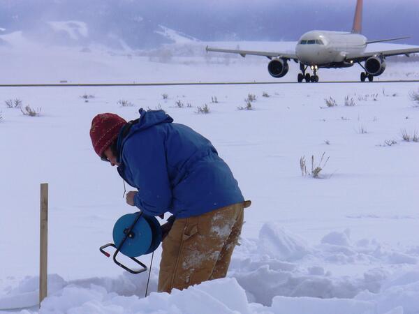
Taking a water-level measurement in a monitoring well at Jackson Hole
Taking a water-level measurement in a monitoring well at Jackson Hole Airport.
Taking a water-level measurement in a monitoring well at Jackson Hole Airport.

Lamar Valley, Yellowstone National Park.
Lamar Valley, Yellowstone National Park.
Lamar Valley, Yellowstone National Park.

Invasive brown treesnake
Brown treesnakes were a major contributor to the loss of nine of 11 native forest birds on Guam.
Brown treesnakes were a major contributor to the loss of nine of 11 native forest birds on Guam.

Ranchlands, Utah and Idaho
Roadsides, ranchlands, and mountains.
Roadsides, ranchlands, and mountains.

Ranchlands, Utah and Idaho
Roadsides, ranchlands, and mountains.
Roadsides, ranchlands, and mountains.

Rainstorms can be localized or widespread.
A localized heavy summer rainstorm in Colorado.
A localized heavy summer rainstorm in Colorado.

Collecting habitat data at 06324970
Collecting habitat data at 06324970
Collecting habitat data at 06324970

Preparing sample for macroinvertebrate analysis
Preparing sample for macroinvertebrate analysis
Preparing sample for macroinvertebrate analysis

The last sheath-tailed bat photo
This photo of a Pacific sheath-tailed bat is the last good photo of this bat from Aguiguan in existence.
This photo of a Pacific sheath-tailed bat is the last good photo of this bat from Aguiguan in existence.

Measuring water level in streambank piezometer nr Wind Riv at Kinnear
Measuring water level in streambank piezometer nr Wind River at Kinnear
Measuring water level in streambank piezometer nr Wind River at Kinnear

Snowpack-sampling pit at Berthoud Pass, Colorado
Snowpack-sampling pit at Berthoud Pass, Colo.
Snowpack-sampling pit at Berthoud Pass, Colo.

Steep alpine terrain above snowpack-sampling site at Big Mountain, MT
Steep alpine terrain above snowpack-sampling site at Big Mountain, MT.
Steep alpine terrain above snowpack-sampling site at Big Mountain, MT.

Coyote on trail to Canyon, Wyoming
Coyote on trail to Canyon, Wyoming
Coyote on trail to Canyon, Wyoming

Parking area for worker's snowmobiles near Deadman Pass, Colorado
Parking area for worker's snowmobiles near Deadman Pass, Colo
Parking area for worker's snowmobiles near Deadman Pass, Colo

Station 1
The Upper monitoring station at Chalk Cliffs, CO.
The Upper monitoring station at Chalk Cliffs, CO.

Well sampled for baseline pesticide concentrations in groundwater
Well sampled to determine baseline pesticide concentrations in groundwater.
Well sampled to determine baseline pesticide concentrations in groundwater.

Measuring water-quality parameters in a domestic-supply well
A hydrologic technician uses a meter to measure water-quality parameters, such as pH, dissolved oxygen, and specific conductance, in a domestic-supply well.
A hydrologic technician uses a meter to measure water-quality parameters, such as pH, dissolved oxygen, and specific conductance, in a domestic-supply well.

Moose on road to Lake Irene, Colorado
Moose on road to Lake Irene, Colorado
Moose on road to Lake Irene, Colorado

Snowpack-sampling pit near Fremont Pass, Colorado
Snowpack-sampling pit near Fremont Pass, Colorado
Snowpack-sampling pit near Fremont Pass, Colorado

Snow-density measurement near Dunckley Pass, Colorado
Snow-density measurement in snowpack-sampling pit near Dunckley Pass, Colorado
Snow-density measurement in snowpack-sampling pit near Dunckley Pass, Colorado