
A major eruption of Mount Hood would pose a great hazard to the regional economy.
Images
Images intro.
Filter Total Items: 211

Mount Hood dominates the skyline outside of Portland, Oregon
A major eruption of Mount Hood would pose a great hazard to the regional economy.

map of historic and current sage-grouse range in 2000
Map of historic and current sage-grouse range in 2000, provided as a download from the old USGS Sagemap website.
Map of historic and current sage-grouse range in 2000, provided as a download from the old USGS Sagemap website.

Surveying channel change in Fanno Creek, OR
USGS hydrologist surveying channel depth across Fanno Creek, OR
USGS hydrologist surveying channel depth across Fanno Creek, OR

Extent of Newberry lavas including approximate ages of surficial flows
Extending approximately 75 miles north to south and 27 miles east to west, Newberry Volcano and its broad apron of lavas (light yellow shaded area) cover a total area of almost 1,200 square miles, making it the largest volcano of the Cascades volcanic chain. Its lavas stretch north beyond Smith Rock State Park, and south almost to Fort Rock State Natural Area.
Extending approximately 75 miles north to south and 27 miles east to west, Newberry Volcano and its broad apron of lavas (light yellow shaded area) cover a total area of almost 1,200 square miles, making it the largest volcano of the Cascades volcanic chain. Its lavas stretch north beyond Smith Rock State Park, and south almost to Fort Rock State Natural Area.

Capturing juvenile Chinook salmon using a Lampara net
Capturing juvenile Chinook salmon in Cougar Reservoir, Oregon using a Lampara net.
Capturing juvenile Chinook salmon in Cougar Reservoir, Oregon using a Lampara net.
Tracking overwintering locations of Oregon spotted frogs
A USGS scientist is using radio telemetry to track the overwintering locations of Oregon spotted frogs at Gold Lake bog in Oregon. Oregon spotted frogs spend nearly half the year at overwintering locations, which can include springs, beaver channels, and crevices in lava rock.
A USGS scientist is using radio telemetry to track the overwintering locations of Oregon spotted frogs at Gold Lake bog in Oregon. Oregon spotted frogs spend nearly half the year at overwintering locations, which can include springs, beaver channels, and crevices in lava rock.

Measuring the light in Minam River, OR
USGS scientist meaures how much light is transmitted into the Wallowa River, near Minam, OR.
USGS scientist meaures how much light is transmitted into the Wallowa River, near Minam, OR.
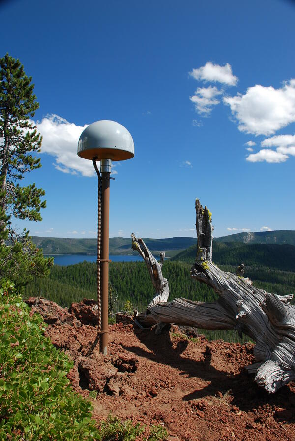
Global Positioning System receiver (called a GPS monument) at North...
Global Positioning System receiver (called a GPS monument) at North Rim Station, a monitoring location at Newberry volcano, Oregon.
Global Positioning System receiver (called a GPS monument) at North Rim Station, a monitoring location at Newberry volcano, Oregon.

Newberry caldera with Paulina Peak, Big Obsidian Flow and Paulina Lake
View looking south across Newberry caldera towards the Big Obsidian flow (left of center) and Paulina Peak, with Paulina Lake in foreground. Photo taken from the north rim of the caldera.
View looking south across Newberry caldera towards the Big Obsidian flow (left of center) and Paulina Peak, with Paulina Lake in foreground. Photo taken from the north rim of the caldera.
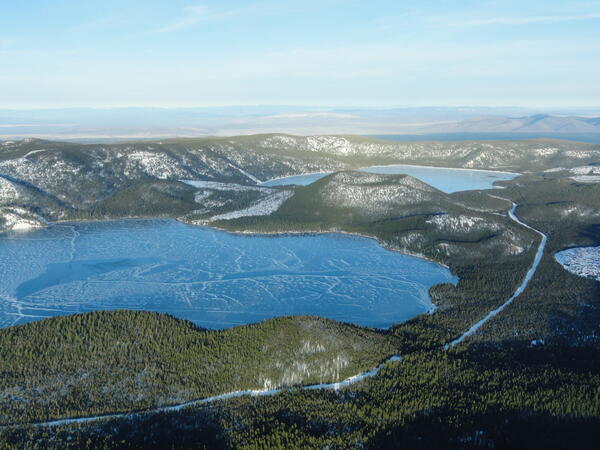
Aerial view of lakes and cinder cone at Newberry Volcano Caldera.
A view looking northeast across the central caldera of Newberry Volcano. Paulina Lake is in the foreground and East Lake is in the distance. The Central Pumice Cone lies between the two lakes. Near the bottom of the photo at the south edge of Paulina Lake, the two hills are named the Lakeshore Domes.
A view looking northeast across the central caldera of Newberry Volcano. Paulina Lake is in the foreground and East Lake is in the distance. The Central Pumice Cone lies between the two lakes. Near the bottom of the photo at the south edge of Paulina Lake, the two hills are named the Lakeshore Domes.

Mount Hood, OR
View of Mount Hood from Pittock Mansion, Portland, OR.
View of Mount Hood from Pittock Mansion, Portland, OR.

Willamette River through downtown Portland, OR
Photograph of the Willamette River passing through downtown Portland, OR.
Photograph of the Willamette River passing through downtown Portland, OR.

Rogue River, Oregon
Rogue River Canyon in southwest Oregon
Rogue River Canyon in southwest Oregon

Upper Klamath Lake cyanobacteria bloom
The green water, caused by massive blooms of Aphanizomenon flos-aquae, as seen in the wake of a boat, is a common sight each summer on Upper Klamath Lake, Oregon. USGS studies how these blooms effect endangered Lost River and shortnose suckers in the lake.
The green water, caused by massive blooms of Aphanizomenon flos-aquae, as seen in the wake of a boat, is a common sight each summer on Upper Klamath Lake, Oregon. USGS studies how these blooms effect endangered Lost River and shortnose suckers in the lake.

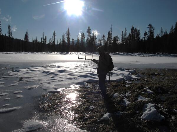
Knife Ridge station locations
Oblique photograph of Knife Ridge monitoring site showing approximate soil pit locations.
Oblique photograph of Knife Ridge monitoring site showing approximate soil pit locations.

Rough skinned newt in defensive posture, EPA ponds, Corvallis, OR
Rough-skinned newt in defensive posture, EPA ponds, Corvallis, OR. Rough-skinned newts produce a powerful neurotoxin as a defense against predators.
Rough-skinned newt in defensive posture, EPA ponds, Corvallis, OR. Rough-skinned newts produce a powerful neurotoxin as a defense against predators.

Eruptions in the Cascade Range during the past 4000 years. USGS GIP 64
Eruptions in the Cascade Range during the past 4000 years. USGS GIP 64
Eruptions in the Cascade Range during the past 4000 years. USGS GIP 64

Adult Oregon spotted frog
Adult Oregon spotted frog at Dilman Meadows, near Wickiup Reservoir, OR
Adult Oregon spotted frog at Dilman Meadows, near Wickiup Reservoir, OR
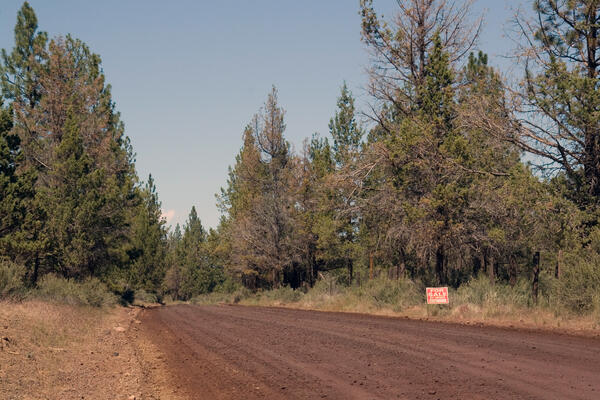
A pine forest with a dirt road running through it in Oregon
A pine forest with a dirt road running through it in Oregon. Photo taken as a part of field work during the Land Cover Trends project.
A pine forest with a dirt road running through it in Oregon. Photo taken as a part of field work during the Land Cover Trends project.

Broken Top volcano, inactive since 150 ka or longer, viewed to NW. ...
Radially dipping strata of the cone include subequal proportions of lava flows and flow breccias and of proximal agglutinate and scoria falls, nearly all having 54 to 56 percent SiO2. Numerous mafic dikes and sills intrude the cone, and an apron of compositionally similar mafic lavas extends far outward from the cone.
Radially dipping strata of the cone include subequal proportions of lava flows and flow breccias and of proximal agglutinate and scoria falls, nearly all having 54 to 56 percent SiO2. Numerous mafic dikes and sills intrude the cone, and an apron of compositionally similar mafic lavas extends far outward from the cone.

Crooked River at Smith Rocks
Crooked River of the Deschutes River Basin, Oregon, flows through Smith Rocks
Crooked River of the Deschutes River Basin, Oregon, flows through Smith Rocks