
The Digital Shoreline Analysis System (DSAS) version 6 is a standalone application that calculates shoreline or boundary change over time. The GIS of a user’s choice is used to prepare the data for DSAS. Like previous versions, DSAS v.6 enables a user to calculate rate-of-change statistics from multiple historical shoreline positions.
Images
Images intro.
Filter Total Items: 1205

DSAS v6.0 Infographic
The Digital Shoreline Analysis System (DSAS) version 6 is a standalone application that calculates shoreline or boundary change over time. The GIS of a user’s choice is used to prepare the data for DSAS. Like previous versions, DSAS v.6 enables a user to calculate rate-of-change statistics from multiple historical shoreline positions.

DSAS
DSAS generates transects that are cast perpendicular to the reference baseline to intersect shorelines at a user-specified spacing alongshore. Please note that the figure above illustrates the placement of both onshore and offshore baselines as examples. In DSAS v6.0 all baselines in a file must be placed either offshore or onshore, not combined.
DSAS generates transects that are cast perpendicular to the reference baseline to intersect shorelines at a user-specified spacing alongshore. Please note that the figure above illustrates the placement of both onshore and offshore baselines as examples. In DSAS v6.0 all baselines in a file must be placed either offshore or onshore, not combined.

Satellite image of south San Francisco Bay
Satellite image of south San Francisco Bay, from the seminar "Monitoring and mapping mercury species in south San Francisco Bay waters".
Satellite image of south San Francisco Bay, from the seminar "Monitoring and mapping mercury species in south San Francisco Bay waters".

Black and white images show damage caused by the 1964 earthquake and tsunami in Valdez, Alaska
Black and white images show damage caused by the 1964 earthquake and tsunami in Valdez, Alaska.
Black and white images show damage caused by the 1964 earthquake and tsunami in Valdez, Alaska.

Map of the Columbia River Littoral Cell showing validation sites where beach profile surveys have been conducted
linkMap of the Columbia River Littoral Cell showing validation sites where beach profile surveys (white dots) have been conducted. The labels of some of the transects at the edge of each subcell are displayed.

Photo of Maria Winters collecting topographic elevation data
Photo of Maria Winters collecting topographic elevation data, as part of her research and seminar titled, "Modeling and Observations of Anthropogenic Dunes on Energetic Coastlines".
Photo of Maria Winters collecting topographic elevation data, as part of her research and seminar titled, "Modeling and Observations of Anthropogenic Dunes on Energetic Coastlines".
Images above show views of the Mud Creek landslide, California before and after the 2024 winter season
linkThe images above show views of the Mud Creek landslide, California before (June 8, 2023) and after (Feb. 23, 2024) the 2024 winter season. Images show shaded-relief views of the 3-dimensional landscape data derived by USGS photogrammetry techniques.
Images show the same views of the Mud Creek landslide, California before and after the winter 2024 season
linkImages show the same views of the Mud Creek landslide, California before and after the winter 2024 season. Vertical change shows both erosion (red) and accretion (blue), which reveals changes to the landscape.

Map indicating the location of Loki's Castle Vent Field
Map indicating the location of Loki's Castle Vent Field (LCVF; red dot) near the intersection of the Mohns and Knipovich ridges and (b) the location of the push cores in relation to the east and west mounds.
Map indicating the location of Loki's Castle Vent Field (LCVF; red dot) near the intersection of the Mohns and Knipovich ridges and (b) the location of the push cores in relation to the east and west mounds.

Photographs, CT scans and stereomicroscope images of cores from Loki's Castle
Photographs, CT scans and stereomicroscope images of cores ROV22PC01 (a) and ROV22PC04 (b) illustrating the discrimination between sediments which were accumulated dominantly through mass wasting (a) and sediments accumulated through plume fallout (b).
Photographs, CT scans and stereomicroscope images of cores ROV22PC01 (a) and ROV22PC04 (b) illustrating the discrimination between sediments which were accumulated dominantly through mass wasting (a) and sediments accumulated through plume fallout (b).
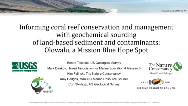
Title card for presentation on geochemical sourcing of land-based contaminants at Olowalu
Title card for the presentation "Informing coral reef conservation and management with geochemical sourcing of land-based sediment and contaminants at Olowalu, a Mission Blue Hope Spot."
Title card for the presentation "Informing coral reef conservation and management with geochemical sourcing of land-based sediment and contaminants at Olowalu, a Mission Blue Hope Spot."

Output examples of SWAN model
Color maps showing output examples of the Simulating Waves Nearshore (SWAN) model and how 1 of the 999 wave conditions was dynamically downscaled to the 200-meter (m) grid scale offshore West Maui, Hawaiʻi. A, The 5-kilometer (km) resolution Hawaiian Chain model. B, The 1-km resolution Maui Nui model embedded in the Hawaiian Chain model.
Color maps showing output examples of the Simulating Waves Nearshore (SWAN) model and how 1 of the 999 wave conditions was dynamically downscaled to the 200-meter (m) grid scale offshore West Maui, Hawaiʻi. A, The 5-kilometer (km) resolution Hawaiian Chain model. B, The 1-km resolution Maui Nui model embedded in the Hawaiian Chain model.

Animated GIF of a clamshell dredge in operation
Animated GIF of a clamshell dredge in operation in San Francisco Bay, California, as part of the Shallow Water Strategic Placement Pilot Project.
Animated GIF of a clamshell dredge in operation in San Francisco Bay, California, as part of the Shallow Water Strategic Placement Pilot Project.

Aerial image of Corte Madera tidal marsh
Aerial image of Corte Madera marsh in San Francisco Bay, California, a study site for the Sediment Transport in Coastal Environments project.
Aerial image of Corte Madera marsh in San Francisco Bay, California, a study site for the Sediment Transport in Coastal Environments project.

Emily Bristol.jpg
Staff profile photo of Emily Bristol, USGS Mendenhall Fellow at the Pacific Coastal and Marine Science Center.
Staff profile photo of Emily Bristol, USGS Mendenhall Fellow at the Pacific Coastal and Marine Science Center.

Staff profile photo of Mark Lundine
Staff profile photo of Mark Lundine, post-doctoral researcher at the USGS Pacific Coastal and Marine Science Center.
Staff profile photo of Mark Lundine, post-doctoral researcher at the USGS Pacific Coastal and Marine Science Center.

Mud Creek slide seen from the air on February 22 2024
Mud Creek slide seen from the air on February 22 2024, as part of USGS remote sensing data to track Big Sur landslides in 2024.
Mud Creek slide seen from the air on February 22 2024, as part of USGS remote sensing data to track Big Sur landslides in 2024.

False color CT scan of sediment core from Floras Lake, Oregon
False color CT scan of sediment core from Floras Lake, Oregon, showing a sediment record stretching back 6,700 years.
False color CT scan of sediment core from Floras Lake, Oregon, showing a sediment record stretching back 6,700 years.

Staff profile photo of Alicia Jones
Staff profile photo of Alicia Jones, Administrative Operations Assistant at the USGS Pacific Coastal and Marine Science Center.
Staff profile photo of Alicia Jones, Administrative Operations Assistant at the USGS Pacific Coastal and Marine Science Center.

Tim Elfers, Marine Operations Manager 2018041_Timothy Elfers.jpg
Staff profile photo of Tim Elfers, Marine Operations Manager for the USGS Pacific Coastal and Marine Science Center.
Staff profile photo of Tim Elfers, Marine Operations Manager for the USGS Pacific Coastal and Marine Science Center.

Photo 1 of USGS Research Vessel William on a trailer
USGS Research Vessel William on a trailer, part of the Pacific Coastal and Marine Science Center's Marine Facility (MarFac) fleet.
USGS Research Vessel William on a trailer, part of the Pacific Coastal and Marine Science Center's Marine Facility (MarFac) fleet.