
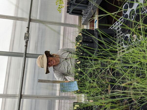
Greenhouse study comparing plant performance during drought will help land managers choose plant species for restoring degraded lands. To find out more, follow the Restoration Assessment and Monitoring Program of the Southwest, housed at the Southwest Biolobigical Science Center. www.ugs.gov/sbsc/ramps
Images
Below are images associated with SBSC's science and staff. Images appear according to the year they were taken. To search, type a keyword or select a year from the dropdown menu. Or, click through the pages using the arrows at the bottom of the page.
Filter Total Items: 406
Drought experiments shed light on plant responses to climate change.
Greenhouse study comparing plant performance during drought will help land managers choose plant species for restoring degraded lands. To find out more, follow the Restoration Assessment and Monitoring Program of the Southwest, housed at the Southwest Biolobigical Science Center. www.ugs.gov/sbsc/ramps

An illustration showing use of a bat echometer and a light trap to detect emerging aquatic insects
linkAn illustration by Diana Valentin from Northern Arizona University shows the use of a bat echometer and a light trap to detect emerging aquatic insects, along the Colorado River in Grand Canyon. This illustration was drawn during Diana Valentin's internship with USGS.
An illustration showing use of a bat echometer and a light trap to detect emerging aquatic insects
linkAn illustration by Diana Valentin from Northern Arizona University shows the use of a bat echometer and a light trap to detect emerging aquatic insects, along the Colorado River in Grand Canyon.
An illustration showing use of a bat echometer and a light trap to detect emerging aquatic insects
linkAn illustration by Diana Valentin from Northern Arizona University shows the use of a bat echometer and a light trap to detect emerging aquatic insects, along the Colorado River in Grand Canyon.

An illustration of a Myotis yuma bat drawn by Diana Valentin during a Northern Arizona University/USGS internship
linkAn illustration of a Myotis yuma bat drawn by Diana Valentin during a Northern Arizona University/USGS internship. This illustration was drawn during a study that examined how the diversity and abundance of emerging aquatic insects affected bat abundance and foraging.

An illustration of a Parastrellus hesperus canyon bat drawn by Diana Valentin during a Northern Arizona University/USGS internship
linkAn illustration of a Parastrellus hesperus canyon bat drawn by Diana Valentin during a Northern Arizona University/USGS internship. This illustration was drawn during a study that examined how the diversity and abundance of emerging aquatic insects affected bat abundance and foraging.

Powerlines & Pollinators
Connecting powerline rights-of-way vegetation management to improve pollinator habitat. A USGS RAMPS technician samples pollinating insects along the Salt River Project powerline that crosses through Apache-Sitgreaves and Tonto National Forests.
Connecting powerline rights-of-way vegetation management to improve pollinator habitat. A USGS RAMPS technician samples pollinating insects along the Salt River Project powerline that crosses through Apache-Sitgreaves and Tonto National Forests.

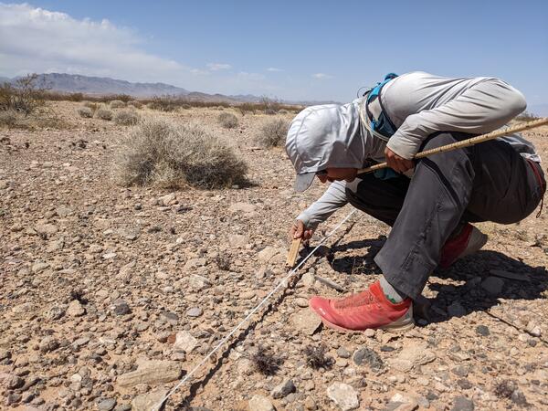
A SBSC technician collects data on native plants for restoration, near Escalante, UT
A SBSC technician, Shannon Lencioni, collects data on native plants for restoration, near Escalante, UT, in May 2021. Photo by Morgan Andrews, SBSC, USGS.
A SBSC technician, Shannon Lencioni, collects data on native plants for restoration, near Escalante, UT, in May 2021. Photo by Morgan Andrews, SBSC, USGS.
Pre-construction monitoring of vegetation for the Gemini Solar Array
The United States is developing renewable energy resources, especially solar, at a rapid rate.
The United States is developing renewable energy resources, especially solar, at a rapid rate.

A pronghorn uses habitat with oil and gas development infrastructure, Utah
A pronghorn (Antilocapra americana) using habitat with oil and gas development near Vernal, Utah. Photo by Mike Duniway, SBSC, USGS.
A pronghorn (Antilocapra americana) using habitat with oil and gas development near Vernal, Utah. Photo by Mike Duniway, SBSC, USGS.

Canyonlands National Park panorama
A panoramic photo of the Colorado River Basin in Canyonlands National Park. Photo by Mike Duniway, Southwest Biological Science Center, USGS.
A panoramic photo of the Colorado River Basin in Canyonlands National Park. Photo by Mike Duniway, Southwest Biological Science Center, USGS.

Gregory M. Anderson "Mark" - staff profile photo
Gregory M. Anderson "Mark" - staff profile photo. Mark is the Deputy Chief of Southwest Biological Science Center's Grand Canyon Monitoring and Research Center (GCMRC).
Gregory M. Anderson "Mark" - staff profile photo. Mark is the Deputy Chief of Southwest Biological Science Center's Grand Canyon Monitoring and Research Center (GCMRC).

USGS staff collects vegetation data on reclaimed oil or gas pad
USGS Southwest Biological Science Center staff collects vegetation data on reclaimed oil or gas pad, Grand Junction, CO, April 2021. Photo by Mike Duniway, SBSC, USGS.
USGS Southwest Biological Science Center staff collects vegetation data on reclaimed oil or gas pad, Grand Junction, CO, April 2021. Photo by Mike Duniway, SBSC, USGS.

FreshwatersIllustrated_USGS_GlenCanyonLowFlowMonitoring20210316b-45.jpg
Botanist Emily Palmquist examines vegetation common to Glen Canyon National Recreation Area
Botanist Emily Palmquist examines vegetation common to Glen Canyon National Recreation Area

FreshwatersIllustrated_USGS_GlenCanyonLowFlowMonitoring20210316b-62.jpg
Scientist on shore and in waders holds up a clear bag full of green algae and insects sampled from Glen Canyon National Recreational Area
Scientist on shore and in waders holds up a clear bag full of green algae and insects sampled from Glen Canyon National Recreational Area

FreshwatersIllustrated_USGS_GlenCanyonLowFlowMonitoring20210316b-128.jpg
Looking upstream at Glen Canyon Dam during the low flow experiment in March 2021
Looking upstream at Glen Canyon Dam during the low flow experiment in March 2021

FreshwatersIllustrated_USGS_GlenCanyonLowFlowMonitoring20210316b-134.jpg
A rock covered with algae is exposed during an experimental low flow release from Glen Canyon Dam in March 2021.
A rock covered with algae is exposed during an experimental low flow release from Glen Canyon Dam in March 2021.

A USGS researcher conducting a metabolism modeling study using a sonde, on the Colorado River below Glen Canyon Dam
linkA USGS researcher, Bridget Deemer, conducting a metabolism modeling study using a submerged sonde, on the Colorado River in Glen Canyon below Glen Canyon Dam. Photo by Freshwaters Illustrated for USGS.

A boat at a landing and a kayak on the water at Lees Ferry, Colorado River, Grand Canyon
A boat with fishing poles tied at a landing at Lees Ferry, Colorado River, downstream of Glen Canyon Dam in Grand Canyon National Park. A kayaker is on the water, and people are visible at the far shore. Photo taken during the spring "disturbance flow" in March, 2021 by Lucas Bair, SBSC, USGS.
A boat with fishing poles tied at a landing at Lees Ferry, Colorado River, downstream of Glen Canyon Dam in Grand Canyon National Park. A kayaker is on the water, and people are visible at the far shore. Photo taken during the spring "disturbance flow" in March, 2021 by Lucas Bair, SBSC, USGS.

JohnBradford_profile_photo.jpg
Profile photo of John Bradford, U.S. Geological Survey Southwest Biological Science Center
Profile photo of John Bradford, U.S. Geological Survey Southwest Biological Science Center

Drylands outside Moab, Utah
A photo of drylands near Moab, Utah. Image taken by Erika Geiger, SBSC. Public domain.
A photo of drylands near Moab, Utah. Image taken by Erika Geiger, SBSC. Public domain.

Drylands near Moab, Utah
Photo of drylands taken near Moab, Utah, by Erika Geiger, USGS SBSC. Public domain.
Photo of drylands taken near Moab, Utah, by Erika Geiger, USGS SBSC. Public domain.