
A USGS researcher takes algae samples at Bear Creek in Redmond, Washington.
Images
Explore water-related photography, imagery, and illustrations.
Filter Total Items: 2402
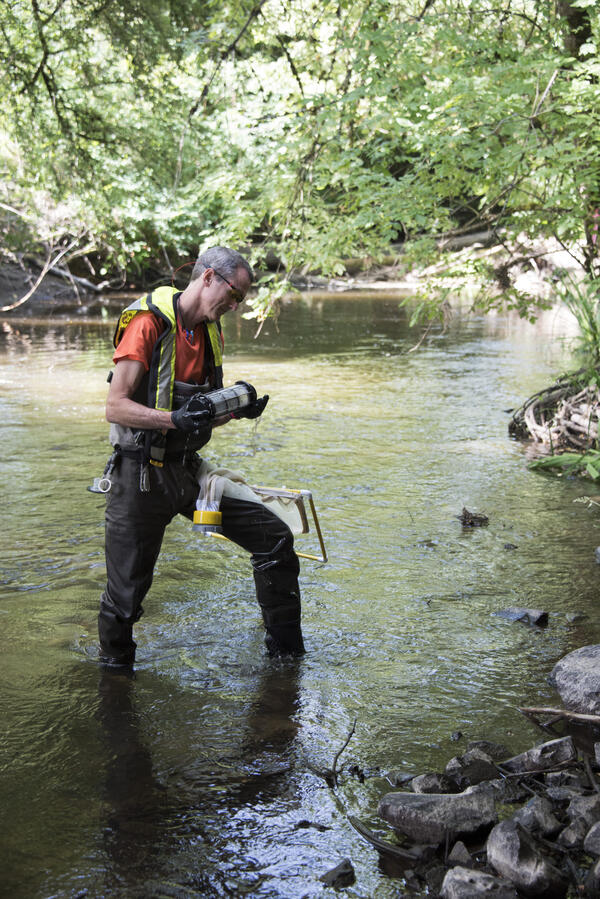
A USGS researcher takes algae samples at Bear Creek in Redmond, WA.
A USGS researcher takes algae samples at Bear Creek in Redmond, Washington.

Salmonid in a Pacific Northwest Stream
Salmonids are inventoried during the ecosurveys done for the Regional Stream Quality Assessment (RSQA)
Salmonids are inventoried during the ecosurveys done for the Regional Stream Quality Assessment (RSQA)

John Redmond Reservoir
John Redmond Reservoir Outlet, June 22, 2015. Ten thousand cubic feet per second being released.
John Redmond Reservoir Outlet, June 22, 2015. Ten thousand cubic feet per second being released.

USGS Gage 10317480 Beaver Creek Near Halleck, Nevada

USGS - flowtracker measurement
USGS - flowtracker measurement
USGS - flowtracker measurement

Collecting pre-sampling measurements in a coastal wetland
USGS hydrologist Tristen Tagliaferri collecting pre-sampling measurements in a coastal wetland after an aerial application of the mosquito insecticide methoprene
USGS hydrologist Tristen Tagliaferri collecting pre-sampling measurements in a coastal wetland after an aerial application of the mosquito insecticide methoprene

Boat Electrofishing
New York State Dept. of Environmental Conservation (NYSDEC) and USGS personnel examine a walleye captured during boat electrofishing on the Barge Canal, near Utica, NY
New York State Dept. of Environmental Conservation (NYSDEC) and USGS personnel examine a walleye captured during boat electrofishing on the Barge Canal, near Utica, NY

San Pedro Riparian National Conservation Area
Photograph showing San Pedro Riparian National Conservation Area, residential development southeast of Sierra Vista, Arizona, and the Huachuca Mountains from Hereford Road, Cochise County, Arizona.
Photograph showing San Pedro Riparian National Conservation Area, residential development southeast of Sierra Vista, Arizona, and the Huachuca Mountains from Hereford Road, Cochise County, Arizona.

Memorial Day Flood in Texas
Road and bridge damage on the Blanco River near Blanco, Texas, from the Memorial Day 2015 Flood.
Road and bridge damage on the Blanco River near Blanco, Texas, from the Memorial Day 2015 Flood.

Blanco River 2015 Memorial Weekend Flood
Picturesque rivers of the Texas Hill Country can turn into raging torrents in the part of Texas known as Flash Flood Alley when storms drop many inches of rain in the river watersheds. This image shows a damaged street sign and flood debris left behind by record flood waters of the Blanco River near Martindale, TX on Memorial weekend, 2015.
Picturesque rivers of the Texas Hill Country can turn into raging torrents in the part of Texas known as Flash Flood Alley when storms drop many inches of rain in the river watersheds. This image shows a damaged street sign and flood debris left behind by record flood waters of the Blanco River near Martindale, TX on Memorial weekend, 2015.

Battle Creek Flooding May 2015, SD
Flooding occurred on May 24 on Battle Creek below Keystone, SD. Heavy rains in western South Dakota caused flash flooding in parts of the Black Hills on May 24-26.
Flooding occurred on May 24 on Battle Creek below Keystone, SD. Heavy rains in western South Dakota caused flash flooding in parts of the Black Hills on May 24-26.

Battle Creek Flooding May 2015, SD
Following heavy rains, Battle Creek near Keystone (streamgage 06404000) peaked at about 1,500 cubic feet per second on May 24 and was about 1 foot below flood stage. This streamgage is operated in cooperation with the South Dakota Department of Natural Resources, Water Rights Division.
Following heavy rains, Battle Creek near Keystone (streamgage 06404000) peaked at about 1,500 cubic feet per second on May 24 and was about 1 foot below flood stage. This streamgage is operated in cooperation with the South Dakota Department of Natural Resources, Water Rights Division.

Grizzly Bear Creek Flooding May 2015, SD
Grizzly Bear Creek in Keystone, SD, on May 24, 2015. USGS streamgage 06403850 (Grizzly Bear Creek near Keystone, SD) showed the creek was more than one-half foot above flood stage on May 24.
Grizzly Bear Creek in Keystone, SD, on May 24, 2015. USGS streamgage 06403850 (Grizzly Bear Creek near Keystone, SD) showed the creek was more than one-half foot above flood stage on May 24.

White River Flooding near Kadoka, SD
Flooding on the White River near Kadoka, SD, streamgage 06447000. The gage house is left of center near hay bales. Streamflow at this site was measured by USGS as about 26,000 cubic feet per second on May 18, 2015. Major flooding on the White River in South Dakota occurred in May 2015 following snow and rain events in western South Dakota.
Flooding on the White River near Kadoka, SD, streamgage 06447000. The gage house is left of center near hay bales. Streamflow at this site was measured by USGS as about 26,000 cubic feet per second on May 18, 2015. Major flooding on the White River in South Dakota occurred in May 2015 following snow and rain events in western South Dakota.

White River Flooding near Kadoka, SD
Flooding on the White River near Kadoka, SD, streamgage 06447000. Streamflow at this site was measured by USGS as about 26,000 cubic feet per second on May 18, 2015. Major flooding on the White River in South Dakota occurred in May 2015 following snow and rain events in western South Dakota.
Flooding on the White River near Kadoka, SD, streamgage 06447000. Streamflow at this site was measured by USGS as about 26,000 cubic feet per second on May 18, 2015. Major flooding on the White River in South Dakota occurred in May 2015 following snow and rain events in western South Dakota.

White River Flooding near Kadoka, SD, May 18, 2015
Flooding on the White River near Kadoka, SD, streamgage 06447000. Streamflow at this site was measured by USGS as about 26,000 cubic feet per second on May 18, 2015. Major flooding on the White River in South Dakota occurred in May 2015 following snow and rain events in western South Dakota.
Flooding on the White River near Kadoka, SD, streamgage 06447000. Streamflow at this site was measured by USGS as about 26,000 cubic feet per second on May 18, 2015. Major flooding on the White River in South Dakota occurred in May 2015 following snow and rain events in western South Dakota.

Denver Streamflow Monitoring
Tony Trease, USGS Hydrologic Technician, measuring streamflow in the South Platte River outside of Denver, Colo.
Tony Trease, USGS Hydrologic Technician, measuring streamflow in the South Platte River outside of Denver, Colo.

Denver Streamflow Monitoring
Tony Trease, USGS Hydrologic Technician, measuring streamflow in the South Platte River outside of Denver, Colo.
Tony Trease, USGS Hydrologic Technician, measuring streamflow in the South Platte River outside of Denver, Colo.

Ben Jones Drills a Core
USGS research geographer Ben Jones is dressed warmly as he stands next to portable core-drilling device in a snow-covered area.
USGS research geographer Ben Jones is dressed warmly as he stands next to portable core-drilling device in a snow-covered area.

Groundwater sample collection
Collecting a groundwater-quality sample from a public-supply well. This well is being sampled for water-quality constituents as part of the NAWQA Enhanced Trend Network project.
Collecting a groundwater-quality sample from a public-supply well. This well is being sampled for water-quality constituents as part of the NAWQA Enhanced Trend Network project.

Collecting a sample for analysis of groundwater quality
This well is being sampled for water-quality constituents as part of the NAWQA Enhanced Trend Network project.
This well is being sampled for water-quality constituents as part of the NAWQA Enhanced Trend Network project.