
Collapsed arch in Guayanilla, Puerto Rico.
Images
Images intro.
Filter Total Items: 2135

Collapsed arch
Collapsed arch in Guayanilla, Puerto Rico.

Iguana in Marine Lab
Iguana in the marine science laboratory at the university of Puerto Rico Isla Magueyes in La Parguera, Puerto Rico.
Iguana in the marine science laboratory at the university of Puerto Rico Isla Magueyes in La Parguera, Puerto Rico.

Map of Puerto Rico Seismic Activity
Map of seismic activity in Southwestern Puerto Rico.
Map of seismic activity in Southwestern Puerto Rico.

Guayanilla Shore
Permanently flooded shore in Guayanilla, Puerto Rico.
Permanently flooded shore in Guayanilla, Puerto Rico.

Regional Map of Puerto Rico
Regional map of Puerto Rico. Less than two months after the largest earthquake in the seismic sequence, the USGS Woods Hole Coastal and Marine Science Center organized a rapid response seismic survey.
Regional map of Puerto Rico. Less than two months after the largest earthquake in the seismic sequence, the USGS Woods Hole Coastal and Marine Science Center organized a rapid response seismic survey.

R/V Sultana
R/V Sultana. Less than two months after the largest earthquake in the seismic sequence, the USGS Woods Hole Coastal and Marine Science Center organized a rapid response seismic survey.
R/V Sultana. Less than two months after the largest earthquake in the seismic sequence, the USGS Woods Hole Coastal and Marine Science Center organized a rapid response seismic survey.

Group Photo in Puerto Rico
From left to right – Uri ten Brink, Eric Moore, Wayne Baldwin, Alex Nichols, Jason Chaytor, and Captain Orlando Espinoza. Less than two months after the largest earthquake in the seismic sequence, the USGS Woods Hole Coastal and Marine Science Center organized a rapid response seismic survey.
From left to right – Uri ten Brink, Eric Moore, Wayne Baldwin, Alex Nichols, Jason Chaytor, and Captain Orlando Espinoza. Less than two months after the largest earthquake in the seismic sequence, the USGS Woods Hole Coastal and Marine Science Center organized a rapid response seismic survey.

Woods Hole Sediment Analysis Lab
View inside the Woods Hole Coastal and Marine Science Center Sediment Analysis Laboratory showing the Beckman Coulter Multisizer 3 and Horiba LA-960 laser diffraction unit.
View inside the Woods Hole Coastal and Marine Science Center Sediment Analysis Laboratory showing the Beckman Coulter Multisizer 3 and Horiba LA-960 laser diffraction unit.

Woods Hole Coastal and Marine Science Center Sediment Analysis Lab
View inside the Woods Hole Coastal and Marine Science Center Sediment Analysis Laboratory showing the laboratory computer workstation, precision balances, and interior of the oven and sieving room.
View inside the Woods Hole Coastal and Marine Science Center Sediment Analysis Laboratory showing the laboratory computer workstation, precision balances, and interior of the oven and sieving room.

Lesson plan key for identifying coral condition
Key used in an educational lesson plan for identifying the composition and condition of corals and coralline algae in a core. (a) Two examples of Pocillopora in good taphonomic condition (<50% erosion or encrustation of the skeleton).
Key used in an educational lesson plan for identifying the composition and condition of corals and coralline algae in a core. (a) Two examples of Pocillopora in good taphonomic condition (<50% erosion or encrustation of the skeleton).

Davina Passeri presents poster about coastal change research
Davina Passeri of the St. Petersburg Coastal and Marine Science Center presents a poster about coastal change research in Dauphin Island, Alabama at the USGS Southeast Regional Meeting in February 2020.
Davina Passeri of the St. Petersburg Coastal and Marine Science Center presents a poster about coastal change research in Dauphin Island, Alabama at the USGS Southeast Regional Meeting in February 2020.

Ilsa Kuffner presents a poster on coral research
Ilsa Kuffner speaks to a group at the USGS Southeast Regional Meeting in February 2020 about coral research conducted by the St. Petersburg Coastal and Marine Science Center
Ilsa Kuffner speaks to a group at the USGS Southeast Regional Meeting in February 2020 about coral research conducted by the St. Petersburg Coastal and Marine Science Center

Sediment laboratory at St. Petersburg Coastal & Marine Science Center
The USGS St. Petersburg Coastal and Marine Science Center strives to provide timely, robust science using modern methods and state-of-the-art technologies. This involves keeping our facilities and equipment updated.
The USGS St. Petersburg Coastal and Marine Science Center strives to provide timely, robust science using modern methods and state-of-the-art technologies. This involves keeping our facilities and equipment updated.

Field equipment for bathymetric and topographic surveys
Field equipment used by USGS Pacific Coastal and Marine Science Center scientists for bathymetric and topographic surveys in the Sacramento-San Joaquin Delta, California
Field equipment used by USGS Pacific Coastal and Marine Science Center scientists for bathymetric and topographic surveys in the Sacramento-San Joaquin Delta, California

Kathryn Smith at an Outreach Event
The USGS St. Petersburg Coastal and Marine Science Center conducted outreach at the Localtopia Event held in February 2020. Staff demonstrated a simulation of how storms can impact sandy coastlines through processes such as erosion.
The USGS St. Petersburg Coastal and Marine Science Center conducted outreach at the Localtopia Event held in February 2020. Staff demonstrated a simulation of how storms can impact sandy coastlines through processes such as erosion.

Thermal image of ocean and groundwater
Thermal infrared image of two USGS researchers standing on the coastline and looking out (up on the image) over a coastal groundwater plume that is non-visible to the naked eye but can be observed in this thermal image due to the temperature differences between the cooler (blue) groundwater and warmer (pink) ocean water over the coral reefs.
Thermal infrared image of two USGS researchers standing on the coastline and looking out (up on the image) over a coastal groundwater plume that is non-visible to the naked eye but can be observed in this thermal image due to the temperature differences between the cooler (blue) groundwater and warmer (pink) ocean water over the coral reefs.

Lauren Toth and Julie Richey speak to students about climate change
The St. Petersburg Coastal and Marine Science Center hosted a mini panel discussion of scientists for local children to learn about USGS research, capabilities, and techniques for studying changes in climate across Earth’s history.
The St. Petersburg Coastal and Marine Science Center hosted a mini panel discussion of scientists for local children to learn about USGS research, capabilities, and techniques for studying changes in climate across Earth’s history.
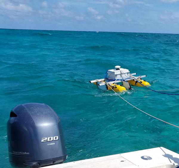
SQUID-5 - Structure-from-Motion Quantitative Underwater Imaging Device
The SQUID-5, or a Structure-from-Motion (SfM) Quantitative Underwater Imaging Device with 5 cameras is a towed surface vehicle with an onboard Global Navigation Satellite System (GNSS) and 5 downward-looking cameras with overlapping views of the seafloor.
The SQUID-5, or a Structure-from-Motion (SfM) Quantitative Underwater Imaging Device with 5 cameras is a towed surface vehicle with an onboard Global Navigation Satellite System (GNSS) and 5 downward-looking cameras with overlapping views of the seafloor.

State of Our Nation’s Coast Stakeholder Engagement Workshop
A group of participants at the Coastal Change Hazards State of Our Nation’s Coast stakeholder engagement workshop at the Waquoit Bay National Estuarine Reserve in Falmouth, MA. Here participants are pictured writing the names of tools they use on sticky notes.
A group of participants at the Coastal Change Hazards State of Our Nation’s Coast stakeholder engagement workshop at the Waquoit Bay National Estuarine Reserve in Falmouth, MA. Here participants are pictured writing the names of tools they use on sticky notes.

State of Our Nation’s Coast Stakeholder Engagement Workshop
Participants of the Coastal Change Hazards State of Our Nation’s Coast stakeholder engagement workshop at the Waquoit Bay National Estuarine Reserve in Falmouth, MA. Participants are pictured here talking in small groups.
Participants of the Coastal Change Hazards State of Our Nation’s Coast stakeholder engagement workshop at the Waquoit Bay National Estuarine Reserve in Falmouth, MA. Participants are pictured here talking in small groups.

GOMEX box corer
USGS marine engineering technician Dan Powers from the USGS Pacific Coastal and Marine Science Center retrieves the GOMEX box corer from Bellingham Bay, Washington.
USGS marine engineering technician Dan Powers from the USGS Pacific Coastal and Marine Science Center retrieves the GOMEX box corer from Bellingham Bay, Washington.