
Photo Contest Winner | March 2020 | Honorable Mention 2
Daniel Skulski conducting PFAS collection
Images
Images
Filter Total Items: 1910

Daniel Skulski conducting PFAS collection
Photo Contest Winner | March 2020 | Honorable Mention 2
Daniel Skulski conducting PFAS collection
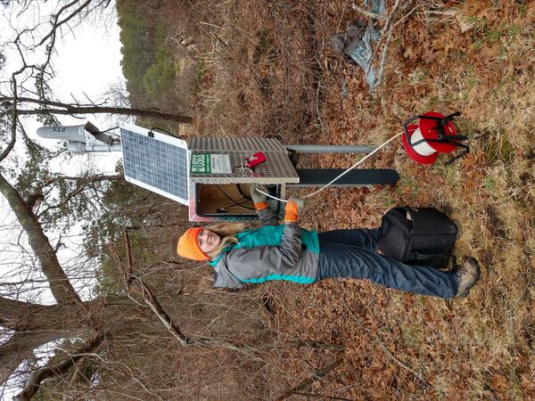
Groundwater Well in Mill Creek Basin in Cape Cod National Seashore
A Geoscientist-in-the-Park Guest Scientist for the National Park Service services a USGS groundwater well located within the Mill Creek basin near the Herring River in Wellfleet, Massachusetts.
A Geoscientist-in-the-Park Guest Scientist for the National Park Service services a USGS groundwater well located within the Mill Creek basin near the Herring River in Wellfleet, Massachusetts.

Shannon Fisher pulling sled at Moreau Lake
Photo Contest Winner | Feb. 2020 | People
Shannon Fisher pulling sled at Moreau Lake area after measuring water levels in GW wells surrounding the lake
Photo Contest Winner | Feb. 2020 | People
Shannon Fisher pulling sled at Moreau Lake area after measuring water levels in GW wells surrounding the lake

Salt flat at Death Valley
Photo Contest Winner | March 2020 | USGS at Work
Salt flat at Death Valley
Photo Contest Winner | March 2020 | USGS at Work
Salt flat at Death Valley

Map of the super gage site locations in Ohio, Kentucky, and Indiana
Map of the super gage site locations in Ohio, Kentucky, and Indiana
Map of the super gage site locations in Ohio, Kentucky, and Indiana

State of Our Nation’s Coast Stakeholder Engagement Workshop
A group of participants at the Coastal Change Hazards State of Our Nation’s Coast stakeholder engagement workshop at the Waquoit Bay National Estuarine Reserve in Falmouth, MA. Here participants are pictured writing the names of tools they use on sticky notes.
A group of participants at the Coastal Change Hazards State of Our Nation’s Coast stakeholder engagement workshop at the Waquoit Bay National Estuarine Reserve in Falmouth, MA. Here participants are pictured writing the names of tools they use on sticky notes.

State of Our Nation’s Coast Stakeholder Engagement Workshop
Participants of the Coastal Change Hazards State of Our Nation’s Coast stakeholder engagement workshop at the Waquoit Bay National Estuarine Reserve in Falmouth, MA. Participants are pictured here talking in small groups.
Participants of the Coastal Change Hazards State of Our Nation’s Coast stakeholder engagement workshop at the Waquoit Bay National Estuarine Reserve in Falmouth, MA. Participants are pictured here talking in small groups.

Buzzards Bay Entrance to the Cape Cod Canal
This image created using the Continuous Bathymetry and Elevation Models of the Massachusetts Coastal Zone and Continental Shelf, shows the entrance to the Buzzards Bay entrance to the Cape Cod Canal.
This image created using the Continuous Bathymetry and Elevation Models of the Massachusetts Coastal Zone and Continental Shelf, shows the entrance to the Buzzards Bay entrance to the Cape Cod Canal.

Elizabeth Islands, Massachusetts
This image created using the Continuous Bathymetry and Elevation Models of the Massachusetts Coastal Zone and Continental Shelf, shows the three-dimensional perspective view of the Elizabeth Islands in the center of the image. Buzzards Bay is to the left (north) of the Elizabeth Islands, and Vineyard Sound is to the right (south).
This image created using the Continuous Bathymetry and Elevation Models of the Massachusetts Coastal Zone and Continental Shelf, shows the three-dimensional perspective view of the Elizabeth Islands in the center of the image. Buzzards Bay is to the left (north) of the Elizabeth Islands, and Vineyard Sound is to the right (south).

Salem and Marblehead, Massachusetts
This image created using the Continuous Bathymetry and Elevation Models of the Massachusetts Coastal Zone and Continental Shelf, shows Salem and Marblehead in the middle of the image and Rocky Neck in the upper middle.
This image created using the Continuous Bathymetry and Elevation Models of the Massachusetts Coastal Zone and Continental Shelf, shows Salem and Marblehead in the middle of the image and Rocky Neck in the upper middle.

Nantucket, Massachusetts
This image created using the Continuous Bathymetry and Elevation Models of the Massachusetts Coastal Zone and Continental Shelf, shows the three-dimensional perspective view of Nantucket Island, MA looking from the Southeast to the Northwest.
This image created using the Continuous Bathymetry and Elevation Models of the Massachusetts Coastal Zone and Continental Shelf, shows the three-dimensional perspective view of Nantucket Island, MA looking from the Southeast to the Northwest.


HABS platform pull on Skaneateles Lake
Photo Contest Winner | Jan. 2020 | Where We Work
John Wernly and Andrew Kowalczk after HABS platform pull on Skaneateles Lake
Photo Contest Winner | Jan. 2020 | Where We Work
John Wernly and Andrew Kowalczk after HABS platform pull on Skaneateles Lake

Large microscope used for counting microplastics found in water sample
Large microscope used for counting microplastics found in water samples
Large microscope used for counting microplastics found in water samples

Merrimack River, Plum Island, and Parker River Wildlife Refuge
This image created using the Continuous Bathymetry and Elevation Models of the Massachusetts Coastal Zone and Continental Shelf, shows the mouth of the Merrimack River, Plum Island and the Parker River National Wildlife Refuge.
This image created using the Continuous Bathymetry and Elevation Models of the Massachusetts Coastal Zone and Continental Shelf, shows the mouth of the Merrimack River, Plum Island and the Parker River National Wildlife Refuge.

Provincetown, MA
This image was created using the Continuous Bathymetry and Elevation Models of the Massachusetts Coastal Zone and Continental Shelf, shows Provincetown, MA and the northern section of the Cape Cod National Seashore.
This image was created using the Continuous Bathymetry and Elevation Models of the Massachusetts Coastal Zone and Continental Shelf, shows Provincetown, MA and the northern section of the Cape Cod National Seashore.

Elizabeth Islands, Vineyard Sound, and Martha’s Vineyard.
This image created using the Continuous Bathymetry and Elevation Models of the Massachusetts Coastal Zone and Continental Shelf, shows the Elizabeth Islands, Vineyard Sound, and Martha’s Vineyard.
This image created using the Continuous Bathymetry and Elevation Models of the Massachusetts Coastal Zone and Continental Shelf, shows the Elizabeth Islands, Vineyard Sound, and Martha’s Vineyard.

Drone Pilots on a mission at Nelson Island Creek, Rowley, MA
In collaboration with the Marine Biological Laboratory (MBL) in Woods Hole, Massachusetts, the AIM group conducted UAS aerial surveys looking at vegetation classification/index surrounding a MBL gas flux tower located in Nelson Island Creek, Rowley, Massachusetts.
In collaboration with the Marine Biological Laboratory (MBL) in Woods Hole, Massachusetts, the AIM group conducted UAS aerial surveys looking at vegetation classification/index surrounding a MBL gas flux tower located in Nelson Island Creek, Rowley, Massachusetts.

Head of the Meadow Beach, MA
Head of the Meadow Beach, Cape Cod National Seashore, Massachusetts
Head of the Meadow Beach, Cape Cod National Seashore, Massachusetts

Head of the Meadow Beach, MA
Head of the Meadow Beach, Cape Cod National Seashore, Massachusetts
Head of the Meadow Beach, Cape Cod National Seashore, Massachusetts

Penobscot River above Millinocket
Northeast Region Photo Contest Winner | Oct. 2019 | Where We Work
Penobscot River above Millinocket
Northeast Region Photo Contest Winner | Oct. 2019 | Where We Work
Penobscot River above Millinocket