
Hydrologic Technician taking a streamgage measurement at USGS 01104415 in the Cambridge Reservoir Watershed, Massachusetts.
Images
Images
Filter Total Items: 1910

Streamgage measurement
Hydrologic Technician taking a streamgage measurement at USGS 01104415 in the Cambridge Reservoir Watershed, Massachusetts.

NYWSC scientist is collecting groundwater samples
NYWSC scientist collecting groundwater samples
NYWSC scientist collecting groundwater samples

Indiana Harbor Canal at East Chicago, IN - ADCP measurement
Indiana Harbor Canal at East Chicago, IN - ADCP measurement - Moriah Will
Indiana Harbor Canal at East Chicago, IN - ADCP measurement - Moriah Will

Indiana Harbor Canal at East Chicago, IN - measurement
Indiana Harbor Canal at East Chicago, IN - measurement - Andy Gorman
Indiana Harbor Canal at East Chicago, IN - measurement - Andy Gorman

Indiana Harbor Canal at East Chicago, IN - walk bridge
Indiana Harbor Canal at East Chicago, IN - walk bridge
Indiana Harbor Canal at East Chicago, IN - walk bridge
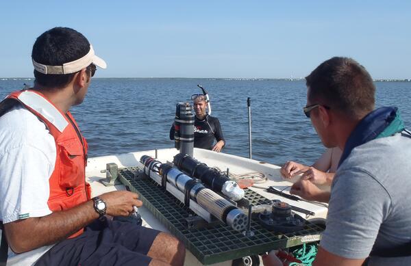
Shallow Water Irradience Platform placement in Barnegat Bay, NJ
Investigators prepare to place a Shallow Water Irradience Platform (SWIP) at a site in Barnegat Bay, NJ.
Investigators prepare to place a Shallow Water Irradience Platform (SWIP) at a site in Barnegat Bay, NJ.

Salt Marsh Research
USGS research supports wetland conservation as critical habitat, Cape Cod, MA
USGS research supports wetland conservation as critical habitat, Cape Cod, MA

USGS and Summer Interns from the Partnership Education Program (PEP) p
USGS and Summer Interns from the Partnership Education Program (PEP) program sampling over a tidal cycle.
USGS and Summer Interns from the Partnership Education Program (PEP) program sampling over a tidal cycle.

Equipment used for a measuring lateral fluxes over tidal cycle
Equipment used for a measuring lateral fluxes over tidal cycle
Equipment used for a measuring lateral fluxes over tidal cycle

Ohio Nowcast
As schools close for the year and summer weather beckons, many recreationalists head to the Great Lakes' public beaches. However, these coastal areas can become contaminated with disease-causing bacteria that threaten public health, disrupt water recreation, and pay a toll on the Great Lakes economies that depend on summer tourism.
As schools close for the year and summer weather beckons, many recreationalists head to the Great Lakes' public beaches. However, these coastal areas can become contaminated with disease-causing bacteria that threaten public health, disrupt water recreation, and pay a toll on the Great Lakes economies that depend on summer tourism.

Deploying a measure flow, Rachel Carlson National Wildlife Refuge
A sensor is deployed to measure flow in a channel of the marsh in Rachel Carlson National Wildlife Refuge in 2013.
A sensor is deployed to measure flow in a channel of the marsh in Rachel Carlson National Wildlife Refuge in 2013.

Rock Castle, VA
View looking east from the Virginia Blue Ridge across the Rock Castle Creek gorge to the rolling hills of the Piedmont.
View looking east from the Virginia Blue Ridge across the Rock Castle Creek gorge to the rolling hills of the Piedmont.

Huron River at Milan, OH - downstream of gage
Huron River at Milan, OH - downstream of gage
Huron River at Milan, OH - downstream of gage

Huron River at Milan, OH - upstream
Huron River at Milan, OH - upstream
Huron River at Milan, OH - upstream

Groundwater collection using a piezometer
Adrian Mann is using a piezometer to extract submarine groundwater to analyze for geochemical parameters in Indian River Bay, DE.
Adrian Mann is using a piezometer to extract submarine groundwater to analyze for geochemical parameters in Indian River Bay, DE.

Mixing of drill cuttings with absorbent polymer
Mixing of drill cuttings with absorbent polymer prior to shipping and disposal in a secured landfill.
Mixing of drill cuttings with absorbent polymer prior to shipping and disposal in a secured landfill.

USGS scientist Simonette Rivera sevicing a gage on Long Island
USGS hydrologic technician Simonette Rivera servicing gage site 01311875 ROCKAWAY INLET NEAR FLOYD BENNETT FIELD NY
USGS hydrologic technician Simonette Rivera servicing gage site 01311875 ROCKAWAY INLET NEAR FLOYD BENNETT FIELD NY

Surveying program study site in the Chandeleur Islands
Surveying A Barrier Island Evolution Research (BIER) program study site in the Chandeleur Islands in 2013. The survey data is used to map the pre-storm conditions.
Surveying A Barrier Island Evolution Research (BIER) program study site in the Chandeleur Islands in 2013. The survey data is used to map the pre-storm conditions.

Surveying a high-water mark on Liberty Island, after Hurricane Sandy
USGS hydrologic technician Amy Simonson surveying a high-water mark on Liberty Island, New York after Hurricane Sandy
USGS hydrologic technician Amy Simonson surveying a high-water mark on Liberty Island, New York after Hurricane Sandy

Collecting data at Ellis Island after Hurricane Sandy
Photo Contest Winner | Feb. 2020 | Honorable Mention 2
Collecting data at Ellis Island after Hurricane Sandy
Photo Contest Winner | Feb. 2020 | Honorable Mention 2
Collecting data at Ellis Island after Hurricane Sandy

Collecting data at Ellis Island after Hurricane Sandy
Photo Contest Winner | Feb. 2020 | Where We Work
Collecting data at Ellis Island after Hurricane Sandy
Photo Contest Winner | Feb. 2020 | Where We Work
Collecting data at Ellis Island after Hurricane Sandy