
Map showing the extent of lava flows erupted during Kīlauea's ongoing east rift zone eruption and labeled with the years in which they were active.
Images
Images intro.
Filter Total Items: 7156

Kīlauea ERZ Eruption Map: Nov. 10, 2012
Map showing the extent of lava flows erupted during Kīlauea's ongoing east rift zone eruption and labeled with the years in which they were active.

A large skylight on the lava tube is supplying lava to surface flow...
This photograph, looking east, shows a large skylight on the lava tube that is supplying lava to surface flows north of Royal Gardens subdivision. The tube trace, which heads southeast, is marked by the line of fume sources in the upper right portion of the image.
This photograph, looking east, shows a large skylight on the lava tube that is supplying lava to surface flows north of Royal Gardens subdivision. The tube trace, which heads southeast, is marked by the line of fume sources in the upper right portion of the image.

skylight
A close-up view of the skylight. The flowing lava stream in the tube was easily visible.
A close-up view of the skylight. The flowing lava stream in the tube was easily visible.
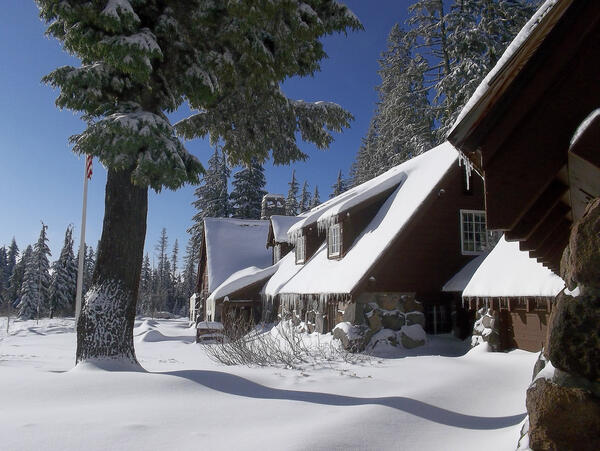
Steel Information Center in Winter at Crater Lake National Park.
Steel Information Center in Winter at Crater Lake National Park.
Steel Information Center in Winter at Crater Lake National Park.

Has Halema‘uma‘u's lava lake changed in 100 years?
Photo of the lava lake within the vent inset within the east wall and floor of Halema‘uma‘u Crater on March 3, 2011, just days before the Kamoamoa fissure eruption caused the lake level to drop much deeper and out of sight.
Photo of the lava lake within the vent inset within the east wall and floor of Halema‘uma‘u Crater on March 3, 2011, just days before the Kamoamoa fissure eruption caused the lake level to drop much deeper and out of sight.

Pu‘u ‘Ō‘ō and Episode 61 flow field: Nov. 3, 2012
Map showing Pu‘u ‘Ō‘ō and the extent of nearby lava flows. The flows of the currently active episode 61 east flank phase (September 21-ongoing) are the two shades of red—pink is the extent of the flow from September 21 to October 25, and bright red marks flow expansion from October 25 to November 3. The trace of the tube carrying lava downslope is shown in yellow.
Map showing Pu‘u ‘Ō‘ō and the extent of nearby lava flows. The flows of the currently active episode 61 east flank phase (September 21-ongoing) are the two shades of red—pink is the extent of the flow from September 21 to October 25, and bright red marks flow expansion from October 25 to November 3. The trace of the tube carrying lava downslope is shown in yellow.

Kīlauea ERZ Eruption Map: Nov. 3, 2012
Map showing the extent of lava flows erupted during Kīlauea's ongoing east rift zone eruption and labeled with the years in which they were active.
Map showing the extent of lava flows erupted during Kīlauea's ongoing east rift zone eruption and labeled with the years in which they were active.

The active episode 61 pāhoehoe flows of Pu‘u ‘Ō‘ō
View looking northwest through rain at the silvery flows at the front of the active episode 61 flow field. Pu‘u ‘Ō‘ō is hidden in the clouds in the top left part of the photo. The ‘A‘ā flow at bottom center is the inactive terminus of the initial flow emplaced on September 21-22, 2011, after the episode 61 fissure on Pu‘u ‘Ō‘ō's east flank opened on September 21.
View looking northwest through rain at the silvery flows at the front of the active episode 61 flow field. Pu‘u ‘Ō‘ō is hidden in the clouds in the top left part of the photo. The ‘A‘ā flow at bottom center is the inactive terminus of the initial flow emplaced on September 21-22, 2011, after the episode 61 fissure on Pu‘u ‘Ō‘ō's east flank opened on September 21.

Ground view looking at the terminus of the active episode 61 pAHOEH...
Ground view looking at the terminus of the active episode 61 pAHOEHEO flows. Pu‘u ‘Ō‘ō, the source of the flows, is hidden in the clouds at the top of the photo, just left of center.
Ground view looking at the terminus of the active episode 61 pAHOEHEO flows. Pu‘u ‘Ō‘ō, the source of the flows, is hidden in the clouds at the top of the photo, just left of center.

Kīlauea ERZ Eruption Map: Oct. 25, 2012
Map showing the extent of lava flows erupted during Kīlauea's ongoing east rift zone eruption and labeled with the years in which they were active.
Map showing the extent of lava flows erupted during Kīlauea's ongoing east rift zone eruption and labeled with the years in which they were active.

Pu‘u ‘Ō‘ō: Oct. 25, 2012
Map showing Pu‘u ‘Ō‘ō and the extent of nearby lava flows. The flows of the currently active Episode 61 east flank phase (September 21-ongoing) are the two shades of red—pink is the extent of the flow from September 21 to October 14, and bright red marks flow expansion from October 14 to 25.
Map showing Pu‘u ‘Ō‘ō and the extent of nearby lava flows. The flows of the currently active Episode 61 east flank phase (September 21-ongoing) are the two shades of red—pink is the extent of the flow from September 21 to October 14, and bright red marks flow expansion from October 14 to 25.

High the active lava channel of Pu‘u ‘Ō‘ō
View looking southwest at the east flank of Pu‘u ‘Ō‘ō. The Pu‘u ‘Ō‘ō cone is at the top of the photo, and the trace of the September 21 fissure is defined by the line of fume at the center of the photo.
View looking southwest at the east flank of Pu‘u ‘Ō‘ō. The Pu‘u ‘Ō‘ō cone is at the top of the photo, and the trace of the September 21 fissure is defined by the line of fume at the center of the photo.

View looking east at the east edge of the Pu‘u ‘Ō‘ō (bottom of phot...
View looking east at the east edge of the Pu‘u ‘Ō‘ō crater (bottom of photo) and the trace of the September 21 fissure (center of photo). The active lava tube carrying lava downslope to the southeast is marked by the line of fume that trends toward the upper right side of the photo.
View looking east at the east edge of the Pu‘u ‘Ō‘ō crater (bottom of photo) and the trace of the September 21 fissure (center of photo). The active lava tube carrying lava downslope to the southeast is marked by the line of fume that trends toward the upper right side of the photo.

View looking nearly straight down into open top of a spatter cone b...
View looking nearly straight down into the open top of a spatter cone built over the September 21 fissure on Pu‘u ‘Ō‘ō's east flank. The brighter, yellowish zone is the surface of the active lava stream as it flows downslope (toward the top of the photo).
View looking nearly straight down into the open top of a spatter cone built over the September 21 fissure on Pu‘u ‘Ō‘ō's east flank. The brighter, yellowish zone is the surface of the active lava stream as it flows downslope (toward the top of the photo).

View to NW looking at the active flows (center of photo). Activity ...
View to the northwest looking at the active flows (center of photo). Activity over the past few weeks has built a broad, low rootless shield (a shield-shaped mound of lava built on the flow field, not the vent), and there has been little advancement downslope.
View to the northwest looking at the active flows (center of photo). Activity over the past few weeks has built a broad, low rootless shield (a shield-shaped mound of lava built on the flow field, not the vent), and there has been little advancement downslope.

Columnar jointing provides clues to cooling history of lava flows
Colonnades in a basaltic lava flow downstream of Boiling Pots on the Wailuku River. Photo courtesy of James Anderson, UH-Hilo.
Colonnades in a basaltic lava flow downstream of Boiling Pots on the Wailuku River. Photo courtesy of James Anderson, UH-Hilo.

Two Scientists Collecting Core Samples
Humboldt State University geologist Nick Graehl and student assistant collecting gouge core sediment samples in the field.
Humboldt State University geologist Nick Graehl and student assistant collecting gouge core sediment samples in the field.

The active pāhoehoe flows of Pu‘u ‘Ō‘ō
This thermal image, looking northwest, shows the active flows east of Pu‘u ‘Ō‘ō. Bright yellow portions of the image represent areas of active lava. A short channelized flow was active on the upper east flank of the cone, with most activity— comprising pāhoehoe (center of image)—heading southeast.
This thermal image, looking northwest, shows the active flows east of Pu‘u ‘Ō‘ō. Bright yellow portions of the image represent areas of active lava. A short channelized flow was active on the upper east flank of the cone, with most activity— comprising pāhoehoe (center of image)—heading southeast.

active pāhoehoe flows.
A close-up of the active pāhoehoe flows.
A close-up of the active pāhoehoe flows.

Kīlauea ERZ Eruption Map
Map showing the extent of lava flows erupted during Kīlauea's ongoing east rift zone eruption. The areas covered during distinct eruptive phases are shown in unique colors and labeled with the years in which those flows were active.
Map showing the extent of lava flows erupted during Kīlauea's ongoing east rift zone eruption. The areas covered during distinct eruptive phases are shown in unique colors and labeled with the years in which those flows were active.

Pu‘u ‘Ō‘ō
Map showing the current configuration of Pu‘u ‘Ō‘ō. Old lava flows are shown in colors that match those in the small scale map. The area in dark reddish brown represents the crater-filling lava and overflows of Episode 61 spanning the period from August 20 to September 21.
Map showing the current configuration of Pu‘u ‘Ō‘ō. Old lava flows are shown in colors that match those in the small scale map. The area in dark reddish brown represents the crater-filling lava and overflows of Episode 61 spanning the period from August 20 to September 21.