
This is a screenshot of the INHABIT web-based decision support tool for invasive species habitat visualization and assessment across the contiguous United States
Catherine S. Jarnevich, PhD
Catherine began working for the USGS while obtaining her doctorate in ecology in 2000. She gained skills in integrating disparate datasets of species’ location data and using these to generate spatially explicit models of species occurrence and abundance.
Catherine has developed a research program to assist multiple agencies and groups with species distributions, focusing on invasive species. Her current research involves the application of habitat suitability models to answer different applied research and management questions for various species across a range of taxa and spatial scales. A major focus involves predicting current and potential distributions of invasive species and deliver this information through a co-produced webtool to inform management actions. She has also been working with spatially explicit state and transition modeling to inform efficient landscape scale invasive plant management.
Science and Products
Filter Total Items: 23
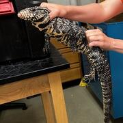
Early detection and rapid response tools for invasive tegu lizards
Scientists at USGS have shown that much of the US is suitable for invasion by tegu lizards, and suitability will likely increase in the future. While tegus can be removed via trapping, it is difficult to monitor every geographic area where tegus could invade. Thus, methods for quickly detecting and removing tegus in new areas are the best way to prevent spread and minimize damage from these...

Scaling-up phenological date matching for invasive species mapping: a free opensource workflow
Matching imagery dates to phenological events across large geographic regions for invasive species mapping.

Fostering greater use of habitat models for managing rare and invasive plants on public lands
Habitat models can provide critical information on the current and potential distribution of plant species, as well as help target and support conservation efforts. Despite their potential utility in public land management, model use may be constrained by a variety of factors including staff access to and trust in models. In this project, we seek to bring together model users and model developers...

Economic assessment of addressing annual invasive grasses across the sagebrush biome
This interdisciplinary project combines expert judgment on treatment costs with spatially explicit ecological modeling to estimate the financial resources needed to address the threat of invasive annual grass across the entire sagebrush biome. Results of the assessment will provide economic insights that can inform cost-effective resource allocation to efficiently achieve sagebrush conservation...

FORT Cottonwood Common Garden
FORT scientists established a Common Garden at the Colorado State Forest Service Nursery in Fort Collins, Colorado in 2005 to study the phenology of riparian cottonwood in relation to annual variation in temperature. Phenology is the seasonal timing of life history events including leaf opening, flowering, seed release, bud formation and leaf senescence.

INHABIT: A web tool for invasive plant management across the contiguous United States
INHABIT is a desktop-optimized web application and decision support tool with mapped and tabular summaries of habitat suitability models for over two hundred fifty terrestrial invasive plant species of management concern across the contiguous United States. It is the product of a scientist-practitioner partnership and is designed to facilitate enhanced invasive species management actions...

Assessing the Proliferation, Connectivity, and Consequences of Invasive Fine Fuels on the Sagebrush Biome
Invasive annual grasses can replace native vegetation and alter fire behavior, impacting a range of habitats and species. A team of researchers from the U.S. Geological Survey, Colorado State University, the Bureau of Land Management, and the U.S. Fish and Wildlife Service are working to identify factors that influence changes in the distribution and abundance of invasive annual grasses (IAGs)...

Developing habitat models for rare plants to inform decision making on multiple-use public lands
Public lands provide important habitat for many rare plants. However, public lands often need to accommodate many other uses, including traditional and renewable energy development, in addition to conservation. We are working with the Bureau of Land Management to coproduce ensemble habitat suitability models that can inform agency planning and permitting decisions that may impact rare plants.

Future Aquatic Invaders of the Northeast U.S.: How Climate Change, Human Vectors, and Natural History Could Bring Southern and Western Species North
Researchers will evaluate the potential of aquatic species to invade the Northeast U.S. Following the identification of appropriate target species by regional stakeholders, researchers will gather data from the NAS database and develop models to determine habitat suitability for each species.

Predicting risk of annual grass invasion following fire in sagebrush steppe and rangeland ecosystems
This project analyzes on-the-ground plant monitoring data across sagebrush and rangeland ecosystems to examine how fire, climate, topography, and plant communities influence the success of invasive annual grasses after fires.

Climate matching with the climatchR R package
Climate matching is a method for understanding species distributions and ranges and may be used as part of horizon scanning. Horizon scanning is the process of examining potential risk of invasion of new invasive species. Preventing new invasive species invasion requires less time and resources than attempting to control and remove established invasive species. Horizon scanning allows resource...

Predicting the phenology of invasive grasses under a changing climate to inform mapping and management
Cheatgrass, an invasive annual grass, reduces ecosystem productivity, negatively impacts biodiversity, and is increasingly problematic in higher elevation ecosystems with climate change. Cheatgrass phenology (that is, the timing of yearly growth and lifespan) varies greatly with elevation, climate, and weather from year to year, which can make management planning difficult and reduce the ability...

INHABIT Screenshot
This is a screenshot of the INHABIT web-based decision support tool for invasive species habitat visualization and assessment across the contiguous United States
Science and Products
Filter Total Items: 23
Early detection and rapid response tools for invasive tegu lizards
Scientists at USGS have shown that much of the US is suitable for invasion by tegu lizards, and suitability will likely increase in the future. While tegus can be removed via trapping, it is difficult to monitor every geographic area where tegus could invade. Thus, methods for quickly detecting and removing tegus in new areas are the best way to prevent spread and minimize damage from these...
Scaling-up phenological date matching for invasive species mapping: a free opensource workflow
Matching imagery dates to phenological events across large geographic regions for invasive species mapping.
Fostering greater use of habitat models for managing rare and invasive plants on public lands
Habitat models can provide critical information on the current and potential distribution of plant species, as well as help target and support conservation efforts. Despite their potential utility in public land management, model use may be constrained by a variety of factors including staff access to and trust in models. In this project, we seek to bring together model users and model developers...
Economic assessment of addressing annual invasive grasses across the sagebrush biome
This interdisciplinary project combines expert judgment on treatment costs with spatially explicit ecological modeling to estimate the financial resources needed to address the threat of invasive annual grass across the entire sagebrush biome. Results of the assessment will provide economic insights that can inform cost-effective resource allocation to efficiently achieve sagebrush conservation...
FORT Cottonwood Common Garden
FORT scientists established a Common Garden at the Colorado State Forest Service Nursery in Fort Collins, Colorado in 2005 to study the phenology of riparian cottonwood in relation to annual variation in temperature. Phenology is the seasonal timing of life history events including leaf opening, flowering, seed release, bud formation and leaf senescence.
INHABIT: A web tool for invasive plant management across the contiguous United States
INHABIT is a desktop-optimized web application and decision support tool with mapped and tabular summaries of habitat suitability models for over two hundred fifty terrestrial invasive plant species of management concern across the contiguous United States. It is the product of a scientist-practitioner partnership and is designed to facilitate enhanced invasive species management actions...
Assessing the Proliferation, Connectivity, and Consequences of Invasive Fine Fuels on the Sagebrush Biome
Invasive annual grasses can replace native vegetation and alter fire behavior, impacting a range of habitats and species. A team of researchers from the U.S. Geological Survey, Colorado State University, the Bureau of Land Management, and the U.S. Fish and Wildlife Service are working to identify factors that influence changes in the distribution and abundance of invasive annual grasses (IAGs)...
Developing habitat models for rare plants to inform decision making on multiple-use public lands
Public lands provide important habitat for many rare plants. However, public lands often need to accommodate many other uses, including traditional and renewable energy development, in addition to conservation. We are working with the Bureau of Land Management to coproduce ensemble habitat suitability models that can inform agency planning and permitting decisions that may impact rare plants.
Future Aquatic Invaders of the Northeast U.S.: How Climate Change, Human Vectors, and Natural History Could Bring Southern and Western Species North
Researchers will evaluate the potential of aquatic species to invade the Northeast U.S. Following the identification of appropriate target species by regional stakeholders, researchers will gather data from the NAS database and develop models to determine habitat suitability for each species.
Predicting risk of annual grass invasion following fire in sagebrush steppe and rangeland ecosystems
This project analyzes on-the-ground plant monitoring data across sagebrush and rangeland ecosystems to examine how fire, climate, topography, and plant communities influence the success of invasive annual grasses after fires.
Climate matching with the climatchR R package
Climate matching is a method for understanding species distributions and ranges and may be used as part of horizon scanning. Horizon scanning is the process of examining potential risk of invasion of new invasive species. Preventing new invasive species invasion requires less time and resources than attempting to control and remove established invasive species. Horizon scanning allows resource...
Predicting the phenology of invasive grasses under a changing climate to inform mapping and management
Cheatgrass, an invasive annual grass, reduces ecosystem productivity, negatively impacts biodiversity, and is increasingly problematic in higher elevation ecosystems with climate change. Cheatgrass phenology (that is, the timing of yearly growth and lifespan) varies greatly with elevation, climate, and weather from year to year, which can make management planning difficult and reduce the ability...
INHABIT Screenshot
This is a screenshot of the INHABIT web-based decision support tool for invasive species habitat visualization and assessment across the contiguous United States
This is a screenshot of the INHABIT web-based decision support tool for invasive species habitat visualization and assessment across the contiguous United States