U.S. flag

An official website of the United States government

Images

Images described and linked on this webpage come from a wide variety of USGS science activities and presentations performed by USGS Science Center staff members in the Region 10:  California-Great Basin. A search tool is provided to narrow the number of image files shown.

Filter Total Items: 76
RestoreNet V2.0 plots at Flying M Ranch. The plot in the foreground has four pits with several seedballs scattered in and around them.
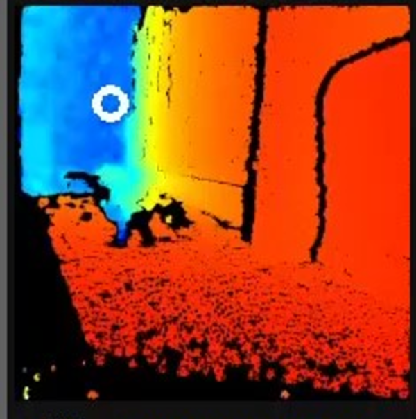
RestoreNet 2.0 restoration experiment sites with pits with seedballs on Northern Arizona rangelands

In 2022, we piloted RestoreNet V2.0 testing soil inoculation from undegraded reference sites, seed balls (white balls in photo), and pitting treatments (small indentions). Soil inoculation with healthy soils is expected to increase beneficial microbes at the degraded restoration site. Soil microbes can help reduce water stress in plants. Photo by Hannah Farrell.

In 2022, we piloted RestoreNet V2.0 testing soil inoculation from undegraded reference sites, seed balls (white balls in photo), and pitting treatments (small indentions). Soil inoculation with healthy soils is expected to increase beneficial microbes at the degraded restoration site. Soil microbes can help reduce water stress in plants. Photo by Hannah Farrell.

A collage of images depicts shoreline habitat and wildlife that use the Salton Sea area
UAS Research Center Engineer walks with Sandy the Rover following close behind
Test Platform Sandy the Rover uses BisonCore-Vehicle Formation Programs to follow Engineer around.

UAS Research Center BisonCore Project, using onboard autopilot systems, BisonCore on Sandy the Rover instructs the Autopilot to deviate course to follow the UAS Engineer around the parking lot. Acting like a ‘duckling’. 

UAS Research Center BisonCore Project, using onboard autopilot systems, BisonCore on Sandy the Rover instructs the Autopilot to deviate course to follow the UAS Engineer around the parking lot. Acting like a ‘duckling’. 

UAS Research Center's BisonCore in use predicting vehicle movement, for better following.
Visualized plot of BisonCore’s Vehicle Formation Programs’ predictive path

UASRC BisonCore Project, using onboard systems inherent to commercial-off-the-shelf (COTS) Autopilots, BisonCore-Vehicle Formation Program predicts the path of the vehicle ahead. 

UASRC BisonCore Project, using onboard systems inherent to commercial-off-the-shelf (COTS) Autopilots, BisonCore-Vehicle Formation Program predicts the path of the vehicle ahead. 

Image showing feature nomenclature on asteroid Didymos
Didymos Nomenclature

Image showing IAU-approved nomenclature for surface features on asteroid Didymos

Image showing IAU-approved nomenclature for surface features on asteroid Didymos

Image showing nomenclature feature names on asteroid Dimorphos.
Dimorphos Nomenclature

Image showing IAU-approved nomenclature for surface features on asteroid Dimophos

Image showing IAU-approved nomenclature for surface features on asteroid Dimophos

USGS and Norsk Elektro Optikk engineers with the NASA ER-2 aircraft for hyperspectral imaging sensor deployment
USGS and partner engineers with the NASA ER-2 aircraft

Left to Right: Trond Loke (Norsk Elektro Optikk), Isaac Anderson (USGS) and Liz Hyde (USGS) standing in front of the NASA ER-2 aircraft, during deployment to NASA Armstrong Flight Research Center, Palmdale, CA.

Left to Right: Trond Loke (Norsk Elektro Optikk), Isaac Anderson (USGS) and Liz Hyde (USGS) standing in front of the NASA ER-2 aircraft, during deployment to NASA Armstrong Flight Research Center, Palmdale, CA.

Natural color image from the first flight of the high-altitude HySpex V-1240 hyperspectral imaging sensor
First natural color image from the high-altitude HySpex hyperspectral imaging sensor

Natural color image from the first flight of the high-altitude HySpex V-1240.  Image is oriented with respect to true North, and is centered around Colombia, CA. 

Natural color image from the first flight of the high-altitude HySpex V-1240.  Image is oriented with respect to true North, and is centered around Colombia, CA. 

BisonCore in use, showing a colorized depth image with a white circle indicating vehicle’s desired direction.
BisonCore Collision Avoidance/GPS Denied Navigation operating in hallway

USGS National Innovation Center UAS Research Center's BisonCore Project, augments an autonomous rover to navigate around obstacles through a hallway, in a GPS Denied Environment. Augmentation done through payload directed operations on data from stereo depth sensors. White circle depicts vehicle’s desired direction.

USGS National Innovation Center UAS Research Center's BisonCore Project, augments an autonomous rover to navigate around obstacles through a hallway, in a GPS Denied Environment. Augmentation done through payload directed operations on data from stereo depth sensors. White circle depicts vehicle’s desired direction.

Image shows a man and a woman smiling and holding a coffee mug
Mendenhall Fellows Sabine Loos and Max Schneider

In June 2022, Mendenhall Fellow Sabine Loos (Research Civil Engineer in the Geological Hazards Science Center) presented a seminar to USGS's Earthquake Science Center at Moffett Field, CA, where Max Schneider (Research Statistician) works as a Mendenhall Fellow.

In June 2022, Mendenhall Fellow Sabine Loos (Research Civil Engineer in the Geological Hazards Science Center) presented a seminar to USGS's Earthquake Science Center at Moffett Field, CA, where Max Schneider (Research Statistician) works as a Mendenhall Fellow.

Partners in Science trip participants cool down under a small waterfall on a hot day

Grand Canyon Youth/Partners in Science trip participants cool down under a small waterfall on a hot day

Image shows a helicopter towing a hoop with mountains in the background
Airborne Geophysical Survey Helicopter in Nevada

A low-flying helicopter towing a geophysical device collects scientific data on groundwater and geology. Information collected during these surveys can help with studying critical mineral resources, natural hazards and groundwater potential.

A low-flying helicopter towing a geophysical device collects scientific data on groundwater and geology. Information collected during these surveys can help with studying critical mineral resources, natural hazards and groundwater potential.

Image shows a cow standing in the foreground with a helicopter towing geophysical data collecting equipment with mountains
Airborne Geophysical Survey Helicopter with Cow

A helicopter rigged with an airborne geophysical survey collecting equipment. Information collected during these surveys can help with studying critical mineral resources, natural hazards and groundwater potential. A cow is here too.

A helicopter rigged with an airborne geophysical survey collecting equipment. Information collected during these surveys can help with studying critical mineral resources, natural hazards and groundwater potential. A cow is here too.

RestoreNet treatments in a Sonoran Desert landscape. In the foreground, there is a 2 x 2 m plot with four pits dug in it. I the background, there is a 2 x 2 m plot with four wire connectivity modifiers (ConMods) in it,
RestoreNet restoration teatments in the Sonoran Desert

RestoreNet treatments include soil pits and connectivity modifiers (ConMods), seen here at a RestoreNet site in the Sonoran Desert.

RestoreNet treatments include soil pits and connectivity modifiers (ConMods), seen here at a RestoreNet site in the Sonoran Desert.

UAS Research Center's BisonCore in use onboard a small autonomous rover named Sandy
Autonomous Augmentation System Test Platform – Sandy the rover with BisonCore installed

UAS Research Center's BisonCore Project, Autonomous Rover Sandy is equipped with a single board companion computer (with BisonCore installed), and various sensors useful for augmentation testing and development. 

UAS Research Center's BisonCore Project, Autonomous Rover Sandy is equipped with a single board companion computer (with BisonCore installed), and various sensors useful for augmentation testing and development. 

USGS scientist with yellow visibility safety vest on talking to the camera with people working in the background.
Joanne Chan - Seismic Survey

Joanne Chan conducting a seismic survey in San Carlos, California, looking for traces of the Serra Fault. 

Joanne Chan conducting a seismic survey in San Carlos, California, looking for traces of the Serra Fault. 

UAS Research Center's BisonCore in use onboard a small autonomous rover named Sandy
BisonCore’s Collision Detection Avoidance Algorithms safely keep the vehicle from running into obstacles

UAS Research Center's BisonCore Project, augments an autonomous rover to avoid running into obstacles. Shown in picture; user set waypoint (2) that runs over a curb/barrier. CDA engaged and navigated south avoiding, and seeking a path around, the curb.

UAS Research Center's BisonCore Project, augments an autonomous rover to avoid running into obstacles. Shown in picture; user set waypoint (2) that runs over a curb/barrier. CDA engaged and navigated south avoiding, and seeking a path around, the curb.

Map of U.S. mainland showing temperate, transitional and tropical temperature patterns
U.S. regions in the tropical-to-temperate transition

A map showing North America's tropical-to-temperate transition zone. Red, orange, and yellow depict the more tropical zones, and blues depict the more temperate zones, based on to the coldest recorded temperature for each area between 1980 and 2009.

A map showing North America's tropical-to-temperate transition zone. Red, orange, and yellow depict the more tropical zones, and blues depict the more temperate zones, based on to the coldest recorded temperature for each area between 1980 and 2009.

A school of snook, large subtropical game fish, in a Florida spring
Subtropical snook gather at a warm Florida springhead in winter

 Winter temperature extremes control the distributions of subtropical fishes. Common snook (Centropomus undecimalis), aggregate at a spring in northern Florida during winter. Snook are warm saltwater game fish, common in Florida, that have been moving further northward as extreme cold spells become less frequent and less intense.

 Winter temperature extremes control the distributions of subtropical fishes. Common snook (Centropomus undecimalis), aggregate at a spring in northern Florida during winter. Snook are warm saltwater game fish, common in Florida, that have been moving further northward as extreme cold spells become less frequent and less intense.

A woman stands in a rut eroded by water, on a very steep hill surrounded by burned trees.
Burned, denuded hillside in the CZU Lightning Complex

The USGS landslide team monitors and continues to update the hazard map models based on data collected in burn areas. This information improves future models and provides better hazard assessments used by officials for emergency response and decision making. Many of the steep hillsides burned and denuded in California fires repel water rather than soak it in.

The USGS landslide team monitors and continues to update the hazard map models based on data collected in burn areas. This information improves future models and provides better hazard assessments used by officials for emergency response and decision making. Many of the steep hillsides burned and denuded in California fires repel water rather than soak it in.